 |
|
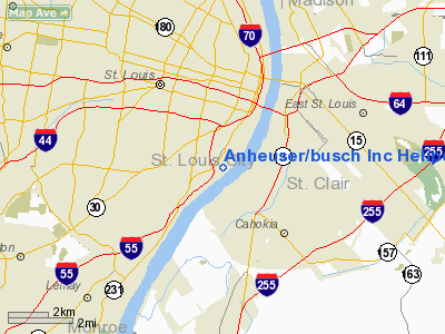
Anheuser / Busch Inc Heliport |
Location & QuickFacts
| FAA Information Effective: | 2008-09-25 |
| Airport Identifier: | 9MO0 |
| Airport Status: | Operational |
| Longitude/Latitude: | 090-12-30.4020W/38-35-30.1850N
-90.208445/38.591718 (Estimated) |
| Elevation: | 548 ft / 167.03 m (Estimated) |
| Land: | 0 acres |
| From nearest city: | 0 nautical miles N of St Louis, MO |
| Location: | St Louis County, MO |
| Magnetic Variation: | 02E (1985) |
Owner & Manager
| Ownership: | Privately owned |
| Owner: | Anheuser-busch Co.inc. |
| Address: | One Busch Place
St. Louis, MO 63118 |
| Phone number: | 573-577-2414 |
| Manager: | Carl Henke |
| Address: | 18130 Edison Avenue
Chesterfield, MO 63005 |
| Phone number: | 314-532-2448 |
Airport Operations and Facilities
| Airport Use: | Private |
| Wind indicator: | No |
| Segmented Circle: | Yes |
| Control Tower: | No |
| Landing fee charge: | No |
| Sectional chart: | St Louis |
| Region: | ACE - Central |
| Boundary ARTCC: | ZKC - Kansas City |
| Tie-in FSS: | STL - Saint Louis |
| FSS on Airport: | No |
| FSS Toll Free: | 1-800-WX-BRIEF |
Airport Communications
Airport Services
| Airframe Repair: | NONE |
| Power Plant Repair: | NONE |
Runway Information
Helipad H1
| Dimension: | 50 x 30 ft / 15.2 x 9.1 m
50' X 30' TOUCHDOWN ZONE WITHIN A 100' X 82' LANDING/TAKEOFF AREA. |
| Surface: | ASPH,
ROOF-TOP. |
| |
Runway H1 |
Runway |
| Traffic Pattern: | Left | Left |
|
Radio Navigation Aids
| ID |
Type |
Name |
Ch |
Freq |
Var |
Dist |
| LM | NDB | Oblio | | 338.00 | 00E | 17.7 nm |
| CVM | NDB | Civic Memorial | | 263.00 | 02E | 19.4 nm |
| BL | NDB | Belleville | | 362.00 | 02E | 22.6 nm |
| FES | NDB | Festus | | 269.00 | 01E | 25.2 nm |
| SAR | NDB | Sparta | | 239.00 | 01E | 35.9 nm |
| LTD | NDB | Litchfield | | 371.00 | 01E | 42.6 nm |
| UUV | NDB | Sullivan | | 356.00 | 02E | 49.8 nm |
| SKE | TACAN | Scott | 059X | | 02E | 17.0 nm |
| CSX | VOR/DME | Cardinal | 111Y | 116.45 | 00E | 12.0 nm |
| TOY | VORTAC | Troy | 107X | 116.00 | 04E | 16.2 nm |
| STL | VORTAC | St Louis | 121X | 117.40 | 01E | 20.6 nm |
| FTZ | VORTAC | Foristell | 045X | 110.80 | 05E | 36.3 nm |
| STL | VOT | St Louis Lambert | | 111.00 | | 11.9 nm |
| SUS | VOT | Spirit Of St Louis | | 112.20 | | 21.2 nm |
Remarks
- INGRESS/EGRESS 225 DEG. CLOCKWISE TO 45 DEG.
Images and information placed above are from
http://www.airport-data.com/airport/9MO0/
We thank them for the data!
| General Info
|
| Country |
United States
|
| State |
MISSOURI
|
| FAA ID |
9MO0
|
| Latitude |
38-35-30.185N
|
| Longitude |
090-12-30.402W
|
| Elevation |
548 feet
|
| Near City |
ST LOUIS
|
We don't guarantee the information is fresh and accurate. The data may
be wrong or outdated.
For more up-to-date information please refer to other sources.
|
|


