 |
|
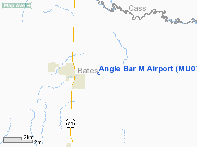
Location & QuickFacts
| FAA Information Effective: | 2008-09-25 |
| Airport Identifier: | MU07 |
| Airport Status: | Operational |
| Longitude/Latitude: | 094-18-36.8130W/38-23-41.0650N
-94.310226/38.394740 (Estimated) |
| Elevation: | 900 ft / 274.32 m (Estimated) |
| Land: | 0 acres |
| From nearest city: | 2 nautical miles W of Adrian, MO |
| Location: | Bates County, MO |
| Magnetic Variation: | 05E (1990) |
Owner & Manager
| Ownership: | Privately owned |
| Owner: | Harley H Martens |
| Address: | Rr 1 Box 280
Adrian, MO 64720 |
| Phone number: | 816-297-2934 |
| Manager: | Harley H Martens |
| Address: | Rr 1 Box 280
Adrian, MO 64720 |
| Phone number: | 816-297-2934 |
Airport Operations and Facilities
| Airport Use: | Private |
| Wind indicator: | Yes |
| Segmented Circle: | No |
| Control Tower: | No |
| Sectional chart: | Kansas City |
| Region: | ACE - Central |
| Boundary ARTCC: | ZKC - Kansas City |
| Tie-in FSS: | COU - Columbia |
| FSS on Airport: | No |
| FSS Toll Free: | 1-800-WX-BRIEF |
Runway Information
Runway 09/27
| Dimension: | 2000 x 30 ft / 609.6 x 9.1 m |
| Surface: | TURF, |
| |
Runway 09 |
Runway 27 |
| Traffic Pattern: | Left | Left |
|
Radio Navigation Aids
| ID |
Type |
Name |
Ch |
Freq |
Var |
Dist |
| GLY | NDB | Golden Valley | | 388.00 | 04E | 29.6 nm |
| EAD | NDB | Nevada | | 209.00 | 06E | 32.2 nm |
| LXT | NDB | Lesumit | | 263.00 | 04E | 34.1 nm |
| HCK | NDB | Hawks | | 296.00 | 04E | 37.4 nm |
| FSK | NDB | Fort Scott | | 379.00 | 05E | 41.9 nm |
| GKB | NDB | Norge | | 517.00 | 05E | 43.2 nm |
| GQ | NDB | Norge | | 517.00 | 05E | 43.2 nm |
| SZL | TACAN | Whiteman | 035X | | 04E | 41.2 nm |
| OJC | VOR/DME | Johnson County | 077X | 113.00 | 06E | 33.5 nm |
| RIS | VOR/DME | Riverside | 051X | 111.40 | 05E | 45.6 nm |
| BUM | VORTAC | Butler | 106X | 115.90 | 07E | 11.2 nm |
| ANX | VORTAC | Napoleon | 087X | 114.00 | 07E | 43.0 nm |
| MKC | VOT | Kansas City Downtown | | 108.60 | | 45.8 nm |
Remarks
- PROVIDED APCHS ARE MAINTAINED FOR A 20:1 SLOPE & TRANSITIONAL SURFACES FOR A 7:1 SLOPE.
Images and information placed above are from
http://www.airport-data.com/airport/MU07/
We thank them for the data!
| General Info
|
| Country |
United States
|
| State |
MISSOURI
|
| FAA ID |
MU07
|
| Latitude |
38-23-41.065N
|
| Longitude |
094-18-36.813W
|
| Elevation |
900 feet
|
| Near City |
ADRIAN
|
We don't guarantee the information is fresh and accurate. The data may
be wrong or outdated.
For more up-to-date information please refer to other sources.
|
|


