 |
|
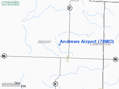
Location & QuickFacts
| FAA Information Effective: | 2008-09-25 |
| Airport Identifier: | 70MO |
| Airport Status: | Operational |
| Longitude/Latitude: | 094-08-46.7870W/37-13-04.2010N
-94.146330/37.217834 (Estimated) |
| Elevation: | 1070 ft / 326.14 m (Estimated) |
| Land: | 0 acres |
| From nearest city: | 7 nautical miles NE of Carthage, MO |
| Location: | Jasper County, MO |
| Magnetic Variation: | 04E (1995) |
Owner & Manager
| Ownership: | Privately owned |
| Owner: | Clint Andrews |
| Address: | 11499 County Road 50
Carthage, MO 64836 |
| Phone number: | 417-439-7066 |
| Manager: | Clint Andrews |
| Address: | 11499 County Road 50
Carthage, MO 64836 |
| Phone number: | 417-439-7066 |
Airport Operations and Facilities
| Airport Use: | Private |
| Wind indicator: | Yes |
| Segmented Circle: | No |
| Control Tower: | No |
| Landing fee charge: | No |
| Sectional chart: | Kansas City |
| Region: | ACE - Central |
| Boundary ARTCC: | ZKC - Kansas City |
| Tie-in FSS: | COU - Columbia |
| FSS on Airport: | No |
| FSS Toll Free: | 1-800-WX-BRIEF |
Runway Information
Runway 04/22
| Dimension: | 1425 x 50 ft / 434.3 x 15.2 m |
| Surface: | TURF, |
| |
Runway 04 |
Runway 22 |
| Traffic Pattern: | Left | Left |
| Obstruction: | 468 ft tower, 8500.0 ft from runway | |
|
Radio Navigation Aids
| ID |
Type |
Name |
Ch |
Freq |
Var |
Dist |
| LLU | NDB | Spring River | | 356.00 | 05E | 18.0 nm |
| PTS | NDB | Pittsburg | | 365.00 | 05E | 30.8 nm |
| ILJ | NDB | Willard | | 254.00 | 03E | 34.1 nm |
| EAD | NDB | Nevada | | 209.00 | 06E | 39.2 nm |
| FSK | NDB | Fort Scott | | 379.00 | 05E | 45.6 nm |
| EOS | VOR/DME | Neosho | 120X | 117.30 | 07E | 26.5 nm |
| SGF | VORTAC | Springfield | 116X | 116.90 | 04E | 39.7 nm |
Remarks
- PRVDD MAINTAIN A CLEAR 20:1 GLIDE SLOPE; MAINTAIN A CLEAR 7:1 SLOPE TRANSITIONAL SURFACE FM THE SIDES OF THE PRIMARY SURFACE AND FMTHE SIDE OF THE APCH SURFACE.
Images and information placed above are from
http://www.airport-data.com/airport/70MO/
We thank them for the data!
| General Info
|
| Country |
United States
|
| State |
MISSOURI
|
| FAA ID |
70MO
|
| Latitude |
37-13-04.201N
|
| Longitude |
094-08-46.787W
|
| Elevation |
1070 feet
|
| Near City |
CARTHAGE
|
We don't guarantee the information is fresh and accurate. The data may
be wrong or outdated.
For more up-to-date information please refer to other sources.
|
|


