 |
|
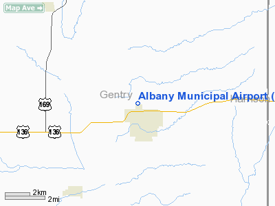
Location & QuickFacts
| FAA Information Effective: | 2008-09-25 |
| Airport Identifier: | K19 |
| Airport Status: | Operational |
| Longitude/Latitude: | 094-20-20.5000W/40-15-43.9000N
-94.339028/40.262194 (Estimated) |
| Elevation: | 886 ft / 270.05 m (Surveyed) |
| Land: | 120 acres |
| From nearest city: | 1 nautical miles N of Albany, MO |
| Location: | Gentry County, MO |
| Magnetic Variation: | 05E (1985) |
Owner & Manager
| Ownership: | Publicly owned |
| Owner: | City Of Albany |
| Address: | 106 E Clay
Albany, MO 64402 |
| Phone number: | 660-726-3935 |
| Manager: | Ken Brenneman
GROUNDS KEEPER. |
| Address: | 106 E. Clay
Albany, MO 64402 |
| Phone number: | 660-726-5755 |
Airport Operations and Facilities
| Airport Use: | Open to public |
| Wind indicator: | Yes |
| Segmented Circle: | Yes |
| Control Tower: | No |
| Lighting Schedule: | DUSK-DAWN |
| Beacon Color: | Clear-Green (lighted land airport)
ROTG BCN OTS INDEFLY. |
| Landing fee charge: | No |
| Sectional chart: | Omaha |
| Region: | ACE - Central |
| Boundary ARTCC: | ZKC - Kansas City |
| Tie-in FSS: | COU - Columbia |
| FSS on Airport: | No |
| FSS Toll Free: | 1-800-WX-BRIEF |
| NOTAMs Facility: | COU (NOTAM-d service avaliable) |
| Federal Agreements: | GY |
Airport Communications
Airport Services
| Fuel available: | 100LL
SELF FUELER - 24 HRS. |
Runway Information
Runway 01/19
| Dimension: | 3300 x 50 ft / 1005.8 x 15.2 m |
| Surface: | CONC, Fair Condition |
| Edge Lights: | Low
RWY 01/19 VARIOUS THLD AND EDGE LGTS ARE BROKEN OR MISSING. |
| |
Runway 01 |
Runway 19 |
| Longitude: | 094-20-24.8000W | 094-20-16.1100W |
| Latitude: | 40-15-27.9200N | 40-15-59.8600N |
| Traffic Pattern: | Left | Right |
| Markings: | Basic, Poor Condition
MARKINGS FADED. | Basic, Poor Condition
MARKINGS FADED. |
| VASI: | system of panels on left side that may or may not be lighted
RWY 01 PNIL OTS INDEFLY. | system of panels on left side that may or may not be lighted
RWY 19 PNIL OTS INDEFLY. |
| Obstruction: | 33 ft trees, 575.0 ft from runway, 60 ft right of centerline, 11:1 slope to clear
+1-10 FT GRASS, BRUSH, FARM ROAD, 0-200 FT FM RY END, BOTH SIDES OF CNTRLN. | 24 ft trees, 281.0 ft from runway, 98 ft left of centerline, 3:1 slope to clear
+1-3 FT GRASS, 0-200 FT FM RY END, L & R. |
|
Radio Navigation Aids
| ID |
Type |
Name |
Ch |
Freq |
Var |
Dist |
| EVU | NDB | Emville | | 317.00 | 05E | 26.9 nm |
| EZZ | NDB | Cameron | | 394.00 | 03E | 32.2 nm |
| AZN | NDB | Amazon | | 233.00 | 06E | 34.7 nm |
| TRX | NDB | Trenton | | 400.00 | 03E | 36.0 nm |
| UNE | NDB | Union County | | 379.00 | 04E | 41.8 nm |
| ICL | NDB | Clarinda | | 353.00 | 04E | 42.1 nm |
| CRZ | NDB | Corning | | 278.00 | 04E | 48.1 nm |
| CHT | NDB | Chillicothe | | 375.00 | 03E | 48.6 nm |
| BQS | VOR/DME | Braymer | 049X | 111.20 | 03E | 43.6 nm |
| LMN | VORTAC | Lamoni | 114X | 116.70 | 07E | 26.3 nm |
| STJ | VORTAC | St Joseph | 102X | 115.50 | 08E | 32.5 nm |
Remarks
- WILDLIFE ON & INVOF ARPT.
Images and information placed above are from
http://www.airport-data.com/airport/K19/
We thank them for the data!
| General Info
|
| Country |
United States
|
| State |
MISSOURI
|
| FAA ID |
K19
|
| Latitude |
40-15-43.947N
|
| Longitude |
094-20-20.499W
|
| Elevation |
886 feet
|
| Near City |
ALBANY
|
We don't guarantee the information is fresh and accurate. The data may
be wrong or outdated.
For more up-to-date information please refer to other sources.
|
|


