|
|
|
 |
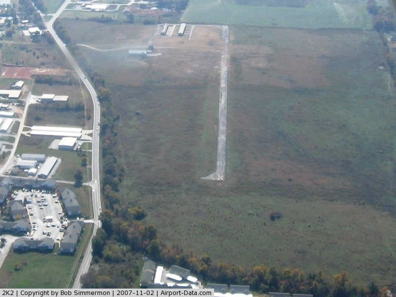
(Click on the photo to enlarge) |
Location & QuickFacts
| FAA Information Effective: | 2008-09-25 |
| Airport Identifier: | 2K2 |
| Airport Status: | Closed Indefinitely |
| Longitude/Latitude: | 093-14-03.3630W/37-03-34.0870N
-93.234268/37.059469 (Estimated) |
| Elevation: | 1336 ft / 407.21 m (Surveyed) |
| Land: | 130 acres |
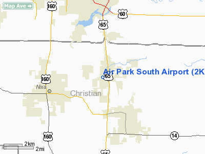
| From nearest city: | 3 nautical miles NW of Ozark, MO |
| Location: | Christian County, MO |
| Magnetic Variation: | 05E (1980) |
Owner & Manager
| Ownership: | Publicly owned |
| Owner: | City Of Springfield |
| Address: | 840 Booneville, Box 8368
Springfield, MO 65801 |
| Phone number: | 417-864-1000 |
| Manager: | Gary Cyr, Sr. |
| Address: | 5000 West Kearney Street, Suite 15
Springfield, MO 65803 |
| Phone number: | 417-869-0300
EXT.2001. |
Airport Operations and Facilities
| Airport Use: | Open to public |
| Wind indicator: | Yes |
| Segmented Circle: | No |
| Control Tower: | No |
| Lighting Schedule: | DUSK-DAWN |
| Landing fee charge: | No |
| Sectional chart: | Kansas City |
| Region: | ACE - Central |
| Traffic Pattern Alt: | 1000 ft |
| Boundary ARTCC: | ZKC - Kansas City |
| Tie-in FSS: | COU - Columbia |
| FSS on Airport: | No |
| FSS Toll Free: | 1-800-WX-BRIEF |
| NOTAMs Facility: | COU (NOTAM-d service avaliable) |
Airport Communications
Airport Services
| Bottled Oxygen: | NONE |
| Bulk Oxygen: | NONE |
Runway Information
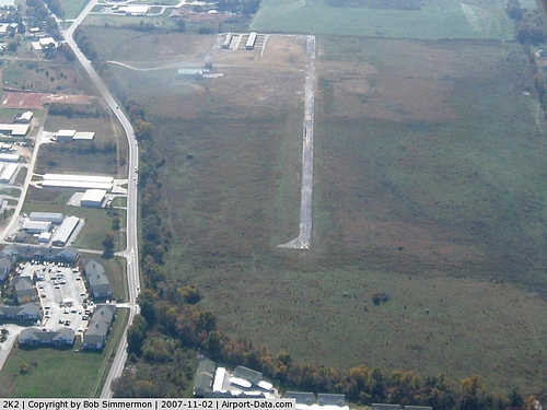
Runway 17/35
| Dimension: | 2528 x 39 ft / 770.5 x 11.9 m
WIDTH VARIANCE 39-40 FT. |
| Surface: | ASPH, Poor Condition
RWY 17/35 ROLLING & UNEVEN WITH GRASS GROWING IN CRACKS THROUGHOUT RY SFC; VARIOUS AREAS WITH BROKEN PVMT; AREAS WHERE PAVEMENT EDGES ARE HIGHER THAN CNTRLN PAVEMENT. |
| Edge Lights: | Non-standard lighting system
NSTD LIRL; 2 THLD LGTS BOTH ENDS; NO YELLOW RY LGTS LAST 1200 FT OF RY 17; RY 17 FIRST 120 FT UNLGTD; RY 35 FIRST 175 FT UNLGTD. |
| |
Runway 17 |
Runway 35 |
| Longitude: | 093-14-03.7520W | 093-14-03.0610W |
| Latitude: | 37-03-46.5620N | 37-03-21.5690N |
| Elevation: | 1308.00 ft | 1336.00 ft |
| Alignment: | 127 | 127 |
| Traffic Pattern: | Left | Left |
| Markings: | Nonstandard, Poor Condition
RWY 17; MARKINGS FADED. | Nonstandard, Poor Condition
RWY 35 MARKINGS FADED. |
| Obstruction: | 60 ft trees, 553.0 ft from runway, 257 ft left of centerline, 5:1 slope to clear
RWY 17 +1-4 FT BRUSH 0-200 FT FM RY END; L & R. | 52 ft trees, 720.0 ft from runway, 296 ft right of centerline, 10:1 slope to clear
RWY 35 +1-4 BRUSH 0-200 FT FM RY END L & R. |
|
Radio Navigation Aids
| ID |
Type |
Name |
Ch |
Freq |
Var |
Dist |
| ILJ | NDB | Willard | | 254.00 | 03E | 17.5 nm |
| PLK | NDB | Point Lookout/dcmsnd | | 204.00 | 03E | 26.0 nm |
| AOV | NDB | Bilmart | | 341.00 | 02E | 27.3 nm |
| IEB | NDB | Lebanon | | 414.00 | 03E | 41.3 nm |
| HRO | VOR/DME | Harrison | 072X | 112.50 | 04E | 44.6 nm |
| DGD | VORTAC | Dogwood | 031X | 109.40 | 06E | 17.3 nm |
| SGF | VORTAC | Springfield | 116X | 116.90 | 04E | 18.4 nm |
Remarks
- WILDLIFE ON & INVOF ARPT.
- (ARPT STATUS) ARPT CLSD INDEFLY.
Images and information placed above are from
http://www.airport-data.com/airport/2K2/
We thank them for the data!
| General Info
|
| Country |
United States
|
| State |
MISSOURI
|
| FAA ID |
2K2
|
| Latitude |
37-03-34.087N
|
| Longitude |
093-14-03.363W
|
| Elevation |
1336 feet
|
| Near City |
OZARK
|
We don't guarantee the information is fresh and accurate. The data may
be wrong or outdated.
For more up-to-date information please refer to other sources.
|
|