 |
|
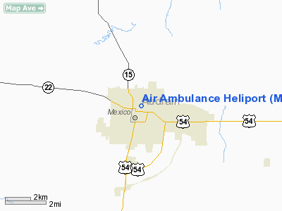
Location & QuickFacts
| FAA Information Effective: | 2008-09-25 |
| Airport Identifier: | MO47 |
| Airport Status: | Operational |
| Longitude/Latitude: | 091-52-45.6120W/39-10-29.1450N
-91.879337/39.174762 (Estimated) |
| Elevation: | 764 ft / 232.87 m (Estimated) |
| Land: | 0 acres |
| From nearest city: | 0 nautical miles E of Mexico, MO |
| Location: | Audrain County, MO |
| Magnetic Variation: | 02E (2000) |
Owner & Manager
| Ownership: | Privately owned |
| Owner: | Audrain Medical Center |
| Address: | 620 East Monroe
Mexico, MO 65265 |
| Phone number: | 573-581-1760 |
| Manager: | Rick Brown |
| Address: | 620 East Monroe
Mexico, MO 65265 |
| Phone number: | 573-581-1760 |
Airport Operations and Facilities
| Airport Use: | Private
MEDICAL. |
| Segmented Circle: | No |
| Control Tower: | No |
| Lighting Schedule: | DUSK-DAWN |
| Sectional chart: | Kansas City |
| Region: | ACE - Central |
| Boundary ARTCC: | ZKC - Kansas City |
| Tie-in FSS: | COU - Columbia |
| FSS Toll Free: | 1-800-WX-BRIEF |
Runway Information
Helipad H1
| Dimension: | 40 x 40 ft / 12.2 x 12.2 m |
| Surface: | CONC, |
| |
Runway H1 |
Runway |
| Traffic Pattern: | Left | Left |
|
Radio Navigation Aids
| ID |
Type |
Name |
Ch |
Freq |
Var |
Dist |
| FTT | NDB | Guthrie | | 317.00 | 03E | 20.8 nm |
| ONH | NDB | Noah | | 515.00 | 03E | 36.6 nm |
| JE | NDB | Algoa | | 397.00 | 03E | 38.7 nm |
| HAE | NDB | Hannibal | | 411.00 | 03E | 38.8 nm |
| VER | NDB | Viertel | | 347.00 | 02E | 39.9 nm |
| COU | VOR/DME | Columbia | 039X | 110.20 | 03E | 27.0 nm |
| MCM | VOR/DME | Macon | 076X | 112.90 | 06E | 40.2 nm |
| HLV | VORTAC | Hallsville | 089X | 114.20 | 06E | 12.2 nm |
| UIN | VORTAC | Quincy | 083X | 113.60 | 05E | 49.1 nm |
| JEF | VOT | Jefferson City | | 112.00 | | 37.4 nm |
Remarks
- OWNER DESIRES HELIPORT NOT BE CHARTED.
- SEE AIRSPACE LTR DATED 7/22/98.
Images and information placed above are from
http://www.airport-data.com/airport/MO47/
We thank them for the data!
| General Info
|
| Country |
United States
|
| State |
MISSOURI
|
| FAA ID |
MO47
|
| Latitude |
39-10-29.145N
|
| Longitude |
091-52-45.612W
|
| Elevation |
764 feet
|
| Near City |
MEXICO
|
We don't guarantee the information is fresh and accurate. The data may
be wrong or outdated.
For more up-to-date information please refer to other sources.
|
|


