 |
|
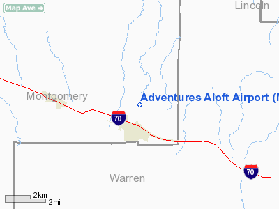
Location & QuickFacts
| FAA Information Effective: | 2008-09-25 |
| Airport Identifier: | MO07 |
| Airport Status: | Operational |
| Longitude/Latitude: | 091-18-00.5600W/38-52-21.1570N
-91.300156/38.872544 (Estimated) |
| Elevation: | 871 ft / 265.48 m (Estimated) |
| Land: | 68 acres |
| From nearest city: | 1 nautical miles N of Jonesburg, MO |
| Location: | Montgomery County, MO |
| Magnetic Variation: | 03E (1984) |
Owner & Manager
| Ownership: | Privately owned |
| Owner: | Reco Properties Inc |
| Address: | Po Box 1967
Platte City, MO 64079 |
| Phone number: | 816-464-5567 |
| Manager: | Bob Lewis |
| Address: | 101 E Walton
Warrenton, MO 63383 |
| Phone number: | 573-456-2615 |
Airport Operations and Facilities
| Airport Use: | Private |
| Wind indicator: | Yes |
| Segmented Circle: | No |
| Control Tower: | No |
| Landing fee charge: | No |
| Sectional chart: | Kansas City |
| Region: | ACE - Central |
| Boundary ARTCC: | ZKC - Kansas City |
| Tie-in FSS: | STL - Saint Louis |
| FSS on Airport: | No |
| FSS Toll Free: | 1-800-WX-BRIEF |
Airport Services
Runway Information
Runway 18/36
| Dimension: | 2075 x 50 ft / 632.5 x 15.2 m |
| Surface: | GRVL, Fair Condition |
| |
Runway 18 |
Runway 36 |
| Traffic Pattern: | Right | Left |
| Obstruction: | 41 ft trees, 925.0 ft from runway, 145 ft left of centerline, 22:1 slope to clear | , 50:1 slope to clear |
|
Radio Navigation Aids
| ID |
Type |
Name |
Ch |
Freq |
Var |
Dist |
| FTT | NDB | Guthrie | | 317.00 | 03E | 33.0 nm |
| UUV | NDB | Sullivan | | 356.00 | 02E | 38.8 nm |
| LM | NDB | Oblio | | 338.00 | 00E | 38.9 nm |
| JE | NDB | Algoa | | 397.00 | 03E | 41.1 nm |
| ONH | NDB | Noah | | 515.00 | 03E | 46.5 nm |
| UBX | NDB | Cuba | | 380.00 | 01E | 48.9 nm |
| COU | VOR/DME | Columbia | 039X | 110.20 | 03E | 43.1 nm |
| CSX | VOR/DME | Cardinal | 111Y | 116.45 | 00E | 44.6 nm |
| VIH | VOR/DME | Vichy | 124X | 117.70 | 06E | 47.2 nm |
| FTZ | VORTAC | Foristell | 045X | 110.80 | 05E | 18.8 nm |
| STL | VORTAC | St Louis | 121X | 117.40 | 01E | 38.3 nm |
| HLV | VORTAC | Hallsville | 089X | 114.20 | 06E | 41.3 nm |
| SUS | VOT | Spirit Of St Louis | | 112.20 | | 32.9 nm |
| JEF | VOT | Jefferson City | | 112.00 | | 43.3 nm |
| STL | VOT | St Louis Lambert | | 111.00 | | 44.6 nm |
Remarks
- HIGH GND & ROAD IN PRIMARY SFC; VIOLATIONS OF 7:1 TRSN=TREES & ROAD ON EAST SIDE; PLINE TREES & ANTENNA ON WEST SIDE.
- PROVIDED APPROACHES ARE MAINTAINED FOR A 20:1 GLIDE SLOPE & TRANSITIONAL SURFACES FOR A 7:1 SLOPE; RIGHT TRAFFIC PATTERN IS ESTABLISHED FOR RWY 18.
Images and information placed above are from
http://www.airport-data.com/airport/MO07/
We thank them for the data!
| General Info
|
| Country |
United States
|
| State |
MISSOURI
|
| FAA ID |
MO07
|
| Latitude |
38-52-21.157N
|
| Longitude |
091-18-00.560W
|
| Elevation |
871 feet
|
| Near City |
JONESBURG
|
We don't guarantee the information is fresh and accurate. The data may
be wrong or outdated.
For more up-to-date information please refer to other sources.
|
|


