 |
|
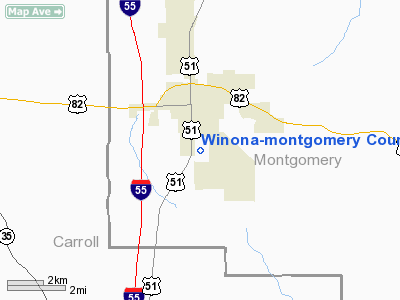
Winona-montgomery County Airport |
Location & QuickFacts
| FAA Information Effective: | 2008-09-25 |
| Airport Identifier: | 5A6 |
| Airport Status: | Operational |
| Longitude/Latitude: | 089-43-48.7830W/33-27-53.9560N
-89.730217/33.464988 (Estimated) |
| Elevation: | 364 ft / 110.95 m (Surveyed) |
| Land: | 50 acres |
| From nearest city: | 1 nautical miles S of Winona, MS |
| Location: | Montgomery County, MS |
| Magnetic Variation: | 01W (2010) |
Owner & Manager
| Ownership: | Publicly owned |
| Owner: | Winona City & Montgomery County |
| Address: | Po Box 29
Winona, MS 38967 |
| Phone number: | 662-283-1232 |
| Manager: | Jimmy Hayward
CHAIRMAN, MONTGOMERY CO. BOARD; JAN W. BAILEY. |
| Address: | 201 Airport Dr
Winona, MS 38967 |
| Phone number: | 662-283-3613 |
Airport Operations and Facilities
| Airport Use: | Open to public |
| Wind indicator: | Yes |
| Segmented Circle: | Yes |
| Control Tower: | No |
| Lighting Schedule: | DUSK-DAWN
ACTIVATE MIRL RY 03/21 - CTAF. RY 03/21 PAPI ON CONT. |
| Beacon Color: | Clear-Green (lighted land airport) |
| Landing fee charge: | No |
| Sectional chart: | Memphis |
| Region: | ASO - Southern |
| Boundary ARTCC: | ZME - Memphis |
| Tie-in FSS: | GWO - Greenwood |
| FSS on Airport: | No |
| FSS Toll Free: | 1-800-WX-BRIEF |
| NOTAMs Facility: | GWO (NOTAM-d service avaliable) |
| Federal Agreements: | NGY |
Airport Communications
Airport Services
| Fuel available: | 100LLMOGAS |
| Airframe Repair: | MINOR |
| Power Plant Repair: | MINOR |
| Bottled Oxygen: | NONE |
| Bulk Oxygen: | NONE |
Runway Information
Runway 03/21
| Dimension: | 4000 x 60 ft / 1219.2 x 18.3 m |
| Surface: | ASPH, Good Condition |
| Weight Limit: | Single wheel: 18000 lbs. |
| Edge Lights: | Medium |
| |
Runway 03 |
Runway 21 |
| Longitude: | 089-44-00.1130W | 089-43-37.4510W |
| Latitude: | 33-27-36.5980N | 33-28-11.3140N |
| Elevation: | 348.00 ft | 364.00 ft |
| Traffic Pattern: | Left | Left |
| Markings: | Basic, Good Condition
RWY 03 MARKINGS BADLY FADED AND PEELING. | Basic, Good Condition
RWY 21 MARKINGS BADLY FADED AND PEELING. |
| Crossing Height: | 30.00 ft | 30.00 ft |
| VASI: | 2-light PAPI on left side | 2-light PAPI on left side |
| Visual Glide Angle: | 3.00° | 3.00° |
| Obstruction: | 85 ft tree, 530.0 ft from runway, 200 ft left of centerline, 3:1 slope to clear | 60 ft trees, 1500.0 ft from runway, 100 ft right of centerline, 21:1 slope to clear |
|
Radio Navigation Aids
| ID |
Type |
Name |
Ch |
Freq |
Var |
Dist |
| OSX | NDB | Kosciusko | | 269.00 | 00W | 24.4 nm |
| SBQ | NDB | Scobey | | 245.00 | 01E | 26.6 nm |
| LMS | NDB | Louisville | | 212.00 | 00E | 38.8 nm |
| STF | NDB | Bryan | | 281.00 | 02E | 44.2 nm |
| IDL | NDB | Indianola | | 284.00 | 03E | 47.4 nm |
| SQS | VORTAC | Sidon | 094X | 114.70 | 03E | 27.4 nm |
Remarks
- RY 03/21 CLSD 0100-1100 DLY.
- PAEW ADJ RY 03/21 & ASSOCIATED TYS.
- VFR ONLY.
Images and information placed above are from
http://www.airport-data.com/airport/5A6/
We thank them for the data!
| General Info
|
| Country |
United States
|
| State |
MISSISSIPPI
|
| FAA ID |
5A6
|
| Latitude |
33-27-55.445N
|
| Longitude |
089-43-45.293W
|
| Elevation |
363 feet
|
| Near City |
WINONA
|
We don't guarantee the information is fresh and accurate. The data may
be wrong or outdated.
For more up-to-date information please refer to other sources.
|
|


