 |
|
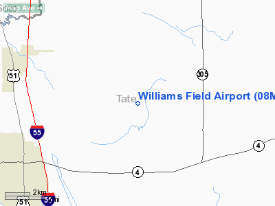
Location & QuickFacts
| FAA Information Effective: | 2008-09-25 |
| Airport Identifier: | 08MS |
| Airport Status: | Operational |
| Longitude/Latitude: | 089-52-06.0000W/34-39-44.0000N
-89.868333/34.662222 (Estimated) |
| Elevation: | 345 ft / 105.16 m (Estimated) |
| Land: | 0 acres |
| From nearest city: | 6 nautical miles SE of Coldwater, MS |
| Location: | Tate County, MS |
| Magnetic Variation: | () |
Owner & Manager
| Ownership: | Privately owned |
| Owner: | Williams Plantation |
| Address: | 108-b East Main Street
Senatobia, MS 38618 |
| Phone number: | 662-560-9099 |
| Manager: | John T. Williams |
| Address: | 108-b East Main Street
Senatobia, MS 38618 |
| Phone number: | 662-560-9099 |
Airport Operations and Facilities
| Airport Use: | Private |
| Wind indicator: | Yes |
| Control Tower: | No |
| Lighting Schedule: | RDO-CTL
ACTVT LIRL RY 07/25 - 122.8. |
| Sectional chart: | Memphis |
| Region: | ASO - Southern |
| Boundary ARTCC: | ZME - Memphis |
| Tie-in FSS: | GWO - Greenwood |
| FSS Toll Free: | 1-800-WX-BRIEF |
Airport Services
Runway Information
Runway 07/25
| Dimension: | 3725 x 50 ft / 1135.4 x 15.2 m |
| Surface: | ASPH-TURF, |
| Edge Lights: | Low |
| |
Runway 07 |
Runway 25 |
| Traffic Pattern: | Left | Left |
|
Radio Navigation Aids
| ID |
Type |
Name |
Ch |
Freq |
Var |
Dist |
| OLV | NDB | Olive Branch | | 275.00 | 01E | 19.5 nm |
| ME | NDB | Elvis | | 287.00 | 01E | 26.0 nm |
| SPQ | NDB | Spain | | 414.00 | 04E | 33.6 nm |
| AWM | NDB | West Memphis | | 362.00 | 01E | 33.8 nm |
| MIG | NDB | Millington | | 232.00 | 04E | 37.2 nm |
| CKM | NDB | Clarksdale | | 341.00 | 02E | 39.0 nm |
| FYE | NDB | Somerville | | 255.00 | 00E | 40.2 nm |
| HEE | NDB | Thompson-robbins | | 251.00 | 01E | 40.3 nm |
| SBQ | NDB | Scobey | | 245.00 | 01E | 46.3 nm |
| FCY | NDB | Forrest City | | 332.00 | 01E | 47.7 nm |
| UJM | VOR/DME | Marvell | 033X | 109.60 | 01E | 40.2 nm |
| HLI | VORTAC | Holly Springs | 071X | 112.40 | 03E | 19.5 nm |
| MEM | VORTAC | Memphis | 122X | 117.50 | 01E | 22.0 nm |
| MEM | VOT | Memphis Metropolitn | | 111.00 | | 23.9 nm |
Remarks
Images and information placed above are from
http://www.airport-data.com/airport/08MS/
We thank them for the data!
| General Info
|
| Country |
United States
|
| State |
MISSISSIPPI
|
| FAA ID |
08MS
|
| Latitude |
34.662222
34° 39' 44.00" N
|
| Longitude |
-89.868333
089° 52' 06.00" W
|
| Elevation |
345 feet
105 meters
|
| Magnetic Variation |
000° W (07/06)
|
| Operating Agency |
PRIVATE
|
We don't guarantee the information is fresh and accurate. The data may
be wrong or outdated.
For more up-to-date information please refer to other sources.
|
|


