 |
|
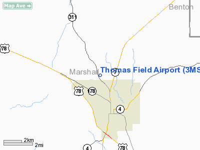
Location & QuickFacts
| FAA Information Effective: | 2008-09-25 |
| Airport Identifier: | 3MS1 |
| Airport Status: | Operational |
| Longitude/Latitude: | 089-27-39.3000W/34-48-21.0000N
-89.460917/34.805833 (Estimated) |
| Elevation: | 485 ft / 147.83 m (Estimated) |
| Land: | 0 acres |
| From nearest city: | 2 nautical miles NW of Holly Springs, MS |
| Location: | Marshall County, MS |
| Magnetic Variation: | 01E (1990) |
Owner & Manager
| Ownership: | Privately owned |
| Owner: | Charles Thomas |
| Address: | Po Box 5155
Holly Springs, MS 38634 |
| Phone number: | 601-252-1161 |
| Address: |
|
Airport Operations and Facilities
| Airport Use: | Private |
| Segmented Circle: | No |
| Control Tower: | No |
| Sectional chart: | Memphis |
| Region: | ASO - Southern |
| Boundary ARTCC: | ZME - Memphis |
| Tie-in FSS: | GWO - Greenwood |
| FSS Toll Free: | 1-800-WX-BRIEF |
Runway Information
Runway 12/30
| Dimension: | 3200 x 60 ft / 975.4 x 18.3 m |
| Surface: | TURF, |
| |
Runway 12 |
Runway 30 |
| Traffic Pattern: | Left | Left |
| Obstruction: | 32 ft trees, 350.0 ft from runway | 32 ft trees, 350.0 ft from runway |
|
Radio Navigation Aids
| ID |
Type |
Name |
Ch |
Freq |
Var |
Dist |
| OLV | NDB | Olive Branch | | 275.00 | 01E | 19.3 nm |
| FYE | NDB | Somerville | | 255.00 | 00E | 24.3 nm |
| BAV | NDB | Hardeman | | 404.00 | 01E | 32.1 nm |
| ME | NDB | Elvis | | 287.00 | 01E | 33.8 nm |
| MIG | NDB | Millington | | 232.00 | 04E | 36.7 nm |
| SPQ | NDB | Spain | | 414.00 | 04E | 37.6 nm |
| AWM | NDB | West Memphis | | 362.00 | 01E | 43.0 nm |
| COO | NDB | Covington | | 326.00 | 02E | 47.5 nm |
| OTB | VOR/DME | Tupelo | 035X | 109.80 | 04E | 48.0 nm |
| HLI | VORTAC | Holly Springs | 071X | 112.40 | 03E | 2.8 nm |
| MEM | VORTAC | Memphis | 122X | 117.50 | 01E | 28.7 nm |
| MEM | VOT | Memphis Metropolitn | | 111.00 | | 29.4 nm |
Remarks
Images and information placed above are from
http://www.airport-data.com/airport/3MS1/
We thank them for the data!
| General Info
|
| Country |
United States
|
| State |
MISSISSIPPI
|
| FAA ID |
3MS1
|
| Latitude |
34-48-21.000N
|
| Longitude |
089-27-39.300W
|
| Elevation |
485 feet
|
| Near City |
HOLLY SPRINGS
|
We don't guarantee the information is fresh and accurate. The data may
be wrong or outdated.
For more up-to-date information please refer to other sources.
|
|


