 |
|
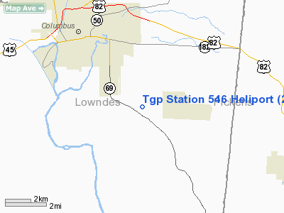
Location & QuickFacts
| FAA Information Effective: | 2008-09-25 |
| Airport Identifier: | 2MS4 |
| Airport Status: | Operational |
| Longitude/Latitude: | 088-21-42.0000W/33-26-57.0000N
-88.361667/33.449167 (Estimated) |
| Elevation: | 219 ft / 66.75 m (Estimated) |
| Land: | 0 acres |
| From nearest city: | 6 nautical miles SE of Columbus, MS |
| Location: | Lowndes County, MS |
| Magnetic Variation: | 01E (1990) |
Owner & Manager
| Ownership: | Privately owned |
| Owner: | Tennessee Gas Pipeline Co. |
| Address: | Box 2444, Highway 69 South
Columbus, MS 39704 |
| Phone number: | 901-376-8449 |
| Manager: | George Weir |
| Address: | 2560 Hwy 125 South
Middleton, TN 38052 |
| Phone number: | 901-376-8449 |
Airport Operations and Facilities
| Airport Use: | Private |
| Segmented Circle: | No |
| Control Tower: | No |
| Sectional chart: | Memphis |
| Region: | ASO - Southern |
| Boundary ARTCC: | ZME - Memphis |
| Tie-in FSS: | GWO - Greenwood |
| FSS on Airport: | No |
| FSS Toll Free: | 1-800-WX-BRIEF |
Runway Information
Helipad H1
| Dimension: | 150 x 150 ft / 45.7 x 45.7 m |
| Surface: | TURF, |
| |
Runway H1 |
Runway |
| Traffic Pattern: | Left | Left |
|
Radio Navigation Aids
| ID |
Type |
Name |
Ch |
Freq |
Var |
Dist |
| AIV | NDB | Aliceville | | 254.00 | | 22.0 nm |
| STF | NDB | Bryan | | 281.00 | 02E | 24.5 nm |
| FDF | NDB | Fayette | | 204.00 | 00E | 31.8 nm |
| LMS | NDB | Louisville | | 212.00 | 00E | 39.6 nm |
| NJW | TACAN | Joe Williams | 61Y | | 01E | 46.0 nm |
| IGB | VORTAC | Bigbee | 109X | 116.20 | 04E | 7.9 nm |
| CBM | VORTAC | Caledonia | 099X | 115.20 | 00E | 12.2 nm |
| LDK | VORTAC | Crimson | 125X | 117.80 | 03E | 43.0 nm |
| HAB | VORTAC | Hamilton | 041X | 110.40 | 02E | 48.1 nm |
Remarks
- PROVIDED PR USE; ALL APCH/DEP ROUTE OPS ARE FROM 220 DEG TO 045 DEG; AREA APPROPRIATELY MKD; A WIND INDICATOR IS MNTND.
Images and information placed above are from
http://www.airport-data.com/airport/2MS4/
We thank them for the data!
| General Info
|
| Country |
United States
|
| State |
MISSISSIPPI
|
| FAA ID |
2MS4
|
| Latitude |
33-26-57.000N
|
| Longitude |
088-21-42.000W
|
| Elevation |
219 feet
|
| Near City |
COLUMBUS
|
We don't guarantee the information is fresh and accurate. The data may
be wrong or outdated.
For more up-to-date information please refer to other sources.
|
|


