 |
|
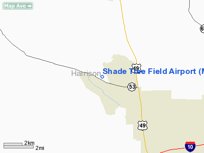
Location & QuickFacts
| FAA Information Effective: | 2008-09-25 |
| Airport Identifier: | MS82 |
| Airport Status: | Operational |
| Longitude/Latitude: | 089-08-50.1510W/30-30-37.7000N
-89.147264/30.510472 (Estimated) |
| Elevation: | 113 ft / 34.44 m (Estimated) |
| Land: | 36 acres |
| From nearest city: | 2 nautical miles W of Lyman, MS |
| Location: | Harrison County, MS |
| Magnetic Variation: | 02E (1985) |
Owner & Manager
| Ownership: | Privately owned |
| Owner: | Danny Miller |
| Address: | Po Box 2026
Gulfport, MS 39505 |
| Phone number: | 228-832-5600 |
| Address: |
|
Airport Operations and Facilities
| Airport Use: | Private |
| Wind indicator: | Yes |
| Segmented Circle: | No |
| Control Tower: | No |
| Lighting Schedule: | RDO-CTL
ACTVT LIRL RY 17/35 - 122.9. |
| Landing fee charge: | No |
| Sectional chart: | New Orleans |
| Region: | ASO - Southern |
| Boundary ARTCC: | ZHU - Houston |
| Tie-in FSS: | GWO - Greenwood |
| FSS on Airport: | No |
| FSS Toll Free: | 1-800-WX-BRIEF |
Runway Information
Runway 17/35
| Dimension: | 2800 x 100 ft / 853.4 x 30.5 m |
| Surface: | TURF, |
| Edge Lights: | Low |
| |
Runway 17 |
Runway 35 |
| Traffic Pattern: | Left | Left |
| Obstruction: | | 15 ft pline |
|
Radio Navigation Aids
| ID |
Type |
Name |
Ch |
Freq |
Var |
Dist |
| HS | NDB | Hanco | | 221.00 | 01E | 16.4 nm |
| AYI | NDB | Hanco | | 221.00 | 03E | 16.4 nm |
| MJD | NDB | Picayune | | 276.00 | 01E | 26.2 nm |
| FNA | NDB | Florenville | | 371.00 | 03E | 35.3 nm |
| DEF | NDB | Slidell | | 256.00 | 03E | 37.9 nm |
| BX | NDB | Carma | | 353.00 | 02E | 43.2 nm |
| MO | NDB | Wisle | | 248.00 | 02E | 46.2 nm |
| BIX | TACAN | Keesler | 055X | | 01E | 12.9 nm |
| GPT | VOR/DME | Gulfport | 27X | 109.00 | 02E | 7.4 nm |
| PCU | VOR/DME | Picayune | 059X | 112.20 | 05E | 30.3 nm |
| SJI | VORTAC | Semmes | 100X | 115.30 | 05E | 42.8 nm |
| GCV | VORTAC | Greene County | 104X | 115.70 | 05E | 49.1 nm |
Remarks
- SOME ULTRALIGHT ACTIVITY ON FIELD.
- VFR; PRIVATE USE ONLY.
Images and information placed above are from
http://www.airport-data.com/airport/MS82/
We thank them for the data!
| General Info
|
| Country |
United States
|
| State |
MISSISSIPPI
|
| FAA ID |
MS82
|
| Latitude |
30-30-37.700N
|
| Longitude |
089-08-50.151W
|
| Elevation |
50 feet
|
| Near City |
LYMAN
|
We don't guarantee the information is fresh and accurate. The data may
be wrong or outdated.
For more up-to-date information please refer to other sources.
|
|


