 |
|
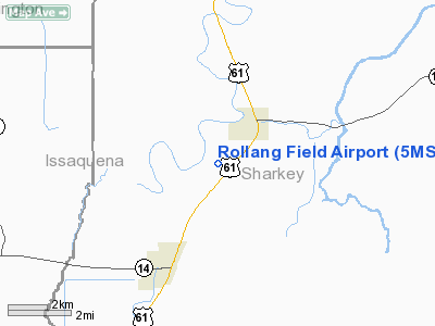
Location & QuickFacts
| FAA Information Effective: | 2008-09-25 |
| Airport Identifier: | 5MS1 |
| Airport Status: | Operational |
| Longitude/Latitude: | 090-50-45.3590W/32-57-15.4560N
-90.845933/32.954293 (Estimated) |
| Elevation: | 106 ft / 32.31 m (Estimated) |
| Land: | 0 acres |
| From nearest city: | 3 nautical miles NE of Rolling Fork, MS |
| Location: | Sharkey County, MS |
| Magnetic Variation: | 03E (1985) |
Owner & Manager
| Ownership: | Privately owned |
| Owner: | Helena Plantation |
| Address: |
|
| Manager: | Bill Rainwater |
| Address: | 206 Meadow Rd
Rolling Fork, MS 39159 |
| Phone number: | 601-873-6273 |
Airport Operations and Facilities
| Airport Use: | Private |
| Wind indicator: | Yes |
| Segmented Circle: | No |
| Control Tower: | No |
| Landing fee charge: | No |
| Sectional chart: | Memphis |
| Region: | ASO - Southern |
| Boundary ARTCC: | ZME - Memphis |
| Tie-in FSS: | GWO - Greenwood |
| FSS on Airport: | No |
| FSS Toll Free: | 1-800-WX-BRIEF |
Airport Services
| Fuel available: | 100 |
| Airframe Repair: | MAJOR |
| Power Plant Repair: | MAJOR |
| Bottled Oxygen: | NONE |
| Bulk Oxygen: | NONE |
Runway Information
Runway 17/35
| Dimension: | 3670 x 75 ft / 1118.6 x 22.9 m |
| Surface: | CONC-TURF, |
| |
Runway 17 |
Runway 35 |
| Traffic Pattern: | Right | Left |
|
Radio Navigation Aids
| ID |
Type |
Name |
Ch |
Freq |
Var |
Dist |
| BLE | NDB | Lake Providence | | 278.00 | 03E | 18.9 nm |
| MTQ | NDB | Metcalf | | 359.00 | 03E | 29.1 nm |
| IDL | NDB | Indianola | | 284.00 | 03E | 32.7 nm |
| VKS | NDB | Vicksburg | | 382.00 | 03E | 43.6 nm |
| TV | NDB | Savry | | 344.00 | 02E | 43.6 nm |
| JH | NDB | Brenz | | 260.00 | 02E | 44.0 nm |
| RYB | NDB | Raymond | | 375.00 | 03E | 45.0 nm |
| GLH | VOR/DME | Greenville | 039X | 110.20 | 04E | 34.9 nm |
| SQS | VORTAC | Sidon | 094X | 114.70 | 03E | 41.9 nm |
| JAN | VORTAC | Jackson | 073X | 112.60 | 05E | 43.6 nm |
Remarks
- RY 17/35 CENTER IS 2000 FT BY 20 FT CONCRETE.
- PRIOR TO 1959.
Images and information placed above are from
http://www.airport-data.com/airport/5MS1/
We thank them for the data!
| General Info
|
| Country |
United States
|
| State |
MISSISSIPPI
|
| FAA ID |
5MS1
|
| Latitude |
32-57-15.456N
|
| Longitude |
090-50-45.359W
|
| Elevation |
106 feet
|
| Near City |
ROLLING FORK
|
We don't guarantee the information is fresh and accurate. The data may
be wrong or outdated.
For more up-to-date information please refer to other sources.
|
|


