 |
|
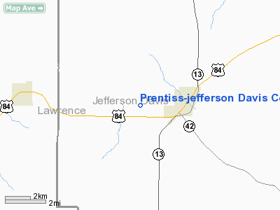
Prentiss - Jefferson Davis County Airport |
Location & QuickFacts
| FAA Information Effective: | 2008-09-25 |
| Airport Identifier: | M43 |
| Airport Status: | Operational |
| Longitude/Latitude: | 089-54-23.2000W/31-35-43.1000N
-89.906444/31.595306 (Estimated) |
| Elevation: | 455 ft / 138.68 m (Surveyed) |
| Land: | 63 acres |
| From nearest city: | 2 nautical miles W of Prentiss, MS |
| Location: | Jefferson Davis County, MS |
| Magnetic Variation: | 00E (2005) |
Owner & Manager
| Ownership: | Publicly owned |
| Owner: | Town Of Prentiss
CHARLES DUMAS, MAYOR. |
| Address: | Po Box 31
Prentiss, MS 39479 |
| Phone number: | 601-792-5196 |
| Manager: | Arpt Board
TONY WAITS ARPT BOARD SECY/TREASURER. |
| Address: | Po Box 933
Prentiss, MS 39474 |
| Phone number: | 601-792-4467 |
Airport Operations and Facilities
| Airport Use: | Open to public |
| Wind indicator: | Yes |
| Segmented Circle: | Yes |
| Control Tower: | No |
| Lighting Schedule: | DUSK-DAWN
RWY 12/30 FOR MIRL AFTER 2300 KEY 121.9 FIVE TIMES. |
| Beacon Color: | Clear-Green (lighted land airport) |
| Landing fee charge: | No |
| Sectional chart: | New Orleans |
| Region: | ASO - Southern |
| Boundary ARTCC: | ZHU - Houston |
| Tie-in FSS: | GWO - Greenwood |
| FSS on Airport: | No |
| FSS Toll Free: | 1-800-WX-BRIEF |
| NOTAMs Facility: | GWO (NOTAM-d service avaliable) |
| Federal Agreements: | NGY |
Airport Communications
| CTAF: | 122.800 |
| Unicom: | 122.800 |
Airport Services
| Fuel available: | 100LL
FUEL AVBL 24 HRS WITH CREDIT CARD. |
| Airframe Repair: | NONE |
| Power Plant Repair: | NONE |
| Bottled Oxygen: | NONE |
| Bulk Oxygen: | NONE |
Runway Information
Runway 12/30
| Dimension: | 3197 x 60 ft / 974.4 x 18.3 m |
| Surface: | ASPH, Good Condition |
| Weight Limit: | Single wheel: 20000 lbs. |
| Edge Lights: | Medium |
| |
Runway 12 |
Runway 30 |
| Longitude: | 089-54-38.7440W | 089-54-07.6402W |
| Latitude: | 31-35-51.6839N | 31-35-34.5850N |
| Elevation: | 455.00 ft | 454.00 ft |
| Alignment: | 123 | 127 |
| Traffic Pattern: | Left | Left |
| Markings: | Basic, Good Condition | Basic, Good Condition |
| VASI: | 2-light PAPI on left side | 2-light PAPI on left side |
| Obstruction: | 21 ft trees, 520.0 ft from runway, 20L/ ft right of centerline, 15:1 slope to clear | 57 ft trees, 1284.0 ft from runway, 250 ft left of centerline, 19:1 slope to clear |
|
Radio Navigation Aids
| ID |
Type |
Name |
Ch |
Freq |
Var |
Dist |
| FOH | NDB | Foxworth | | 331.00 | 05E | 18.5 nm |
| BVV | NDB | Brookhaven | | 407.00 | 03E | 25.8 nm |
| THJ | NDB | Tallahala | | 346.00 | 00E | 37.1 nm |
| MC | NDB | Ferni | | 413.00 | 03E | 37.1 nm |
| BX | NDB | Carma | | 353.00 | 02E | 43.0 nm |
| RYB | NDB | Raymond | | 375.00 | 03E | 49.7 nm |
| MCB | VORTAC | Mc Comb | 114X | 116.70 | 03E | 25.1 nm |
| LBY | VORTAC | Eaton | 043X | 110.60 | 05E | 31.0 nm |
| JAN | VOT | Jackson | | 111.00 | | 43.7 nm |
Remarks
- ULTRALIGHT ACTIVITY ON & INVOF ARPT.
Images and information placed above are from
http://www.airport-data.com/airport/M43/
We thank them for the data!
| General Info
|
| Country |
United States
|
| State |
MISSISSIPPI
|
| FAA ID |
M43
|
| Latitude |
31-35-43.605N
|
| Longitude |
089-54-22.286W
|
| Elevation |
454 feet
|
| Near City |
PRENTISS
|
We don't guarantee the information is fresh and accurate. The data may
be wrong or outdated.
For more up-to-date information please refer to other sources.
|
|


