 |
|
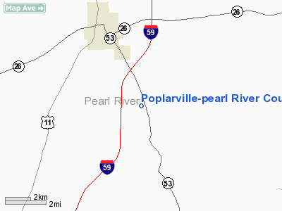
Poplarville - Pearl River County Airport |
Location & QuickFacts
| FAA Information Effective: | 2008-09-25 |
| Airport Identifier: | M13 |
| Airport Status: | Operational |
| Longitude/Latitude: | 089-30-16.2250W/30-47-09.6740N
-89.504507/30.786021 (Estimated) |
| Elevation: | 320 ft / 97.54 m (Surveyed) |
| Land: | 140 acres |
| From nearest city: | 3 nautical miles SE of Poplarville, MS |
| Location: | Pearl River County, MS |
| Magnetic Variation: | 03E (1985) |
Owner & Manager
| Ownership: | Publicly owned |
| Owner: | City Of Poplarville
CITY OF POPLARVILLE & PEARL RIVER COUNTY. |
| Address: | City Hall, 101 N Main St
Poplarville, MS 39470 |
| Phone number: | 601-795-8161 |
| Manager: | Reggie Savoie |
| Address: | Po Box 901
Poplarville, MS 39470 |
| Phone number: | 601-795-9371
601-795-7285 (CELL) |
Airport Operations and Facilities
| Airport Use: | Open to public |
| Wind indicator: | Yes |
| Segmented Circle: | Yes |
| Control Tower: | No |
| Lighting Schedule: | DUSK-DAWN
MIRL RY 16/34 & PAPI RYS 16 AND 34 OPER DUSK-2100; AFT 2100 ACTVT - CTAF. |
| Beacon Color: | Clear-Green (lighted land airport) |
| Sectional chart: | New Orleans |
| Region: | ASO - Southern |
| Boundary ARTCC: | ZHU - Houston |
| Tie-in FSS: | GWO - Greenwood |
| FSS on Airport: | No |
| FSS Toll Free: | 1-800-WX-BRIEF |
| NOTAMs Facility: | GWO (NOTAM-d service avaliable) |
| Federal Agreements: | NGY |
Airport Communications
Airport Services
| Fuel available: | 100LL
24 HR SELF-SERVE WITH CREDIT CARD. |
| Airframe Repair: | NONE |
| Power Plant Repair: | NONE |
| Bottled Oxygen: | NONE |
| Bulk Oxygen: | NONE |
Runway Information
Runway 16/34
| Dimension: | 4000 x 100 ft / 1219.2 x 30.5 m |
| Surface: | ASPH, Good Condition |
| Weight Limit: | Single wheel: 25200 lbs. |
| Edge Lights: | Medium |
| |
Runway 16 |
Runway 34 |
| Traffic Pattern: | Left | Left |
| Markings: | Basic, Good Condition | Basic, Good Condition |
| VASI: | 2-light PAPI on left side | 2-light PAPI on left side |
| Obstruction: | 58 ft trees, 1860.0 ft from runway, 28:1 slope to clear | 58 ft trees, 1445.0 ft from runway, 300 ft left of centerline, 21:1 slope to clear |
|
Radio Navigation Aids
| ID |
Type |
Name |
Ch |
Freq |
Var |
Dist |
| MJD | NDB | Picayune | | 276.00 | 01E | 19.1 nm |
| BX | NDB | Carma | | 353.00 | 02E | 19.3 nm |
| HS | NDB | Hanco | | 221.00 | 01E | 20.3 nm |
| AYI | NDB | Hanco | | 221.00 | 03E | 20.3 nm |
| FNA | NDB | Florenville | | 371.00 | 03E | 27.6 nm |
| DEF | NDB | Slidell | | 256.00 | 03E | 34.0 nm |
| FOH | NDB | Foxworth | | 331.00 | 05E | 34.7 nm |
| BIX | TACAN | Keesler | 055X | | 01E | 37.5 nm |
| HMU | VOR | Hammond | | 109.60 | 03E | 49.9 nm |
| PCU | VOR/DME | Picayune | 059X | 112.20 | 05E | 17.9 nm |
| GPT | VOR/DME | Gulfport | 27X | 109.00 | 02E | 31.9 nm |
| LBY | VORTAC | Eaton | 043X | 110.60 | 05E | 39.0 nm |
| MCB | VORTAC | Mc Comb | 114X | 116.70 | 03E | 49.8 nm |
Remarks
- RY 34 TERRAIN DROPS OFF ABRUPTLY AT 200' FROM THR.
- 335' AGL ANTENNA TWR ON LEFT DOWNWIND PATTERN TO RWY 16.
- ULTRALIGHT ACTIVITY ON & INVOF ARPT.
Images and information placed above are from
http://www.airport-data.com/airport/M13/
We thank them for the data!
| General Info
|
| Country |
United States
|
| State |
MISSISSIPPI
|
| FAA ID |
M13
|
| Latitude |
30-47-09.674N
|
| Longitude |
089-30-16.225W
|
| Elevation |
320 feet
|
| Near City |
POPLARVILLE
|
We don't guarantee the information is fresh and accurate. The data may
be wrong or outdated.
For more up-to-date information please refer to other sources.
|
|


