 |
|
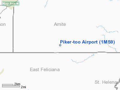
Location & QuickFacts
| FAA Information Effective: | 2008-09-25 |
| Airport Identifier: | 1MS9 |
| Airport Status: | Operational |
| Longitude/Latitude: | 090-58-05.3700W/31-00-42.6400N
-90.968158/31.011844 (Estimated) |
| Elevation: | 300 ft / 91.44 m (Estimated) |
| Land: | 20 acres |
| From nearest city: | 9 nautical miles SE of Centreville, MS |
| Location: | Amite County, MS |
| Magnetic Variation: | 03E (1990) |
Owner & Manager
| Ownership: | Privately owned |
| Owner: | John F. Piker |
| Address: | P. O. Box 38
Clinton, LA 70722 |
| Phone number: | 504-683-3901 |
| Manager: | John F. Piker |
| Address: | P. O. Box 38
Clinton, LA 70722 |
| Phone number: | 601-645-5642 |
Airport Operations and Facilities
| Airport Use: | Private |
| Wind indicator: | Yes |
| Segmented Circle: | No |
| Control Tower: | No |
| Lighting Schedule: | PHONE REQ
FOR LIRL RY 04/22 CALL 504-683-3901. |
| Sectional chart: | New Orleans |
| Region: | ASO - Southern |
| Boundary ARTCC: | ZHU - Houston |
| Tie-in FSS: | GWO - Greenwood |
| FSS on Airport: | No |
| FSS Toll Free: | 1-800-WX-BRIEF |
Runway Information
Runway 04/22
| Dimension: | 2750 x 100 ft / 838.2 x 30.5 m
ADDL 250 FT AVBL FOR LNDG RY 22; ADDL 50 FT AVBL FOR LNDG RY 04. |
| Surface: | TURF, |
| Edge Lights: | Low |
| |
Runway 04 |
Runway 22 |
| Traffic Pattern: | Left | Left |
| Obstruction: | | 26 ft wires, 560.0 ft from runway |
|
Radio Navigation Aids
| ID |
Type |
Name |
Ch |
Freq |
Var |
Dist |
| MC | NDB | Ferni | | 413.00 | 03E | 27.7 nm |
| HZ | NDB | Hazer | | 356.00 | 04E | 35.2 nm |
| HAH | NDB | Natchez-adams County | | 388.00 | 03E | 44.1 nm |
| BVV | NDB | Brookhaven | | 407.00 | 03E | 45.9 nm |
| HMU | VOR | Hammond | | 109.60 | 03E | 41.0 nm |
| HEZ | VOR/DME | Natchez | 037X | 110.00 | 03E | 40.2 nm |
| BTR | VORTAC | Baton Rouge | 112X | 116.50 | 06E | 35.9 nm |
| MCB | VORTAC | Mc Comb | 114X | 116.70 | 03E | 40.5 nm |
Remarks
Images and information placed above are from
http://www.airport-data.com/airport/1MS9/
We thank them for the data!
| General Info
|
| Country |
United States
|
| State |
MISSISSIPPI
|
| FAA ID |
1MS9
|
| Latitude |
31-00-42.640N
|
| Longitude |
090-58-05.370W
|
| Elevation |
300 feet
|
| Near City |
CENTREVILLE
|
We don't guarantee the information is fresh and accurate. The data may
be wrong or outdated.
For more up-to-date information please refer to other sources.
|
|


