 |
|
Philadelphia Municipal Airport |
| Philadelphia Municipal Airport |
| IATA: none – ICAO: KMPE – FAA LID: MPE |
| Summary |
| Airport type |
Public |
| Owner |
City of Philadelphia |
| Serves |
Philadelphia, Mississippi |
| Elevation AMSL |
458 ft / 140 m |
| Coordinates |
32°47′57″N 089°07′34″W / 32.79917°N 89.12611°W / 32.79917; -89.12611 |
| Runways |
| Direction |
Length |
Surface |
| ft |
m |
| 18/36 |
5,001 |
1,524 |
Asphalt |
| Statistics (2010) |
| Aircraft operations |
13,300 |
| Based aircraft |
9 |
| Source: Federal Aviation Administration |
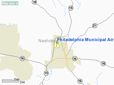
Philadelphia Municipal Airport (ICAO: KMPE, FAA LID: MPE) is a city-owned public-use airport located two nautical miles (3.7 km) northwest of the central business district of Philadelphia, a city in Neshoba County, Mississippi, United States. This airport is included in the FAA's National Plan of Integrated Airport Systems for 2009–2013, which categorized it as a general aviation facility.
Although many U.S. airports use the same three-letter location identifier for the FAA and IATA, this facility is assigned MPE by the FAA but has no designation from the IATA.
Facilities and aircraft
Philadelphia Municipal Airport covers an area of 60 acres (24 ha) at an elevation of 458 feet (140 m) above mean sea level. It has one runway designated 18/36 with an asphalt surface measuring 5,001 by 75 feet (1,524 x 23 m).
For the 12-month period ending May 5, 2010, the airport had 13,300 aircraft operations, an average of 36 per day: 98.5% general aviation and 1.5% military. At that time there were 9 aircraft based at this airport: 67% single-engine, 22% multi-engine and 11% jet.
The above content comes from Wikipedia and is published under free licenses – click here to read more.
Location & QuickFacts
| FAA Information Effective: | 2008-09-25 |
| Airport Identifier: | MPE |
| Airport Status: | Operational |
| Longitude/Latitude: | 089-07-33.5899W/32-47-57.1663N
-89.125997/32.799213 (Estimated) |
| Elevation: | 458 ft / 139.60 m (Surveyed) |
| Land: | 60 acres |
| From nearest city: | 2 nautical miles NW of Philadelphia, MS |
| Location: | Neshoba County, MS |
| Magnetic Variation: | 01E (1990) |
Owner & Manager
| Ownership: | Publicly owned |
| Owner: | City Of Philadelphia
RAYBORN WADDELL, MAYOR OF PHILADELPHIA. |
| Address: | 525 Main Street
Philadelphia, MS 39350 |
| Phone number: | 662-656-3612 |
| Manager: | Dan Cumberland |
| Address: | 1036 Airport Rd.
Philadelphia, MS 39350 |
| Phone number: | 601-656-0203 |
Airport Operations and Facilities
| Airport Use: | Open to public |
| Wind indicator: | Yes |
| Segmented Circle: | No |
| Control Tower: | No |
| Lighting Schedule: | DUSK-DAWN
ACTVT MIRL RY 18/36 & PAPI RYS 18 & 36 - CTAF. |
| Beacon Color: | Clear-Green (lighted land airport) |
| Landing fee charge: | No |
| Sectional chart: | Memphis |
| Region: | ASO - Southern |
| Boundary ARTCC: | ZME - Memphis |
| Tie-in FSS: | GWO - Greenwood |
| FSS on Airport: | No |
| FSS Toll Free: | 1-800-WX-BRIEF |
| NOTAMs Facility: | GWO (NOTAM-d service avaliable) |
| Federal Agreements: | NY1 |
Airport Communications
| CTAF: | 123.000 |
| Unicom: | 123.000 |
Airport Services
| Fuel available: | 100LLA |
| Bottled Oxygen: | NONE |
| Bulk Oxygen: | NONE |
Runway Information
Runway 18/36
| Dimension: | 5001 x 75 ft / 1524.3 x 22.9 m |
| Surface: | ASPH, Good Condition |
| Weight Limit: | Single wheel: 30000 lbs. |
| Edge Lights: | Medium |
| |
Runway 18 |
Runway 36 |
| Longitude: | 089-07-30.6311W | 089-07-36.5487W |
| Latitude: | 32-48-21.7771N | 32-47-32.5495N |
| Elevation: | 440.00 ft | 458.00 ft |
| Alignment: | 127 | 5 |
| Traffic Pattern: | Left | Left |
| Markings: | Non-precision instrument, Good Condition | Non-precision instrument, Good Condition |
| Crossing Height: | 42.00 ft | 42.00 ft |
| VASI: | 2-light PAPI on left side
VASI OTS INDEFLY. | 2-light PAPI on left side |
| Visual Glide Angle: | 3.00° | 3.00° |
| Obstruction: | 27 ft trees, 1160.0 ft from runway, 325 ft left of centerline, 35:1 slope to clear | 54 ft tree, 1235.0 ft from runway, 19:1 slope to clear |
|
Radio Navigation Aids
| ID |
Type |
Name |
Ch |
Freq |
Var |
Dist |
| LMS | NDB | Louisville | | 212.00 | 00E | 21.0 nm |
| OSX | NDB | Kosciusko | | 269.00 | 00W | 27.3 nm |
| ME | NDB | Savoy | | 356.00 | 01E | 37.7 nm |
| STF | NDB | Bryan | | 281.00 | 02E | 40.5 nm |
| NJW | TACAN | Joe Williams | 61Y | | 01E | 14.7 nm |
| NMM | TACAN | Meridian | 056X | | 01E | 32.2 nm |
| MEI | VORTAC | Meridian | 117X | 117.00 | 05E | 30.1 nm |
| EWA | VORTAC | Kewanee | 085X | 113.80 | 04E | 42.6 nm |
Remarks
- AFTER HRS SERVICE CALL 601-416-1721
- PROVIDED DEVELOPEMENT IS IN ACCORDANCE WITH APPROVED AIRPORT LAYOUT PLAN.
Images and information placed above are from
http://www.airport-data.com/airport/MPE/
We thank them for the data!
| General Info
|
| Country |
United States
|
| State |
MISSISSIPPI
|
| FAA ID |
MPE
|
| Latitude |
32-47-57.968N
|
| Longitude |
089-07-33.550W
|
| Elevation |
456 feet
|
| Near City |
PHILADELPHIA
|
We don't guarantee the information is fresh and accurate. The data may
be wrong or outdated.
For more up-to-date information please refer to other sources.
|
|


