 |
|
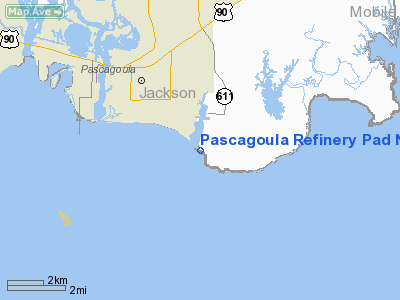
Pascagoula Refinery Pad Nr 1 Heliport |
Location & QuickFacts
| FAA Information Effective: | 2008-09-25 |
| Airport Identifier: | MS78 |
| Airport Status: | Operational |
| Longitude/Latitude: | 088-30-30.0480W/30-19-45.7200N
-88.508347/30.329367 (Estimated) |
| Elevation: | 20 ft / 6.10 m (Estimated) |
| Land: | 0 acres |
| From nearest city: | 2 nautical miles SE of Pascagoula, MS |
| Location: | Jackson County, MS |
| Magnetic Variation: | 01E (1990) |
Owner & Manager
| Ownership: | Privately owned |
| Owner: | Chevron Usa Inc |
| Address: | 250 Industrial Rd
Pascagoula, MS 39581 |
| Phone number: | 601-938-3250 |
| Manager: | J S Sabree |
| Address: | Box 26845
New Orleans, LA 70186 |
| Phone number: | 504-244-4118 |
Airport Operations and Facilities
| Airport Use: | Private |
| Wind indicator: | Yes |
| Segmented Circle: | No |
| Control Tower: | No |
| Sectional chart: | New Orleans |
| Region: | ASO - Southern |
| Boundary ARTCC: | ZHU - Houston |
| Tie-in FSS: | GWO - Greenwood |
| FSS Toll Free: | 1-800-WX-BRIEF |
Runway Information
Helipad H1
| Dimension: | 40 x 40 ft / 12.2 x 12.2 m |
| Surface: | CONC, |
| |
Runway H1 |
Runway |
| Traffic Pattern: | Left | Left |
|
Radio Navigation Aids
| ID |
Type |
Name |
Ch |
Freq |
Var |
Dist |
| MO | NDB | Wisle | | 248.00 | 02E | 28.0 nm |
| ESU | NDB | Summerdale | | 204.00 | 01E | 41.8 nm |
| HS | NDB | Hanco | | 221.00 | 01E | 49.6 nm |
| AYI | NDB | Hanco | | 221.00 | 03E | 49.6 nm |
| BIX | TACAN | Keesler | 055X | | 01E | 22.3 nm |
| GPT | VOR/DME | Gulfport | 27X | 109.00 | 02E | 29.7 nm |
| SJI | VORTAC | Semmes | 100X | 115.30 | 05E | 25.1 nm |
| BFM | VORTAC | Brookley | 075X | 112.80 | 04E | 29.0 nm |
| GCV | VORTAC | Greene County | 104X | 115.70 | 05E | 46.2 nm |
Remarks
- PVT USE OPERATIONS FM 320 TO 240; AREA MKD; WIND IND MAINTAINED.
Images and information placed above are from
http://www.airport-data.com/airport/MS78/
We thank them for the data!
| General Info
|
| Country |
United States
|
| State |
MISSISSIPPI
|
| FAA ID |
MS78
|
| Latitude |
30-19-45.720N
|
| Longitude |
088-30-30.048W
|
| Elevation |
20 feet
|
| Near City |
PASCAGOULA
|
We don't guarantee the information is fresh and accurate. The data may
be wrong or outdated.
For more up-to-date information please refer to other sources.
|
|


