 |
|
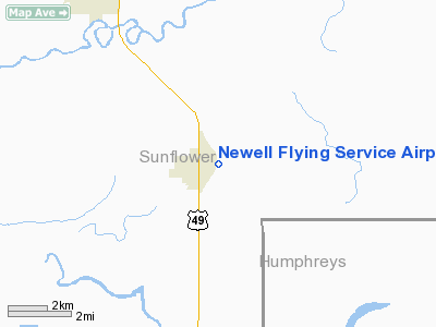
Newell Flying Service Airport |
Location & QuickFacts
| FAA Information Effective: | 2008-09-25 |
| Airport Identifier: | MS20 |
| Airport Status: | Operational |
| Longitude/Latitude: | 090-34-44.3250W/33-21-17.4330N
-90.578979/33.354843 (Estimated) |
| Elevation: | 126 ft / 38.40 m (Estimated) |
| Land: | 0 acres |
| From nearest city: | 1 nautical miles E of Inverness, MS |
| Location: | Sunflower County, MS |
| Magnetic Variation: | 03E (1985) |
Owner & Manager
| Ownership: | Privately owned |
| Owner: | S. Newell |
| Address: |
Inverness, MS 38753 |
| Phone number: | 601-265-2341 |
| Manager: | S. Newell |
| Address: |
Inverness, MS 38753 |
| Phone number: | 601-265-2341 |
Airport Operations and Facilities
| Airport Use: | Private |
| Wind indicator: | Yes |
| Segmented Circle: | No |
| Control Tower: | No |
| Landing fee charge: | No |
| Sectional chart: | Memphis |
| Region: | ASO - Southern |
| Boundary ARTCC: | ZME - Memphis |
| Tie-in FSS: | GWO - Greenwood |
| FSS on Airport: | No |
| FSS Toll Free: | 1-800-WX-BRIEF |
Airport Services
| Airframe Repair: | NONE |
| Power Plant Repair: | NONE |
Runway Information
Runway 03/21
| Dimension: | 2000 x 100 ft / 609.6 x 30.5 m |
| Surface: | TURF, |
| |
Runway 03 |
Runway 21 |
| Traffic Pattern: | Left | Left |
| Obstruction: | | 20 ft pline, 100.0 ft from runway |
|
Radio Navigation Aids
| ID |
Type |
Name |
Ch |
Freq |
Var |
Dist |
| IDL | NDB | Indianola | | 284.00 | 03E | 9.0 nm |
| MTQ | NDB | Metcalf | | 359.00 | 03E | 20.7 nm |
| RNV | NDB | Renova | | 272.00 | 04E | 28.7 nm |
| BLE | NDB | Lake Providence | | 278.00 | 03E | 44.0 nm |
| SBQ | NDB | Scobey | | 245.00 | 01E | 47.8 nm |
| GLH | VOR/DME | Greenville | 039X | 110.20 | 04E | 22.7 nm |
| SQS | VORTAC | Sidon | 094X | 114.70 | 03E | 16.5 nm |
Remarks
Images and information placed above are from
http://www.airport-data.com/airport/MS20/
We thank them for the data!
| General Info
|
| Country |
United States
|
| State |
MISSISSIPPI
|
| FAA ID |
MS20
|
| Latitude |
33-21-17.433N
|
| Longitude |
090-34-44.325W
|
| Elevation |
126 feet
|
| Near City |
INVERNESS
|
We don't guarantee the information is fresh and accurate. The data may
be wrong or outdated.
For more up-to-date information please refer to other sources.
|
|


