 |
|
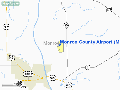
Location & QuickFacts
| FAA Information Effective: | 2008-09-25 |
| Airport Identifier: | M40 |
| Airport Status: | Operational |
| Longitude/Latitude: | 088-29-22.8000W/33-52-25.5000N
-88.489667/33.873750 (Estimated) |
| Elevation: | 226 ft / 68.88 m (Surveyed) |
| Land: | 320 acres |
| From nearest city: | 4 nautical miles NE of Aberdeen/amory, MS |
| Location: | Monroe County, MS |
| Magnetic Variation: | 01E (1985) |
Owner & Manager
| Ownership: | Publicly owned |
| Owner: | Monroe County
MR RANDALE GRAY, PRESIDENT BOARD OF SUPERVISORS. |
| Address: | Rt 4 Box 16
Aberdeen, MS 39730 |
| Phone number: | 662-369-8143 |
| Manager: | John Oswalt |
| Address: | 50068 Airport Rd
Aberdeen, MS 39730 |
| Phone number: | 662-369-4800
OR 662-369-7523. |
Airport Operations and Facilities
| Airport Use: | Open to public |
| Wind indicator: | Yes |
| Segmented Circle: | Yes |
| Control Tower: | No |
| Lighting Schedule: | DUSK-DAWN
ACTVT MIRL RY 18/36 - CTAF. |
| Beacon Color: | Clear-Green (lighted land airport) |
| Landing fee charge: | No |
| Sectional chart: | Memphis |
| Region: | ASO - Southern |
| Boundary ARTCC: | ZME - Memphis |
| Tie-in FSS: | GWO - Greenwood |
| FSS on Airport: | No |
| FSS Toll Free: | 1-800-WX-BRIEF |
| NOTAMs Facility: | GWO (NOTAM-d service avaliable) |
| Federal Agreements: | NGY |
Airport Communications
| CTAF: | 122.800 |
| Unicom: | 122.800 |
Airport Services
| Fuel available: | 100LLA
FOR FUEL AFTER HRS CALL: 662-369-7610/369-7523. |
| Airframe Repair: | MINOR |
| Power Plant Repair: | MINOR |
| Bottled Oxygen: | NONE |
| Bulk Oxygen: | NONE |
Runway Information
Runway 18/36
| Dimension: | 4999 x 75 ft / 1523.7 x 22.9 m |
| Surface: | ASPH, Good Condition |
| Weight Limit: | Single wheel: 21000 lbs. |
| Edge Lights: | Medium |
| |
Runway 18 |
Runway 36 |
| Longitude: | 088-29-19.6374W | 088-29-26.0332W |
| Latitude: | 33-52-50.0789N | 33-52-00.9120N |
| Elevation: | 223.00 ft | 225.00 ft |
| Alignment: | 127 | 6 |
| Traffic Pattern: | Left | Left |
| Markings: | Non-precision instrument, Fair Condition | Non-precision instrument, Fair Condition |
| VASI: | 4-box on left side | |
| Runway End Identifier: | Yes | |
| Obstruction: | 39 ft trees, 1212.0 ft from runway, 26:1 slope to clear | 63 ft trees, 1920.0 ft from runway, 27:1 slope to clear |
|
Radio Navigation Aids
| ID |
Type |
Name |
Ch |
Freq |
Var |
Dist |
| STF | NDB | Bryan | | 281.00 | 02E | 32.1 nm |
| FDF | NDB | Fayette | | 204.00 | 00E | 35.2 nm |
| AIV | NDB | Aliceville | | 254.00 | | 48.1 nm |
| OTB | VOR/DME | Tupelo | 035X | 109.80 | 04E | 26.0 nm |
| CBM | VORTAC | Caledonia | 099X | 115.20 | 00E | 14.2 nm |
| IGB | VORTAC | Bigbee | 109X | 116.20 | 04E | 23.4 nm |
| HAB | VORTAC | Hamilton | 041X | 110.40 | 02E | 30.6 nm |
Remarks
- FREE PHONE AVAILABLE OUTSIDE 662-369-4800.
Images and information placed above are from
http://www.airport-data.com/airport/M40/
We thank them for the data!
| General Info
|
| Country |
United States
|
| State |
MISSISSIPPI
|
| FAA ID |
M40
|
| Latitude |
33-52-25.495N
|
| Longitude |
088-29-22.842W
|
| Elevation |
226 feet
|
| Near City |
ABERDEEN/AMORY
|
We don't guarantee the information is fresh and accurate. The data may
be wrong or outdated.
For more up-to-date information please refer to other sources.
|
|


