 |
|
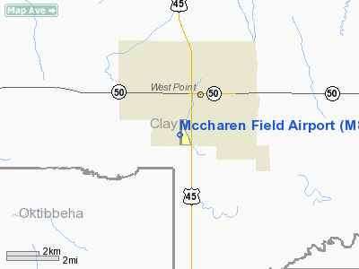
Location & QuickFacts
| FAA Information Effective: | 2008-09-25 |
| Airport Identifier: | M83 |
| Airport Status: | Operational |
| Longitude/Latitude: | 088-40-00.0700W/33-35-02.5300N
-88.666686/33.584036 (Estimated) |
| Elevation: | 205 ft / 62.48 m (Surveyed) |
| Land: | 67 acres |
| From nearest city: | 2 nautical miles S of West Point, MS |
| Location: | Clay County, MS |
| Magnetic Variation: | 00E (1995) |
Owner & Manager
| Ownership: | Publicly owned |
| Owner: | City Of West Point |
| Address: | 204 Commerce/box 1117
West Point, MS 39773 |
| Phone number: | 662-494-2573 |
| Manager: | Randy Jones |
| Address: | Po Box 1117
West Point, MS 39773 |
| Phone number: | 662-524-0039 |
Airport Operations and Facilities
| Airport Use: | Open to public |
| Wind indicator: | Yes |
| Segmented Circle: | Yes |
| Control Tower: | No |
| Lighting Schedule: | DUSK-DAWN
AFTER 2200, ACTVT MIRL RY 18/36 - CTAF. |
| Beacon Color: | Clear-Green (lighted land airport) |
| Landing fee charge: | No |
| Sectional chart: | Memphis |
| Region: | ASO - Southern |
| Boundary ARTCC: | ZME - Memphis |
| Tie-in FSS: | GWO - Greenwood |
| FSS on Airport: | No |
| FSS Toll Free: | 1-800-WX-BRIEF |
| NOTAMs Facility: | GWO (NOTAM-d service avaliable) |
| Federal Agreements: | NGY |
Airport Communications
Airport Services
| Airframe Repair: | NONE |
| Power Plant Repair: | NONE |
| Bottled Oxygen: | NONE |
| Bulk Oxygen: | NONE |
Runway Information
Runway 18/36
| Dimension: | 3850 x 75 ft / 1173.5 x 22.9 m |
| Surface: | ASPH, Good Condition |
| Weight Limit: | Single wheel: 30000 lbs.
Dual wheel: 36000 lbs. |
| Edge Lights: | Medium |
| |
Runway 18 |
Runway 36 |
| Longitude: | 088-39-59.9200W | 088-40-00.2500W |
| Latitude: | 33-35-21.5600N | 33-34-43.4800N |
| Elevation: | 205.00 ft | 203.00 ft |
| Alignment: | 127 | 127 |
| Traffic Pattern: | Left | Left |
| Markings: | Non-precision instrument, Good Condition
RY 18/36 MARKINGS FADED. | Non-precision instrument, Good Condition |
| Displaced threshold: | 392.00 ft | 0.00 ft |
| Obstruction: | 36 ft trees, 1400.0 ft from runway, 33:1 slope to clear
APCH RATIO 24:1 FROM DSPLCD THLD. RR 50 FT FROM END OF RY.
RR 50 FT FROM RY END. | 77 ft trees, 1670.0 ft from runway, 125 ft left of centerline, 19:1 slope to clear
4 FT FENCE 200 FT FM END OF RY. |
|
Radio Navigation Aids
| ID |
Type |
Name |
Ch |
Freq |
Var |
Dist |
| STF | NDB | Bryan | | 281.00 | 02E | 13.0 nm |
| LMS | NDB | Louisville | | 212.00 | 00E | 33.0 nm |
| AIV | NDB | Aliceville | | 254.00 | | 37.2 nm |
| FDF | NDB | Fayette | | 204.00 | 00E | 43.4 nm |
| NJW | TACAN | Joe Williams | 61Y | | 01E | 48.2 nm |
| OTB | VOR/DME | Tupelo | 035X | 109.80 | 04E | 39.0 nm |
| IGB | VORTAC | Bigbee | 109X | 116.20 | 04E | 9.7 nm |
| CBM | VORTAC | Caledonia | 099X | 115.20 | 00E | 11.9 nm |
| HAB | VORTAC | Hamilton | 041X | 110.40 | 02E | 49.1 nm |
Remarks
- (PAY PHONE) PAY PHONE AVAILABLE.
Images and information placed above are from
http://www.airport-data.com/airport/M83/
We thank them for the data!
| General Info
|
| Country |
United States
|
| State |
MISSISSIPPI
|
| FAA ID |
M83
|
| Latitude |
33-35-02.528N
|
| Longitude |
088-40-00.073W
|
| Elevation |
205 feet
|
| Near City |
WEST POINT
|
We don't guarantee the information is fresh and accurate. The data may
be wrong or outdated.
For more up-to-date information please refer to other sources.
|
|


