 |
|
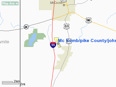
Mc Comb / Pike County/john E Lewis Field Airport |
McComb-Pike County Airport
John E. Lewis Field |
| IATA: MCB – ICAO: KMCB – FAA LID: MCB |
| Summary |
| Airport type |
Public |
| Owner |
City of McComb & Pike County |
| Serves |
McComb, Mississippi |
| Elevation AMSL |
413 ft / 126 m |
| Coordinates |
31°10′42″N 090°28′19″W / 31.17833°N 90.47194°W / 31.17833; -90.47194 |
| Runways |
| Direction |
Length |
Surface |
| ft |
m |
| 15/33 |
5,000 |
1,524 |
Asphalt |
| Statistics (2007) |
| Aircraft operations |
10,950 |
| Based aircraft |
21 |
| Source: Federal Aviation Administration |
McComb-Pike County Airport (IATA: MCB, ICAO: KMCB, FAA LID: MCB), also known as John E. Lewis Field, is a public airport located four miles (6 km) south of the central business district of McComb, a city in Pike County, Mississippi, United States. It is owned by the City of McComb and Pike County.
Facilities and aircraft
McComb-Pike County Airport covers an area of 430 acres (174 ha) which contains one runway designated 15/33 with a 5,000 x 100 ft (1,524 x 30 m) asphalt pavement. For the 12-month period ending April 24, 2007, the airport had 10,950 aircraft operations, an average of 30 per day: 95% general aviation and 5% military. At that time there were 21 aircraft based at this airport: 90% single-engine, 5% multi-engine and 5% ultralight.
The above content comes from Wikipedia and is published under free licenses – click here to read more.
Location & QuickFacts
| FAA Information Effective: | 2008-09-25 |
| Airport Identifier: | MCB |
| Airport Status: | Operational |
| Longitude/Latitude: | 090-28-18.7000W/31-10-42.4000N
-90.471861/31.178444 (Estimated) |
| Elevation: | 413 ft / 125.88 m (Surveyed) |
| Land: | 430 acres |
| From nearest city: | 4 nautical miles S of Mc Comb, MS |
| Location: | Pike County, MS |
| Magnetic Variation: | 03E (1985) |
Owner & Manager
| Ownership: | Publicly owned |
| Owner: | City Of Mc Comb & Pike County |
| Address: | Po Box 1247
Mc Comb, MS 39648 |
| Phone number: | 601-684-1450 |
| Manager: | Kirby Harvey |
| Address: | 2051 John E. Lewis Dr.
Mccomb, MS 39648 |
| Phone number: | 601-684-8950 |
Airport Operations and Facilities
| Airport Use: | Open to public |
| Wind indicator: | Yes |
| Segmented Circle: | Yes |
| Control Tower: | No |
| Lighting Schedule: | DUSK-DAWN
MIRL RY 15/33 PRESET MED INTST DUSK-0000; AFTER 0000 INCR INTST, ACTVT MALSF - CTAF. |
| Beacon Color: | Clear-Green (lighted land airport) |
| Landing fee charge: | No |
| Sectional chart: | New Orleans |
| Region: | ASO - Southern |
| Boundary ARTCC: | ZHU - Houston |
| Tie-in FSS: | GWO - Greenwood |
| FSS on Airport: | No |
| FSS Toll Free: | 1-800-WX-BRIEF |
| NOTAMs Facility: | MCB (NOTAM-d service avaliable) |
| Federal Agreements: | NGY |
Airport Communications
| CTAF: | 123.050 |
| Unicom: | 123.050 |
Airport Services
| Fuel available: | 100LLA1+
FOR ATTENDANT & FUEL AFT HRS CALL 601-684-8950. |
| Airframe Repair: | MAJOR |
| Power Plant Repair: | MAJOR |
| Bottled Oxygen: | NONE |
| Bulk Oxygen: | NONE |
Runway Information
Runway 15/33
| Dimension: | 5000 x 100 ft / 1524.0 x 30.5 m |
| Surface: | ASPH, Good Condition |
| Surface Treatment: | Saw-cut or plastic Grooved |
| Weight Limit: | Single wheel: 25000 lbs.
Dual wheel: 30000 lbs.
Dual tandem wheel: 60000 lbs. |
| Edge Lights: | Medium |
| |
Runway 15 |
Runway 33 |
| Longitude: | 090-28-30.5676W | 090-28-06.8344W |
| Latitude: | 31-11-04.9020N | 31-10-19.8245N |
| Elevation: | 413.00 ft | 389.00 ft |
| Alignment: | 127 | 127 |
| ILS Type: | ILS
| |
| Traffic Pattern: | Left | Left |
| Markings: | Non-precision instrument, Good Condition | Non-precision instrument, Good Condition |
| Crossing Height: | 38.00 ft | 46.00 ft |
| VASI: | 2-light PAPI on left side | 2-light PAPI on left side |
| Visual Glide Angle: | 3.00° | 3.00° |
| Approach lights: | MALSF | |
| Obstruction: | 51 ft , 1880.0 ft from runway, 200 ft left of centerline, 32:1 slope to clear | 48 ft , 1440.0 ft from runway, 50 ft left of centerline, 25:1 slope to clear |
|
Radio Navigation Aids
| ID |
Type |
Name |
Ch |
Freq |
Var |
Dist |
| MC | NDB | Ferni | | 413.00 | 03E | 5.0 nm |
| BVV | NDB | Brookhaven | | 407.00 | 03E | 26.0 nm |
| FOH | NDB | Foxworth | | 331.00 | 05E | 34.3 nm |
| BX | NDB | Carma | | 353.00 | 02E | 36.1 nm |
| HMU | VOR | Hammond | | 109.60 | 03E | 39.7 nm |
| MCB | VORTAC | Mc Comb | 114X | 116.70 | 03E | 13.3 nm |
Images and information placed above are from
http://www.airport-data.com/airport/MCB/
We thank them for the data!
| General Info
|
| Country |
United States
|
| State |
MISSISSIPPI
|
| FAA ID |
MCB
|
| Latitude |
31-10-42.436N
|
| Longitude |
090-28-18.751W
|
| Elevation |
413 feet
|
| Near City |
MC COMB
|
We don't guarantee the information is fresh and accurate. The data may
be wrong or outdated.
For more up-to-date information please refer to other sources.
|
|


