 |
|
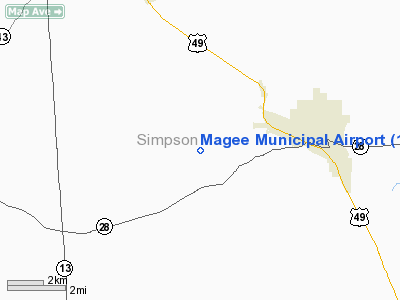
Location & QuickFacts
| FAA Information Effective: | 2008-09-25 |
| Airport Identifier: | 17M |
| Airport Status: | Operational |
| Longitude/Latitude: | 089-48-02.1590W/31-51-45.8700N
-89.800600/31.862742 (Estimated) |
| Elevation: | 555 ft / 169.16 m (Surveyed) |
| Land: | 62 acres |
| From nearest city: | 3 nautical miles W of Magee, MS |
| Location: | Simpson County, MS |
| Magnetic Variation: | 03E (1985) |
Owner & Manager
| Ownership: | Publicly owned |
| Owner: | City Of Magee
MAYOR JIMMY CLYDE. |
| Address: | 123 N. Main St.
Magee, MS 39111 |
| Phone number: | 601-849-3344 |
| Manager: | Ashley Steele |
| Address: | 111 Prine Dr.
Magee, MS 39111 |
| Phone number: | 601-849-3571 |
Airport Operations and Facilities
| Airport Use: | Open to public |
| Wind indicator: | Yes |
| Segmented Circle: | Yes |
| Control Tower: | No |
| Lighting Schedule: | DUSK-DAWN
ACTVT MIRL RY 18/36 - CTAF. |
| Beacon Color: | Clear-Green (lighted land airport) |
| Landing fee charge: | No |
| Sectional chart: | New Orleans |
| Region: | ASO - Southern |
| Boundary ARTCC: | ZME - Memphis |
| Tie-in FSS: | GWO - Greenwood |
| FSS on Airport: | No |
| FSS Toll Free: | 1-800-WX-BRIEF |
| NOTAMs Facility: | GWO (NOTAM-d service avaliable) |
| Federal Agreements: | NGY |
Airport Communications
| CTAF: | 122.800 |
| Unicom: | 122.800 |
Airport Services
| Fuel available: | 100LL |
| Airframe Repair: | NONE |
| Power Plant Repair: | NONE |
| Bottled Oxygen: | NONE |
| Bulk Oxygen: | NONE |
Runway Information
Runway 18/36
| Dimension: | 3104 x 50 ft / 946.1 x 15.2 m |
| Surface: | ASPH, |
| Weight Limit: | Single wheel: 19000 lbs. |
| Edge Lights: | Medium |
| |
Runway 18 |
Runway 36 |
| Traffic Pattern: | Left | Left |
| Markings: | Basic, Good Condition | Basic, Good Condition |
| Displaced threshold: | 165.00 ft | 0.00 ft |
| Obstruction: | 57 ft tree, 910.0 ft from runway, 85 ft right of centerline, 12:1 slope to clear
RWY 18 APCH RATIO 20:1 TO DSPLCD THLD. | 51 ft trees, 1180.0 ft from runway, 19:1 slope to clear |
|
Radio Navigation Aids
| ID |
Type |
Name |
Ch |
Freq |
Var |
Dist |
| THJ | NDB | Tallahala | | 346.00 | 00E | 32.9 nm |
| FOH | NDB | Foxworth | | 331.00 | 05E | 34.1 nm |
| BVV | NDB | Brookhaven | | 407.00 | 03E | 34.7 nm |
| JH | NDB | Brenz | | 260.00 | 02E | 40.5 nm |
| RYB | NDB | Raymond | | 375.00 | 03E | 40.8 nm |
| LBY | VORTAC | Eaton | 043X | 110.60 | 05E | 35.7 nm |
| MCB | VORTAC | Mc Comb | 114X | 116.70 | 03E | 40.9 nm |
| JAN | VORTAC | Jackson | 073X | 112.60 | 05E | 43.0 nm |
| JAN | VOT | Jackson | | 111.00 | | 30.1 nm |
Remarks
- RY 36 4 FT DEEP DITCH 250 FT FROM THR.
Images and information placed above are from
http://www.airport-data.com/airport/17M/
We thank them for the data!
| General Info
|
| Country |
United States
|
| State |
MISSISSIPPI
|
| FAA ID |
17M
|
| Latitude |
31-51-40.577N
|
| Longitude |
089-48-10.273W
|
| Elevation |
555 feet
|
| Near City |
MAGEE
|
We don't guarantee the information is fresh and accurate. The data may
be wrong or outdated.
For more up-to-date information please refer to other sources.
|
|


