 |
|
Location & QuickFacts
| FAA Information Effective: | 2008-09-25 |
| Airport Identifier: | MS60 |
| Airport Status: | Operational |
| Longitude/Latitude: | 088-56-15.1160W/30-27-16.7100N
-88.937532/30.454642 (Estimated) |
| Elevation: | 22 ft / 6.71 m (Estimated) |
| Land: | 3 acres |
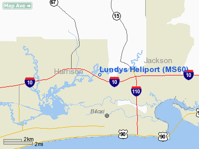
| From nearest city: | 3 nautical miles NW of Biloxi, MS |
| Location: | Harrison County, MS |
| Magnetic Variation: | 02E (1985) |
Owner & Manager
| Ownership: | Privately owned |
| Owner: | C. E. Lundy |
| Address: | 11532 Cedar Lake Road
Biloxi, MS 39532-8440 |
| Phone number: | 601-392-3096 |
| Manager: | C. E. Lundy |
| Address: | 11532 Cedar Lake Road
Biloxi, MS 39532-8440 |
| Phone number: | 601-392-3096 |
Airport Operations and Facilities
| Airport Use: | Private |
| Wind indicator: | Yes |
| Segmented Circle: | No |
| Control Tower: | No |
| Landing fee charge: | No |
| Sectional chart: | New Orleans |
| Region: | ASO - Southern |
| Boundary ARTCC: | ZHU - Houston |
| Tie-in FSS: | GWO - Greenwood |
| FSS on Airport: | No |
| FSS Toll Free: | 1-800-WX-BRIEF |
Runway Information
Helipad H1
| Dimension: | 60 x 60 ft / 18.3 x 18.3 m |
| Surface: | TURF, |
| |
Runway H1 |
Runway |
| Traffic Pattern: | Left | Left |
|
Radio Navigation Aids
| ID |
Type |
Name |
Ch |
Freq |
Var |
Dist |
| HS | NDB | Hanco | | 221.00 | 01E | 26.8 nm |
| AYI | NDB | Hanco | | 221.00 | 03E | 26.8 nm |
| MJD | NDB | Picayune | | 276.00 | 01E | 37.1 nm |
| MO | NDB | Wisle | | 248.00 | 02E | 37.6 nm |
| FNA | NDB | Florenville | | 371.00 | 03E | 45.8 nm |
| DEF | NDB | Slidell | | 256.00 | 03E | 47.5 nm |
| BIX | TACAN | Keesler | 055X | | 01E | 2.9 nm |
| GPT | VOR/DME | Gulfport | 27X | 109.00 | 02E | 7.7 nm |
| PCU | VOR/DME | Picayune | 059X | 112.20 | 05E | 41.6 nm |
| SJI | VORTAC | Semmes | 100X | 115.30 | 05E | 34.1 nm |
| GCV | VORTAC | Greene County | 104X | 115.70 | 05E | 45.2 nm |
| BFM | VORTAC | Brookley | 075X | 112.80 | 04E | 46.6 nm |
Remarks
- VFR OPERATIONS/PRIVATE USE. COORDINATE USE OF FACILITY WITH JACKSON MS GADO. OPERATIONAL PROCEDURES ESTABLISHED WITH KEESLER AFB ATCT. TWO-WAY RADIO COMMUNICATIONS ESTABLISHED AND APPROVAL OBTAINED PRIOR TO CONDUCTING FLIGHT OPERATIONS IN THE BILOXI CONTROL ZONE.
Images and information placed above are from
http://www.airport-data.com/airport/MS60/
We thank them for the data!
| General Info
|
| Country |
United States
|
| State |
MISSISSIPPI
|
| FAA ID |
MS60
|
| Latitude |
30-27-16.710N
|
| Longitude |
088-56-15.116W
|
| Elevation |
22 feet
|
| Near City |
BILOXI
|
We don't guarantee the information is fresh and accurate. The data may
be wrong or outdated.
For more up-to-date information please refer to other sources.
|
|


