 |
|
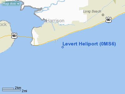
Location & QuickFacts
| FAA Information Effective: | 2008-09-25 |
| Airport Identifier: | 0MS6 |
| Airport Status: | Operational |
| Longitude/Latitude: | 089-14-04.1510W/30-18-04.7100N
-89.234486/30.301308 (Estimated) |
| Elevation: | 25 ft / 7.62 m (Estimated) |
| Land: | 2 acres |
| From nearest city: | 1 nautical miles E of Pass Christian, MS |
| Location: | Harrison County, MS |
| Magnetic Variation: | 02E (1985) |
Owner & Manager
| Ownership: | Privately owned |
| Owner: | J. Alfred Levert, Ii |
| Address: | 533 E Scenic Dr
Pass Christian, MS 39571 |
| Phone number: | 601-452-3522 |
| Manager: | J. Alfred Levert, Ii |
| Address: | 533 E Scenic Dr
Pass Christian, MS 39571 |
| Phone number: | 601-452-3522 |
Airport Operations and Facilities
| Airport Use: | Private |
| Segmented Circle: | No |
| Control Tower: | No |
| Sectional chart: | New Orleans |
| Region: | ASO - Southern |
| Boundary ARTCC: | ZHU - Houston |
| Tie-in FSS: | GWO - Greenwood |
| FSS on Airport: | No |
| FSS Toll Free: | 1-800-WX-BRIEF |
Airport Communications
Runway Information
Helipad H1
| Dimension: | 240 x 150 ft / 73.2 x 45.7 m |
| Surface: | TURF, Good Condition |
| |
Runway H1 |
Runway |
| Traffic Pattern: | Left | Left |
|
Radio Navigation Aids
| ID |
Type |
Name |
Ch |
Freq |
Var |
Dist |
| AYI | NDB | Hanco | | 221.00 | 03E | 14.6 nm |
| HS | NDB | Hanco | | 221.00 | 01E | 14.6 nm |
| MJD | NDB | Picayune | | 276.00 | 01E | 24.6 nm |
| DEF | NDB | Slidell | | 256.00 | 03E | 31.1 nm |
| FNA | NDB | Florenville | | 371.00 | 03E | 31.1 nm |
| BX | NDB | Carma | | 353.00 | 02E | 47.7 nm |
| BIX | TACAN | Keesler | 055X | | 01E | 17.0 nm |
| GPT | VOR/DME | Gulfport | 27X | 109.00 | 02E | 10.4 nm |
| PCU | VOR/DME | Picayune | 059X | 112.20 | 05E | 30.1 nm |
| HRV | VORTAC | Harvey | 088X | 114.10 | 02E | 48.3 nm |
| NEW | VOT | New Orleans Lakefront | | 111.00 | | 44.1 nm |
Remarks
- 50' TREES 150' S AND 22' PLINE N OF HELI.
- PRVDD VFR PVT USE ONLY.
Images and information placed above are from
http://www.airport-data.com/airport/0MS6/
We thank them for the data!
| General Info
|
| Country |
United States
|
| State |
MISSISSIPPI
|
| FAA ID |
0MS6
|
| Latitude |
30-18-04.710N
|
| Longitude |
089-14-04.151W
|
| Elevation |
25 feet
|
| Near City |
PASS CHRISTIAN
|
We don't guarantee the information is fresh and accurate. The data may
be wrong or outdated.
For more up-to-date information please refer to other sources.
|
|


