 |
|
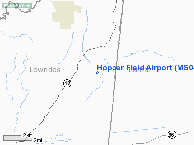
Location & QuickFacts
| FAA Information Effective: | 2008-09-25 |
| Airport Identifier: | MS04 |
| Airport Status: | Operational |
| Longitude/Latitude: | 088-17-10.0000W/33-37-21.0000N
-88.286111/33.622500 (Estimated) |
| Elevation: | 300 ft / 91.44 m (Estimated) |
| Land: | 0 acres |
| From nearest city: | 3 nautical miles NE of Steens, MS |
| Location: | Lowndes County, MS |
| Magnetic Variation: | 01E (1985) |
Owner & Manager
| Ownership: | Privately owned |
| Owner: | James A. Hopper |
| Address: | 358 Hopper Rd
Steens, MS 39766 |
| Phone number: | 662-356-6654 |
| Address: |
|
Airport Operations and Facilities
| Airport Use: | Private |
| Wind indicator: | Yes |
| Segmented Circle: | No |
| Control Tower: | No |
| Landing fee charge: | No |
| Sectional chart: | Memphis |
| Region: | ASO - Southern |
| Boundary ARTCC: | ZME - Memphis |
| Tie-in FSS: | GWO - Greenwood |
| FSS on Airport: | No |
| FSS Toll Free: | 1-800-WX-BRIEF |
Airport Services
| Airframe Repair: | MAJOR |
| Power Plant Repair: | MAJOR |
Runway Information
Runway 18/36
| Dimension: | 1400 x 110 ft / 426.7 x 33.5 m |
| Surface: | TURF, |
| |
Runway 18 |
Runway 36 |
| Traffic Pattern: | Right | Right |
|
Radio Navigation Aids
| ID |
Type |
Name |
Ch |
Freq |
Var |
Dist |
| FDF | NDB | Fayette | | 204.00 | 00E | 24.3 nm |
| STF | NDB | Bryan | | 281.00 | 02E | 30.5 nm |
| AIV | NDB | Aliceville | | 254.00 | | 31.0 nm |
| LMS | NDB | Louisville | | 212.00 | 00E | 48.4 nm |
| OTB | VOR/DME | Tupelo | 035X | 109.80 | 04E | 44.2 nm |
| CBM | VORTAC | Caledonia | 099X | 115.20 | 00E | 7.7 nm |
| IGB | VORTAC | Bigbee | 109X | 116.20 | 04E | 14.1 nm |
| HAB | VORTAC | Hamilton | 041X | 110.40 | 02E | 37.0 nm |
| LDK | VORTAC | Crimson | 125X | 117.80 | 03E | 43.5 nm |
Remarks
- PVT USE ONLY, FLIGHT OPERATIONS ARE CONDUCTED EAST OF RWY AND RWY CNTRLN EXTENDED.
Images and information placed above are from
http://www.airport-data.com/airport/MS04/
We thank them for the data!
| General Info
|
| Country |
United States
|
| State |
MISSISSIPPI
|
| FAA ID |
MS04
|
| Latitude |
33-37-21.000N
|
| Longitude |
088-17-10.000W
|
| Elevation |
300 feet
|
| Near City |
STEENS
|
We don't guarantee the information is fresh and accurate. The data may
be wrong or outdated.
For more up-to-date information please refer to other sources.
|
|


