 |
|
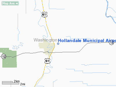
Hollandale Municipal Airport |
Location & QuickFacts
| FAA Information Effective: | 2008-09-25 |
| Airport Identifier: | 14M |
| Airport Status: | Operational |
| Longitude/Latitude: | 090-49-50.3560W/33-10-57.4380N
-90.830654/33.182622 (Estimated) |
| Elevation: | 114 ft / 34.75 m (Surveyed) |
| Land: | 23 acres |
| From nearest city: | 2 nautical miles NE of Hollandale, MS |
| Location: | Washington County, MS |
| Magnetic Variation: | 03E (1985) |
Owner & Manager
| Ownership: | Publicly owned |
| Owner: | City Of Hollandale |
| Address: | City Hall
Hollandale, MS 38748 |
| Phone number: | 662-827-2241 |
| Manager: | City Of Hollandale
MAYOR OF HOLLANDALE - HONORABLE WILLIE BURNSIDE |
| Address: | Po Box 395
Hollandale, MS 38748 |
| Phone number: | 662-827-0568 |
Airport Operations and Facilities
| Airport Use: | Open to public |
| Wind indicator: | Yes
LIGHT IS OTS INDEF. |
| Segmented Circle: | Yes |
| Control Tower: | No |
| Lighting Schedule: | DUSK-DAWN
MIRL RY 08/26 OPERS DUSK-2200; AFT 2200 ACTVT - 122.7. |
| Beacon Color: | Clear-Green (lighted land airport)
RTG BCN OTS INDEFLY. |
| Landing fee charge: | No |
| Sectional chart: | Memphis |
| Region: | ASO - Southern |
| Boundary ARTCC: | ZME - Memphis |
| Tie-in FSS: | GWO - Greenwood |
| FSS on Airport: | No |
| FSS Toll Free: | 1-800-WX-BRIEF |
| NOTAMs Facility: | GWO (NOTAM-d service avaliable) |
| Federal Agreements: | NGY |
Airport Communications
Airport Services
| Airframe Repair: | NONE |
| Power Plant Repair: | NONE |
| Bottled Oxygen: | NONE |
| Bulk Oxygen: | NONE |
Runway Information
Runway 08/26
| Dimension: | 3000 x 50 ft / 914.4 x 15.2 m |
| Surface: | ASPH, Fair Condition |
| Weight Limit: | Single wheel: 21000 lbs. |
| Edge Lights: | Medium |
| |
Runway 08 |
Runway 26 |
| Traffic Pattern: | Left | Left |
| Markings: | Basic, Fair Condition | Basic, Fair Condition |
|
Radio Navigation Aids
| ID |
Type |
Name |
Ch |
Freq |
Var |
Dist |
| MTQ | NDB | Metcalf | | 359.00 | 03E | 16.5 nm |
| IDL | NDB | Indianola | | 284.00 | 03E | 19.5 nm |
| BLE | NDB | Lake Providence | | 278.00 | 03E | 27.9 nm |
| RNV | NDB | Renova | | 272.00 | 04E | 37.7 nm |
| GLH | VOR/DME | Greenville | 039X | 110.20 | 04E | 21.9 nm |
| MON | VOR/DME | Monticello | 053X | 111.60 | 04E | 49.9 nm |
| SQS | VORTAC | Sidon | 094X | 114.70 | 03E | 32.5 nm |
Remarks
- NUMEROUS AG ACFT LNDG SOUTH AND DPTG NORTH ON WEST TWY SR-SS THR OCT.
- WILD LIFE ON & INVOF ARPT.
Images and information placed above are from
http://www.airport-data.com/airport/14M/
We thank them for the data!
| General Info
|
| Country |
United States
|
| State |
MISSISSIPPI
|
| FAA ID |
14M
|
| Latitude |
33-10-57.438N
|
| Longitude |
090-49-50.356W
|
| Elevation |
114 feet
|
| Near City |
HOLLANDALE
|
We don't guarantee the information is fresh and accurate. The data may
be wrong or outdated.
For more up-to-date information please refer to other sources.
|
|


