 |
|
Location & QuickFacts
| FAA Information Effective: | 2008-09-25 |
| Airport Identifier: | MS48 |
| Airport Status: | Operational |
| Longitude/Latitude: | 089-41-47.3000W/30-37-18.7000N
-89.696472/30.621861 (Estimated) |
| Elevation: | 60 ft / 18.29 m (Estimated) |
| Land: | 15 acres |
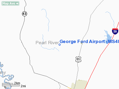
| From nearest city: | 6 nautical miles N of Picayune, MS |
| Location: | Pearl River County, MS |
| Magnetic Variation: | 01E () |
Owner & Manager
| Ownership: | Privately owned |
| Owner: | John Griffin |
| Address: | 101 Elizabeth Street
Picayune, MS 39466 |
| Phone number: | 601-798-7038 |
| Manager: | John Griffin |
| Address: | 101 Elizabeth Street
Picayune, MS 39466 |
| Phone number: | 601-798-4761 |
Airport Operations and Facilities
| Airport Use: | Private |
| Wind indicator: | Yes |
| Segmented Circle: | No |
| Control Tower: | No |
| Sectional chart: | New Orleans |
| Region: | ASO - Southern |
| Boundary ARTCC: | ZHU - Houston |
| Tie-in FSS: | GWO - Greenwood |
| FSS Toll Free: | 1-800-WX-BRIEF |
Runway Information
Runway 18/36
| Dimension: | 2500 x 80 ft / 762.0 x 24.4 m |
| Surface: | TURF, |
| |
Runway 18 |
Runway 36 |
| Traffic Pattern: | Left | Left |
| Obstruction: | 50 ft trees, 150.0 ft from runway | 50 ft trees, 500.0 ft from runway |
|
Radio Navigation Aids
| ID |
Type |
Name |
Ch |
Freq |
Var |
Dist |
| MJD | NDB | Picayune | | 276.00 | 01E | 8.0 nm |
| FNA | NDB | Florenville | | 371.00 | 03E | 14.0 nm |
| HS | NDB | Hanco | | 221.00 | 01E | 16.2 nm |
| AYI | NDB | Hanco | | 221.00 | 03E | 16.2 nm |
| BX | NDB | Carma | | 353.00 | 02E | 17.8 nm |
| DEF | NDB | Slidell | | 256.00 | 03E | 20.8 nm |
| FOH | NDB | Foxworth | | 331.00 | 05E | 41.0 nm |
| BIX | TACAN | Keesler | 055X | | 01E | 41.8 nm |
| HMU | VOR | Hammond | | 109.60 | 03E | 37.8 nm |
| PCU | VOR/DME | Picayune | 059X | 112.20 | 05E | 4.1 nm |
| GPT | VOR/DME | Gulfport | 27X | 109.00 | 02E | 34.7 nm |
| HRV | VORTAC | Harvey | 088X | 114.10 | 02E | 49.0 nm |
| NEW | VOT | New Orleans Lakefront | | 111.00 | | 39.0 nm |
Remarks
- 50 FT TREES ALONG BOTH SIDES OF RY 150 FT FROM RY CNTRLN.
- PRVDD VFR OPNS, PVT USE, OWNERS OF SIMPSON FIELD AND KARL SCOTT AIRPORT HONOR THE LETTER OF AGREEMENT.
Images and information placed above are from
http://www.airport-data.com/airport/MS48/
We thank them for the data!
| General Info
|
| Country |
United States
|
| State |
MISSISSIPPI
|
| FAA ID |
MS48
|
| Latitude |
30-37-18.700N
|
| Longitude |
089-41-47.300W
|
| Elevation |
60 feet
|
| Near City |
PICAYUNE
|
We don't guarantee the information is fresh and accurate. The data may
be wrong or outdated.
For more up-to-date information please refer to other sources.
|
|


