 |
|
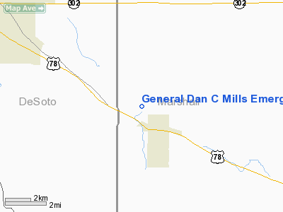
General Dan C Mills Emergency Heliport |
Location & QuickFacts
| FAA Information Effective: | 2008-09-25 |
| Airport Identifier: | 1MS5 |
| Airport Status: | Operational |
| Longitude/Latitude: | 089-42-10.3030W/34-53-20.3430N
-89.702862/34.888984 (Estimated) |
| Elevation: | 44 ft / 13.41 m (Estimated) |
| Land: | 1 acres |
| From nearest city: | 0 nautical miles N of Byhalia, MS |
| Location: | Marshall County, MS |
| Magnetic Variation: | 02E (1985) |
Owner & Manager
| Ownership: | Privately owned |
| Owner: | Major General Dan C. Mills |
| Address: | 944 Shinault Rd
Byhalia, MS 38611 |
| Phone number: | 662-838-2909 |
| Address: |
|
Airport Operations and Facilities
| Airport Use: | Private |
| Wind indicator: | Yes |
| Segmented Circle: | No |
| Control Tower: | No |
| Lighting Schedule: | PHONE REQ
FOR PERIMETER LGTS CALL 601 838-6843. |
| Sectional chart: | Memphis |
| Region: | ASO - Southern |
| Boundary ARTCC: | ZME - Memphis |
| Tie-in FSS: | MKL - Jackson |
| FSS Toll Free: | 1-800-WX-BRIEF |
Runway Information
Helipad H1
| Dimension: | 50 x 50 ft / 15.2 x 15.2 m |
| Surface: | CONC, |
| |
Runway H1 |
Runway |
| Traffic Pattern: | Left | Left |
|
Radio Navigation Aids
| ID |
Type |
Name |
Ch |
Freq |
Var |
Dist |
| OLV | NDB | Olive Branch | | 275.00 | 01E | 6.9 nm |
| ME | NDB | Elvis | | 287.00 | 01E | 20.9 nm |
| FYE | NDB | Somerville | | 255.00 | 00E | 24.4 nm |
| SPQ | NDB | Spain | | 414.00 | 04E | 25.4 nm |
| MIG | NDB | Millington | | 232.00 | 04E | 26.0 nm |
| AWM | NDB | West Memphis | | 362.00 | 01E | 30.1 nm |
| BAV | NDB | Hardeman | | 404.00 | 01E | 37.9 nm |
| COO | NDB | Covington | | 326.00 | 02E | 42.5 nm |
| GQE | VOR/DME | Gilmore | 077X | 113.00 | 04E | 47.0 nm |
| HLI | VORTAC | Holly Springs | 071X | 112.40 | 03E | 12.4 nm |
| MEM | VORTAC | Memphis | 122X | 117.50 | 01E | 15.8 nm |
| MEM | VOT | Memphis Metropolitn | | 111.00 | | 16.7 nm |
Remarks
Images and information placed above are from
http://www.airport-data.com/airport/1MS5/
We thank them for the data!
| General Info
|
| Country |
United States
|
| State |
MISSISSIPPI
|
| FAA ID |
1MS5
|
| Latitude |
34-53-20.343N
|
| Longitude |
089-42-10.303W
|
| Elevation |
44 feet
|
| Near City |
BYHALIA
|
We don't guarantee the information is fresh and accurate. The data may
be wrong or outdated.
For more up-to-date information please refer to other sources.
|
|


