 |
|
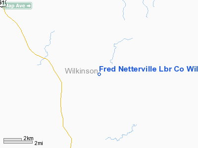
Fred Netterville Lbr Co Wilkinson Commnty Airport |
Location & QuickFacts
| FAA Information Effective: | 2008-09-25 |
| Airport Identifier: | MS57 |
| Airport Status: | Operational |
| Longitude/Latitude: | 091-14-25.3920W/31-13-12.6170N
-91.240387/31.220171 (Estimated) |
| Elevation: | 120 ft / 36.58 m (Estimated) |
| Land: | 0 acres |
| From nearest city: | 9 nautical miles N of Woodville, MS |
| Location: | Wilkinson County, MS |
| Magnetic Variation: | 03E (1985) |
Owner & Manager
| Ownership: | Privately owned |
| Owner: | Fred Netterville |
| Address: | P.o. Box 857
Woodville, MS 39669 |
| Phone number: | 601-888-4343 |
| Manager: | Fred Netterville |
| Address: | P.o. Box 857
Woodville, MS 39669 |
| Phone number: | 601-888-4343 |
Airport Operations and Facilities
| Airport Use: | Private |
| Wind indicator: | Yes |
| Segmented Circle: | No |
| Control Tower: | No |
| Lighting Schedule: | DUSK-DAWN |
| Landing fee charge: | No |
| Sectional chart: | Houston |
| Region: | ASO - Southern |
| Boundary ARTCC: | ZHU - Houston |
| Tie-in FSS: | GWO - Greenwood |
| FSS on Airport: | No |
| FSS Toll Free: | 1-800-WX-BRIEF |
Airport Services
| Fuel available: | 100 |
| Airframe Repair: | NONE |
| Power Plant Repair: | NONE |
Runway Information
Runway 06/24
| Dimension: | 3000 x 30 ft / 914.4 x 9.1 m |
| Surface: | ASPH, |
| Edge Lights: | Low |
| |
Runway 06 |
Runway 24 |
| Traffic Pattern: | Left | Left |
|
Radio Navigation Aids
| ID |
Type |
Name |
Ch |
Freq |
Var |
Dist |
| HAH | NDB | Natchez-adams County | | 388.00 | 03E | 28.4 nm |
| HZ | NDB | Hazer | | 356.00 | 04E | 37.5 nm |
| MC | NDB | Ferni | | 413.00 | 03E | 37.6 nm |
| MKV | NDB | Marksville | | 347.00 | 02E | 43.5 nm |
| BVV | NDB | Brookhaven | | 407.00 | 03E | 48.5 nm |
| HEZ | VOR/DME | Natchez | 037X | 110.00 | 03E | 24.1 nm |
| BTR | VORTAC | Baton Rouge | 112X | 116.50 | 06E | 44.3 nm |
Remarks
Images and information placed above are from
http://www.airport-data.com/airport/MS57/
We thank them for the data!
| General Info
|
| Country |
United States
|
| State |
MISSISSIPPI
|
| FAA ID |
MS57
|
| Latitude |
31-13-12.617N
|
| Longitude |
091-14-25.392W
|
| Elevation |
120 feet
|
| Near City |
WOODVILLE
|
We don't guarantee the information is fresh and accurate. The data may
be wrong or outdated.
For more up-to-date information please refer to other sources.
|
|


