 |
|
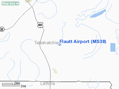
Location & QuickFacts
| FAA Information Effective: | 2008-09-25 |
| Airport Identifier: | MS38 |
| Airport Status: | Operational |
| Longitude/Latitude: | 090-17-00.3180W/33-52-20.4120N
-90.283422/33.872337 (Estimated) |
| Elevation: | 145 ft / 44.20 m (Surveyed) |
| Land: | 10 acres |
| From nearest city: | 0 nautical miles NE of Swan Lake, MS |
| Location: | Tallahatchie County, MS |
| Magnetic Variation: | 03E (1985) |
Owner & Manager
| Ownership: | Privately owned |
| Owner: | Jack G Flautt |
| Address: | P.o. Box 335
Swan Lake, MS 38958 |
| Phone number: | 601-375-7243 |
| Manager: | Jerome Strickland |
| Address: | P.o. Box 548
Webb, MS 38966 |
| Phone number: | 601-375-7243 |
Airport Operations and Facilities
| Airport Use: | Private |
| Wind indicator: | Yes |
| Segmented Circle: | No |
| Control Tower: | No |
| Landing fee charge: | No |
| Sectional chart: | Memphis |
| Region: | ASO - Southern |
| Boundary ARTCC: | ZME - Memphis |
| Tie-in FSS: | GWO - Greenwood |
| FSS on Airport: | No |
| FSS Toll Free: | 1-800-WX-BRIEF |
Runway Information
Runway 18/36
| Dimension: | 2000 x 100 ft / 609.6 x 30.5 m |
| Surface: | CONC-TURF,
RWY 18-36 2000'X100', TURF-CONC; CNTR SECTION 500'X100' CONCRETE; ENDS 750'X100' TURF. (OWNER REPORT). |
| |
Runway 18 |
Runway 36 |
| Traffic Pattern: | Left | Left |
|
Radio Navigation Aids
| ID |
Type |
Name |
Ch |
Freq |
Var |
Dist |
| SBQ | NDB | Scobey | | 245.00 | 01E | 20.4 nm |
| RNV | NDB | Renova | | 272.00 | 04E | 24.2 nm |
| CKM | NDB | Clarksdale | | 341.00 | 02E | 27.8 nm |
| IDL | NDB | Indianola | | 284.00 | 03E | 30.7 nm |
| MTQ | NDB | Metcalf | | 359.00 | 03E | 44.1 nm |
| HEE | NDB | Thompson-robbins | | 251.00 | 01E | 46.3 nm |
| GLH | VOR/DME | Greenville | 039X | 110.20 | 04E | 40.8 nm |
| UJM | VOR/DME | Marvell | 033X | 109.60 | 01E | 46.5 nm |
| SQS | VORTAC | Sidon | 094X | 114.70 | 03E | 24.6 nm |
Images and information placed above are from
http://www.airport-data.com/airport/MS38/
We thank them for the data!
| General Info
|
| Country |
United States
|
| State |
MISSISSIPPI
|
| FAA ID |
MS38
|
| Latitude |
33-52-20.412N
|
| Longitude |
090-17-00.318W
|
| Elevation |
145 feet
|
| Near City |
SWAN LAKE
|
We don't guarantee the information is fresh and accurate. The data may
be wrong or outdated.
For more up-to-date information please refer to other sources.
|
|


