 |
|
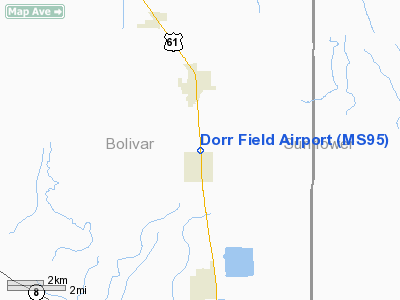
Location & QuickFacts
| FAA Information Effective: | 2008-09-25 |
| Airport Identifier: | MS95 |
| Airport Status: | Operational |
| Longitude/Latitude: | 090-43-30.3510W/33-50-50.4030N
-90.725098/33.847334 (Estimated) |
| Elevation: | 142 ft / 43.28 m (Estimated) |
| Land: | 51 acres |
| From nearest city: | 1 nautical miles N of Merigold, MS |
| Location: | Bolivar County, MS |
| Magnetic Variation: | 03E (1985) |
Owner & Manager
| Ownership: | Privately owned |
| Owner: | Mrs. John E. Dorr |
| Address: | Po Box 1567
Cleveland, MS 38732 |
| Phone number: | 662-748-2195 |
| Manager: | Mrs. John E. Dorr |
| Address: | Po Box 1567
Cleveland, MS 38732 |
| Phone number: | 662-748-2195 |
Airport Operations and Facilities
| Airport Use: | Private |
| Wind indicator: | Yes |
| Segmented Circle: | No |
| Control Tower: | No |
| Landing fee charge: | No |
| Sectional chart: | Memphis |
| Region: | ASO - Southern |
| Boundary ARTCC: | ZME - Memphis |
| Tie-in FSS: | GWO - Greenwood |
| FSS on Airport: | No |
| FSS Toll Free: | 1-800-WX-BRIEF |
Airport Services
| Airframe Repair: | NONE |
| Power Plant Repair: | NONE |
| Bottled Oxygen: | NONE |
| Bulk Oxygen: | NONE |
Runway Information
Runway 09/27
| Dimension: | 2800 x 200 ft / 853.4 x 61.0 m |
| Surface: | TURF, Poor Condition |
| |
Runway 09 |
Runway 27 |
| Traffic Pattern: | Right | Left |
| Obstruction: | 25 ft pole, 125.0 ft from runway, 5:1 slope to clear | 42 ft trees, 300.0 ft from runway, 7:1 slope to clear |
|
Runway 16/34
| Dimension: | 2000 x 100 ft / 609.6 x 30.5 m |
| Surface: | TURF, Fair Condition |
| |
Runway 16 |
Runway 34 |
| Traffic Pattern: | Right | Left |
| Obstruction: | 60 ft tree, 200.0 ft from runway, 25 ft left of centerline, 3:1 slope to clear | 53 ft trees, 600.0 ft from runway, 15 ft right of centerline, 11:1 slope to clear
+3' STOCK FENCE. |
|
Runway 18/36
| Dimension: | 1800 x 100 ft / 548.6 x 30.5 m |
| Surface: | TURF, Fair Condition |
| |
Runway 18 |
Runway 36 |
| Traffic Pattern: | Left | Left |
| Obstruction: | 6 ft road, 100.0 ft from runway, 16:1 slope to clear | 48 ft trees, 150.0 ft from runway, 3:1 slope to clear
+3' STOCK FENCE. |
|
Radio Navigation Aids
| ID |
Type |
Name |
Ch |
Freq |
Var |
Dist |
| RNV | NDB | Renova | | 272.00 | 04E | 3.1 nm |
| IDL | NDB | Indianola | | 284.00 | 03E | 22.2 nm |
| MTQ | NDB | Metcalf | | 359.00 | 03E | 28.4 nm |
| CKM | NDB | Clarksdale | | 341.00 | 02E | 28.7 nm |
| SBQ | NDB | Scobey | | 245.00 | 01E | 42.5 nm |
| HEE | NDB | Thompson-robbins | | 251.00 | 01E | 43.6 nm |
| GLH | VOR/DME | Greenville | 039X | 110.20 | 04E | 23.3 nm |
| UJM | VOR/DME | Marvell | 033X | 109.60 | 01E | 43.8 nm |
| SQS | VORTAC | Sidon | 094X | 114.70 | 03E | 32.1 nm |
Remarks
Images and information placed above are from
http://www.airport-data.com/airport/MS95/
We thank them for the data!
| General Info
|
| Country |
United States
|
| State |
MISSISSIPPI
|
| FAA ID |
MS95
|
| Latitude |
33-50-50.403N
|
| Longitude |
090-43-30.351W
|
| Elevation |
142 feet
|
| Near City |
MERIGOLD
|
We don't guarantee the information is fresh and accurate. The data may
be wrong or outdated.
For more up-to-date information please refer to other sources.
|
|


