 |
|
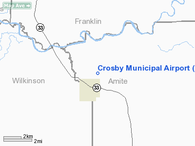
Location & QuickFacts
| FAA Information Effective: | 2008-09-25 |
| Airport Identifier: | C71 |
| Airport Status: | Operational |
| Longitude/Latitude: | 091-03-10.3740W/31-17-45.6170N
-91.052882/31.296005 (Estimated) |
| Elevation: | 336 ft / 102.41 m (Surveyed) |
| Land: | 40 acres |
| From nearest city: | 1 nautical miles NE of Crosby, MS |
| Location: | Amite County, MS |
| Magnetic Variation: | 03E (1985) |
Owner & Manager
| Ownership: | Publicly owned |
| Owner: | City Of Crosby |
| Address: | Box 416
Crosby, MS 39633 |
| Phone number: | 601-639-4516 |
| Manager: | James Bateaste
MAYOR OF CROSBY. |
| Address: | Box 416
Crosby, MS 39633 |
| Phone number: | 601-639-4516
CELL PHONE 601-807-8214 |
Airport Operations and Facilities
| Airport Use: | Open to public |
| Wind indicator: | Yes |
| Segmented Circle: | No |
| Control Tower: | No |
| Landing fee charge: | No |
| Sectional chart: | Houston |
| Region: | ASO - Southern |
| Boundary ARTCC: | ZHU - Houston |
| Tie-in FSS: | GWO - Greenwood |
| FSS on Airport: | No |
| FSS Toll Free: | 1-800-WX-BRIEF |
| NOTAMs Facility: | GWO (NOTAM-d service avaliable) |
| Federal Agreements: | N1 |
Airport Communications
Airport Services
| Airframe Repair: | NONE |
| Power Plant Repair: | NONE |
| Bottled Oxygen: | NONE |
| Bulk Oxygen: | NONE |
Runway Information
Runway 17/35
| Dimension: | 3127 x 60 ft / 953.1 x 18.3 m |
| Surface: | ASPH, Good Condition |
| Weight Limit: | Single wheel: 16000 lbs. |
| |
Runway 17 |
Runway 35 |
| Traffic Pattern: | Left | Left |
| Markings: | Basic, Good Condition | Basic, Good Condition |
| Obstruction: | 39 ft trees, 310.0 ft from runway, 100 ft right of centerline, 2:1 slope to clear
3-23 FT TREES & BUSHES 120 FT EITHER SIDE OF RY. | 24 ft trees, 260.0 ft from runway, 2:1 slope to clear
3-20 FT TREES & BUSHES 120 FT EITHER SIDE OF RY. |
|
Radio Navigation Aids
| ID |
Type |
Name |
Ch |
Freq |
Var |
Dist |
| HAH | NDB | Natchez-adams County | | 388.00 | 03E | 26.7 nm |
| MC | NDB | Ferni | | 413.00 | 03E | 28.0 nm |
| BVV | NDB | Brookhaven | | 407.00 | 03E | 37.9 nm |
| HZ | NDB | Hazer | | 356.00 | 04E | 45.8 nm |
| HEZ | VOR/DME | Natchez | 037X | 110.00 | 03E | 23.1 nm |
| MCB | VORTAC | Mc Comb | 114X | 116.70 | 03E | 40.8 nm |
Remarks
- DEER ON & INVOF ARPT.
- PRVDD ALL OPNS VFR ONLY; APCHS TO EACH RY ARE CLEAR 20:1; MEET DESIGN STANDARDS IN A/C 150/5300-13.
Images and information placed above are from
http://www.airport-data.com/airport/C71/
We thank them for the data!
| General Info
|
| Country |
United States
|
| State |
MISSISSIPPI
|
| FAA ID |
C71
|
| Latitude |
31-17-45.617N
|
| Longitude |
091-03-10.374W
|
| Elevation |
336 feet
|
| Near City |
CROSBY
|
We don't guarantee the information is fresh and accurate. The data may
be wrong or outdated.
For more up-to-date information please refer to other sources.
|
|


