 |
|
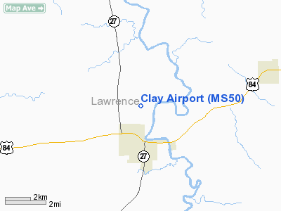
Location & QuickFacts
| FAA Information Effective: | 2008-09-25 |
| Airport Identifier: | MS50 |
| Airport Status: | Operational |
| Longitude/Latitude: | 090-06-40.3080W/31-34-45.6080N
-90.111197/31.579336 (Estimated) |
| Elevation: | 201 ft / 61.26 m (Surveyed) |
| Land: | 114 acres |
| From nearest city: | 2 nautical miles N of Monticello, MS |
| Location: | Lawrence County, MS |
| Magnetic Variation: | 03E (1985) |
Owner & Manager
| Ownership: | Privately owned |
| Owner: | T F Clay Jr |
| Address: | P.o. Box 326
Monticello, MS 39654 |
| Phone number: | 601-587-4656 |
| Manager: | T F Clay Jr |
| Address: | P.o. Box 326
Monticello, MS 39654 |
| Phone number: | 601-587-4656 |
Airport Operations and Facilities
| Airport Use: | Private |
| Wind indicator: | No |
| Segmented Circle: | No |
| Control Tower: | No |
| Landing fee charge: | No |
| Sectional chart: | New Orleans |
| Region: | ASO - Southern |
| Boundary ARTCC: | ZHU - Houston |
| Tie-in FSS: | GWO - Greenwood |
| FSS on Airport: | No |
| FSS Toll Free: | 1-800-WX-BRIEF |
Airport Services
| Airframe Repair: | NONE |
| Power Plant Repair: | NONE |
| Bottled Oxygen: | NONE |
| Bulk Oxygen: | NONE |
Runway Information
Runway 10/28
| Dimension: | 1600 x 60 ft / 487.7 x 18.3 m |
| Surface: | TURF, |
| |
Runway 10 |
Runway 28 |
| Traffic Pattern: | Left | Left |
| Markings: | None, | None, |
| Runway End Identifier: | No | No |
| Centerline Lights: | No | No |
| Touchdown Lights: | No | No |
| Obstruction: | 6 ft fence, 30.0 ft from runway, 20:1 slope to clear
4' FENCE AT THR. | , 20:1 slope to clear |
|
Radio Navigation Aids
| ID |
Type |
Name |
Ch |
Freq |
Var |
Dist |
| BVV | NDB | Brookhaven | | 407.00 | 03E | 15.4 nm |
| FOH | NDB | Foxworth | | 331.00 | 05E | 22.7 nm |
| MC | NDB | Ferni | | 413.00 | 03E | 28.3 nm |
| BX | NDB | Carma | | 353.00 | 02E | 43.8 nm |
| RYB | NDB | Raymond | | 375.00 | 03E | 46.0 nm |
| THJ | NDB | Tallahala | | 346.00 | 00E | 47.6 nm |
| MCB | VORTAC | Mc Comb | 114X | 116.70 | 03E | 18.2 nm |
| LBY | VORTAC | Eaton | 043X | 110.60 | 05E | 40.8 nm |
| JAN | VOT | Jackson | | 111.00 | | 44.0 nm |
Remarks
- FARM EQUIPMENT LEFT ON RWY OVERNIGHT - CLEAR INSPECTION BEFORE LANDING.
- NOT REQUESTED.
Images and information placed above are from
http://www.airport-data.com/airport/MS50/
We thank them for the data!
| General Info
|
| Country |
United States
|
| State |
MISSISSIPPI
|
| FAA ID |
MS50
|
| Latitude |
31-34-45.608N
|
| Longitude |
090-06-40.308W
|
| Elevation |
201 feet
|
| Near City |
MONTICELLO
|
We don't guarantee the information is fresh and accurate. The data may
be wrong or outdated.
For more up-to-date information please refer to other sources.
|
|


