 |
|
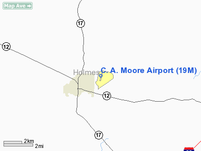
Location & QuickFacts
| FAA Information Effective: | 2008-09-25 |
| Airport Identifier: | 19M |
| Airport Status: | Operational |
| Longitude/Latitude: | 090-01-32.0050W/33-07-31.6600N
-90.025557/33.125461 (Estimated) |
| Elevation: | 340 ft / 103.63 m (Surveyed) |
| Land: | 90 acres |
| From nearest city: | 2 nautical miles NE of Lexington, MS |
| Location: | Holmes County, MS |
| Magnetic Variation: | 02E (1985) |
Owner & Manager
| Ownership: | Publicly owned |
| Owner: | City Of Lexington |
| Address: | 112 Spring St
Lexington, MS 39095 |
| Phone number: | 662-834-1261 |
| Manager: | Mayor Robin M. Mccrory
MAYOR OF LEXINGTON: ROBIN M. MCCRORY. |
| Address: | P.o. Box 455, 112 Spring St
Lexington, MS 39095 |
| Phone number: | 662-417-0167
POLICE DEPT (662) 834-3508 |
Airport Operations and Facilities
| Airport Use: | Open to public |
| Wind indicator: | Yes |
| Segmented Circle: | Yes |
| Control Tower: | No |
| Lighting Schedule: | DUSK-DAWN |
| Beacon Color: | Clear-Green (lighted land airport)
ARPT BCN OTS IDEFLY. |
| Landing fee charge: | No |
| Sectional chart: | Memphis |
| Region: | ASO - Southern |
| Boundary ARTCC: | ZME - Memphis |
| Tie-in FSS: | GWO - Greenwood |
| FSS on Airport: | No |
| FSS Toll Free: | 1-800-WX-BRIEF |
| NOTAMs Facility: | GWO (NOTAM-d service avaliable) |
| Federal Agreements: | NGY |
Airport Communications
Airport Services
| Airframe Repair: | NONE |
| Power Plant Repair: | NONE |
| Bottled Oxygen: | NONE |
| Bulk Oxygen: | NONE |
Runway Information
Runway 01/19
| Dimension: | 3199 x 60 ft / 975.1 x 18.3 m |
| Surface: | ASPH, Good Condition |
| Weight Limit: | Single wheel: 20000 lbs. |
| Edge Lights: | Medium |
| |
Runway 01 |
Runway 19 |
| Longitude: | 090-01-35.8300W | 090-01-28.1220W |
| Latitude: | 33-07-16.1750N | 33-07-47.1550N |
| Elevation: | 324.00 ft | 339.00 ft |
| Alignment: | 12 | 127 |
| Traffic Pattern: | Left | Left |
| Markings: | Basic, Good Condition | Basic, Good Condition |
| Obstruction: | 17 ft trees, 710.0 ft from runway, 30:1 slope to clear | 40 ft trees, 1200.0 ft from runway, 140 ft left of centerline, 25:1 slope to clear |
|
Radio Navigation Aids
| ID |
Type |
Name |
Ch |
Freq |
Var |
Dist |
| OSX | NDB | Kosciusko | | 269.00 | 00W | 24.5 nm |
| IDL | NDB | Indianola | | 284.00 | 03E | 39.0 nm |
| JH | NDB | Brenz | | 260.00 | 02E | 44.4 nm |
| SBQ | NDB | Scobey | | 245.00 | 01E | 46.6 nm |
| LMS | NDB | Louisville | | 212.00 | 00E | 48.6 nm |
| MPE | NDB | Philadelphia | | 219.00 | 01E | 49.5 nm |
| SQS | VORTAC | Sidon | 094X | 114.70 | 03E | 24.0 nm |
| JAN | VORTAC | Jackson | 073X | 112.60 | 05E | 37.8 nm |
| JAN | VOT | Jackson | | 111.00 | | 49.0 nm |
Images and information placed above are from
http://www.airport-data.com/airport/19M/
We thank them for the data!
| General Info
|
| Country |
United States
|
| State |
MISSISSIPPI
|
| FAA ID |
19M
|
| Latitude |
33-07-31.660N
|
| Longitude |
090-01-32.005W
|
| Elevation |
340 feet
|
| Near City |
LEXINGTON
|
We don't guarantee the information is fresh and accurate. The data may
be wrong or outdated.
For more up-to-date information please refer to other sources.
|
|


