 |
|
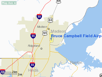
Bruce Campbell Field Airport |
Location & QuickFacts
| FAA Information Effective: | 2008-09-25 |
| Airport Identifier: | MBO |
| Airport Status: | Operational |
| Longitude/Latitude: | 090-06-11.1320W/32-26-19.1920N
-90.103092/32.438664 (Estimated) |
| Elevation: | 326 ft / 99.36 m (Surveyed) |
| Land: | 260 acres |
| From nearest city: | 2 nautical miles SE of Madison, MS |
| Location: | Madison County, MS |
| Magnetic Variation: | 01E (2000) |
Owner & Manager
| Ownership: | Publicly owned |
| Owner: | City Of Madison |
| Address: | Town Hall (po Box 40)
Madison, MS 39110 |
| Phone number: | 601-856-7116 |
| Manager: | Rheese Lincecum
FBO IS MADISON AIR CENTER. |
| Address: | 7504 Old Canton Road
Madison, MS 39110 |
| Phone number: | 601-853-1960 |
Airport Operations and Facilities
| Airport Use: | Open to public |
| Wind indicator: | Yes |
| Segmented Circle: | Yes |
| Control Tower: | No |
| Lighting Schedule: | DUSK-DAWN |
| Beacon Color: | Clear-Green (lighted land airport) |
| Landing fee charge: | No |
| Sectional chart: | Memphis |
| Region: | ASO - Southern |
| Boundary ARTCC: | ZME - Memphis |
| Tie-in FSS: | GWO - Greenwood |
| FSS on Airport: | No |
| FSS Toll Free: | 1-800-WX-BRIEF |
| NOTAMs Facility: | GWO (NOTAM-d service avaliable) |
| Federal Agreements: | NRY1 |
Airport Communications
| CTAF: | 122.800 |
| Unicom: | 122.800 |
Airport Services
| Fuel available: | 100LLA1+ |
| Airframe Repair: | MINOR |
| Power Plant Repair: | MINOR |
| Bulk Oxygen: | NONE |
Runway Information
Runway 17/35
| Dimension: | 4444 x 75 ft / 1354.5 x 22.9 m |
| Surface: | ASPH, Good Condition |
| Weight Limit: | Single wheel: 25000 lbs. |
| Edge Lights: | Medium |
| |
Runway 17 |
Runway 35 |
| Longitude: | 090-06-13.2440W | 090-06-09.0200W |
| Latitude: | 32-26-41.1050N | 32-25-57.2800N |
| Elevation: | 326.00 ft | 315.00 ft |
| Alignment: | 127 | 127 |
| Traffic Pattern: | Left | Left |
| Markings: | Non-precision instrument, Good Condition | Basic, Good Condition |
| Crossing Height: | 40.00 ft | 0.00 ft |
| Displaced threshold: | 0.00 ft | 200.00 ft |
| VASI: | 2-light PAPI on left side | |
| Visual Glide Angle: | 3.00° | 0.00° |
| Obstruction: | 68 ft trees, 1775.0 ft from runway, 23:1 slope to clear | 62 ft trees, 1979.0 ft from runway, 28:1 slope to clear
APCH RATIO 35:1 TO DSPLCD THLD. |
|
Radio Navigation Aids
| ID |
Type |
Name |
Ch |
Freq |
Var |
Dist |
| JH | NDB | Brenz | | 260.00 | 02E | 8.2 nm |
| RYB | NDB | Raymond | | 375.00 | 03E | 17.7 nm |
| VKS | NDB | Vicksburg | | 382.00 | 03E | 43.6 nm |
| TV | NDB | Savry | | 344.00 | 02E | 48.3 nm |
| OSX | NDB | Kosciusko | | 269.00 | 00W | 48.4 nm |
| JAN | VORTAC | Jackson | 073X | 112.60 | 05E | 5.3 nm |
| JAN | VOT | Jackson | | 111.00 | | 7.9 nm |
Remarks
- DEER & COYOTES ON & INVOF ARPT.
- AWOS FREQ. 119.12/PH#601-605-8137
Images and information placed above are from
http://www.airport-data.com/airport/MBO/
We thank them for the data!
| General Info
tr>
| Country |
United States
|
| State |
MISSISSIPPI
|
| FAA ID |
MBO
|
| Latitude |
32-26-19.192N
|
| Longitude |
090-06-11.132W
|
| Elevation |
326 feet
|
| Near City |
MADISON
|
We don't guarantee the information is fresh and accurate. The data may
be wrong or outdated.
For more up-to-date information please refer to other sources.
|
|


