 |
|
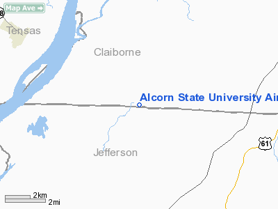
Alcorn State University Airport |
Location & QuickFacts
| FAA Information Effective: | 2008-09-25 |
| Airport Identifier: | MS28 |
| Airport Status: | Operational |
| Longitude/Latitude: | 091-08-05.3900W/31-52-07.5780N
-91.134831/31.868772 (Estimated) |
| Elevation: | 269 ft / 81.99 m (Surveyed) |
| Land: | 0 acres |
| From nearest city: | 5 nautical miles NW of Lorman, MS |
| Location: | Claiborne County, MS |
| Magnetic Variation: | 03E (1985) |
Owner & Manager
| Ownership: | Publicly owned |
| Owner: | Alcorn State University |
| Address: |
Lorman, MS 39096 |
| Manager: | P L Fluker |
| Address: | Alcorn State University
Lorman, MS 39096 |
| Phone number: | 601-877-6530 |
Airport Operations and Facilities
| Airport Use: | Private |
| Wind indicator: | Yes |
| Segmented Circle: | No |
| Control Tower: | No |
| Landing fee charge: | No |
| Sectional chart: | Houston |
| Region: | ASO - Southern |
| Boundary ARTCC: | ZME - Memphis |
| Tie-in FSS: | GWO - Greenwood |
| FSS on Airport: | No |
| FSS Toll Free: | 1-800-WX-BRIEF |
Airport Services
| Airframe Repair: | NONE |
| Power Plant Repair: | NONE |
Runway Information
Runway 12/30
| Dimension: | 2750 x 100 ft / 838.2 x 30.5 m |
| Surface: | TURF, |
| |
Runway 12 |
Runway 30 |
| Traffic Pattern: | Right | Left |
|
Radio Navigation Aids
| ID |
Type |
Name |
Ch |
Freq |
Var |
Dist |
| HAH | NDB | Natchez-adams County | | 388.00 | 03E | 13.4 nm |
| TV | NDB | Savry | | 344.00 | 02E | 23.3 nm |
| VKS | NDB | Vicksburg | | 382.00 | 03E | 24.3 nm |
| BVV | NDB | Brookhaven | | 407.00 | 03E | 40.2 nm |
| RYB | NDB | Raymond | | 375.00 | 03E | 45.1 nm |
| MRK | NDB | Molly Ridge | | 338.00 | 02E | 45.8 nm |
| MC | NDB | Ferni | | 413.00 | 03E | 48.8 nm |
| HEZ | VOR/DME | Natchez | 037X | 110.00 | 03E | 17.3 nm |
Remarks
Images and information placed above are from
http://www.airport-data.com/airport/MS28/
We thank them for the data!
| General Info
|
| Country |
United States
|
| State |
MISSISSIPPI
|
| FAA ID |
MS28
|
| Latitude |
31-52-07.578N
|
| Longitude |
091-08-05.390W
|
| Elevation |
269 feet
|
| Near City |
LORMAN
|
We don't guarantee the information is fresh and accurate. The data may
be wrong or outdated.
For more up-to-date information please refer to other sources.
|
|


