 |
|
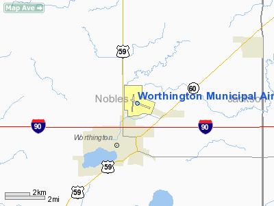
Worthington Municipal Airport |
Location & QuickFacts
| FAA Information Effective: | 2008-09-25 |
| Airport Identifier: | OTG |
| Airport Status: | Operational |
| Longitude/Latitude: | 095-34-45.1530W/43-39-18.2380N
-95.579209/43.655066 (Estimated) |
| Elevation: | 1574 ft / 479.76 m (Surveyed) |
| Land: | 652 acres |
| From nearest city: | 2 nautical miles N of Worthington, MN |
| Location: | Nobles County, MN |
| Magnetic Variation: | 07E (1975) |
Owner & Manager
| Ownership: | Publicly owned |
| Owner: | City Of Worthington |
| Address: | 303 Ninth St., Box 279
Worthington, MN 56187 |
| Phone number: | 507-372-8600 |
| Manager: | Jim Laffrenzen |
| Address: | 303 Ninth St., Box 279
Worthington, MN 56817-0279 |
| Phone number: | 507-372-8601 |
Airport Operations and Facilities
| Airport Use: | Open to public |
| Wind indicator: | Yes |
| Segmented Circle: | Yes |
| Control Tower: | No |
| Lighting Schedule: | DUSK-DAWN
HIRL 11/29 PRESET ON LOW INTST; TO INCR INTST & ACTVT MIRL RY 17/35; REIL RYS 11 & 17 & 35, PAPI RYS 11 & 29 & VASI RYS 17 & 35, MALSR RY 29 - CTAF. |
| Beacon Color: | Clear-Green (lighted land airport) |
| Landing fee charge: | No |
| Sectional chart: | Omaha |
| Region: | AGL - Great Lakes |
| Boundary ARTCC: | ZMP - Minneapolis |
| Tie-in FSS: | PNM - Princeton |
| FSS on Airport: | No |
| FSS Toll Free: | 1-800-WX-BRIEF |
| NOTAMs Facility: | OTG (NOTAM-d service avaliable) |
| Federal Agreements: | NGY |
Airport Communications
| CTAF: | 122.800 |
| Unicom: | 122.800 |
Airport Services
| Fuel available: | 100LLA
SELF SVC FUEL WITH CREDIT CARD. |
| Airframe Repair: | MAJOR |
| Power Plant Repair: | MINOR |
| Bottled Oxygen: | NONE |
| Bulk Oxygen: | NONE |
Runway Information
Runway 11/29
| Dimension: | 5506 x 100 ft / 1678.2 x 30.5 m |
| Surface: | ASPH, Good Condition
ALLIGATOR CRACKING. |
| Surface Treatment: | Saw-cut or plastic Grooved |
| Weight Limit: | Single wheel: 44000 lbs.
Dual wheel: 60000 lbs. |
| Edge Lights: | High |
| |
Runway 11 |
Runway 29 |
| Longitude: | 095-35-07.4700W | 095-33-59.4440W |
| Latitude: | 43-39-27.4910N | 43-39-04.7440N |
| Elevation: | 1574.00 ft | 1564.00 ft |
| Alignment: | 115 | 127 |
| ILS Type: | | ILS
|
| Traffic Pattern: | Left | Left |
| Markings: | Non-precision instrument, Good Condition | Precision instrument, Good Condition |
| Crossing Height: | 42.00 ft | 43.00 ft |
| VASI: | 4-light PAPI on left side | 4-light PAPI on left side |
| Visual Glide Angle: | 3.00° | 3.00° |
| Approach lights: | | MALSR |
| Runway End Identifier: | Yes | |
| Obstruction: | 43 ft trees, 1130.0 ft from runway, 550 ft right of centerline, 21:1 slope to clear | , 50:1 slope to clear |
|
Runway 17/35
| Dimension: | 4201 x 100 ft / 1280.5 x 30.5 m |
| Surface: | ASPH, Poor Condition
ALLIGATOR CRACKING. |
| Surface Treatment: | Saw-cut or plastic Grooved |
| Weight Limit: | Single wheel: 44000 lbs.
Dual wheel: 60000 lbs. |
| Edge Lights: | Medium |
| |
Runway 17 |
Runway 35 |
| Longitude: | 095-35-00.5000W | 095-35-00.4740W |
| Latitude: | 43-39-41.7570N | 43-39-00.2750N |
| Elevation: | 1568.00 ft | 1574.00 ft |
| Alignment: | 127 | 127 |
| Traffic Pattern: | Left | Left |
| Markings: | Non-precision instrument, Good Condition | Non-precision instrument, Good Condition |
| Crossing Height: | 26.00 ft | 34.00 ft |
| VASI: | 4-box on left side | 4-box on left side |
| Visual Glide Angle: | 3.00° | 3.00° |
| Runway End Identifier: | Yes | Yes |
|
Radio Navigation Aids
| ID |
Type |
Name |
Ch |
Freq |
Var |
Dist |
| ISB | NDB | Sibley | | 269.00 | 05E | 18.8 nm |
| MWM | NDB | Windom | | 203.00 | 03E | 25.5 nm |
| MJQ | NDB | Jackson | | 353.00 | 04E | 25.8 nm |
| SHL | NDB | Sheldon | | 338.00 | 05E | 28.7 nm |
| LTU | NDB | Little Sioux | | 326.00 | 05E | 37.3 nm |
| PUF | NDB | Puff | | 345.00 | 04E | 41.0 nm |
| SOY | NDB | Sioux Center | | 368.00 | 06E | 41.2 nm |
| ORC | NDB | Orange City | | 521.00 | 05E | 45.1 nm |
| JYG | NDB | St James | | 260.00 | 04E | 48.8 nm |
| PQN | NDB/DME | Pipestone | 028X | 284.00 | 06E | 36.9 nm |
| EST | VOR | Estherville | | 110.40 | 07E | 39.3 nm |
| OTG | VOR/DME | Worthington | 043X | 110.60 | 08E | 0.5 nm |
| DDL | VOR/DME | Sheldon | 023X | 108.60 | 05E | 28.9 nm |
| SPW | VOR/DME | Spencer | 037X | 110.00 | 05E | 33.9 nm |
| MML | VOR/DME | Marshall | 047X | 111.00 | 05E | 48.9 nm |
Images and information placed above are from
http://www.airport-data.com/airport/OTG/
We thank them for the data!
| General Info
|
| Country |
United States
|
| State |
MINNESOTA
|
| FAA ID |
OTG
|
| Latitude |
43-39-18.238N
|
| Longitude |
095-34-45.153W
|
| Elevation |
1574 feet
|
| Near City |
WORTHINGTON
|
We don't guarantee the information is fresh and accurate. The data may
be wrong or outdated.
For more up-to-date information please refer to other sources.
|
|


