 |
|
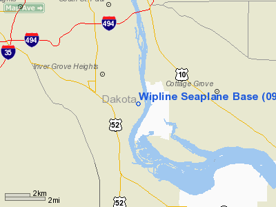
Location & QuickFacts
| FAA Information Effective: | 2008-09-25 |
| Airport Identifier: | 09Y |
| Airport Status: | Operational |
| Longitude/Latitude: | 093-00-55.7690W/44-48-59.8790N
-93.015491/44.816633 (Estimated) |
| Elevation: | 687 ft / 209.40 m (Estimated) |
| Land: | 2 acres |
| From nearest city: | 2 nautical miles SE of Inver Grove Hgts, MN |
| Location: | Dakota County, MN |
| Magnetic Variation: | 03E (1985) |
Owner & Manager
| Ownership: | Privately owned |
| Owner: | Robert Wiplinger |
| Address: | 8520 River Rd
Inver Grove Hgts, MN 55076 |
| Phone number: | 612-451-1205 |
| Manager: | Robert Wiplinger |
| Address: | 9100 River Rd
Inver Grove Hts, MN 55076 |
| Phone number: | 612-451-1205 |
Airport Operations and Facilities
| Airport Use: | Open to public |
| Wind indicator: | Yes |
| Segmented Circle: | No |
| Control Tower: | No |
| Landing fee charge: | No |
| Sectional chart: | Twin Cities |
| Region: | AGL - Great Lakes |
| Boundary ARTCC: | ZMP - Minneapolis |
| Tie-in FSS: | PNM - Princeton |
| FSS on Airport: | No |
| FSS Toll Free: | 1-800-WX-BRIEF |
| NOTAMs Facility: | PNM (NOTAM-d service avaliable) |
Airport Communications
Airport Services
| Fuel available: | 100LLA |
| Airframe Repair: | MAJOR |
| Power Plant Repair: | MAJOR |
| Bottled Oxygen: | NONE |
| Bulk Oxygen: | NONE |
Runway Information
Runway 17/35
| Dimension: | 8000 x 500 ft / 2438.4 x 152.4 m |
| Surface: | WATER, |
| |
Runway 17 |
Runway 35 |
| Traffic Pattern: | Left | Right |
|
Radio Navigation Aids
| ID |
Type |
Name |
Ch |
Freq |
Var |
Dist |
| MS | NDB | Narco | | 266.00 | 02E | 3.3 nm |
| PPI | NDB | Hopey | | 400.00 | 03E | 4.6 nm |
| RNH | NDB | New Richmond | | 257.00 | 02E | 28.5 nm |
| OEO | NDB | Osceola | | 233.00 | 01E | 32.8 nm |
| AHH | NDB | Ameron | | 278.00 | 01E | 39.1 nm |
| CBG | NDB | Cambridge | | 350.00 | 03E | 45.7 nm |
| GYL | NDB | Glencoe | | 407.00 | 03E | 45.8 nm |
| MSP | VOR/DME | Minneapolis | 100X | 115.30 | 02E | 10.6 nm |
| FCM | VOR/DME | Flying Cloud | 055X | 111.80 | 06E | 18.8 nm |
| FOW | VOR/DME | Halfway | 049X | 111.20 | 02E | 39.8 nm |
| FGT | VORTAC | Farmington | 104X | 115.70 | 06E | 13.2 nm |
| GEP | VORTAC | Gopher | 120X | 117.30 | 06E | 25.0 nm |
| STP | VOT | St Paul | | 114.40 | | 7.7 nm |
| MSP | VOT | Minneapolis St Paul | | 111.00 | | 9.4 nm |
Remarks
- RIVER CHNL MRKD BY BUOYS.
- CAUTION REQUIRED AT ALL TIMES ON RIVER FOR FLOATING DEBRIS.
Images and information placed above are from
http://www.airport-data.com/airport/09Y/
We thank them for the data!
| General Info
|
| Country |
United States
|
| State |
MINNESOTA
|
| FAA ID |
09Y
|
| Latitude |
44-48-59.879N
|
| Longitude |
093-00-55.769W
|
| Elevation |
687 feet
|
| Near City |
INVER GROVE HGTS
|
We don't guarantee the information is fresh and accurate. The data may
be wrong or outdated.
For more up-to-date information please refer to other sources.
|
|


