 |
|
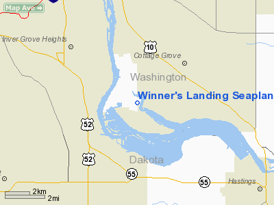
Winner's Landing Seaplane Base |
Location & QuickFacts
| FAA Information Effective: | 2008-09-25 |
| Airport Identifier: | 0MN0 |
| Airport Status: | Operational |
| Longitude/Latitude: | 092-59-02.7630W/44-47-48.8800N
-92.984101/44.796911 (Estimated) |
| Elevation: | 690 ft / 210.31 m (Estimated) |
| Land: | 0 acres |
| From nearest city: | 5 nautical miles S of St Paul Park, MN |
| Location: | Washington County, MN |
| Magnetic Variation: | 03E (1985) |
Owner & Manager
| Ownership: | Privately owned |
| Owner: | L. Thomas Norton |
| Address: | 10760 Island Dr
St Paul Park, MN 55071 |
| Phone number: | 612-459-1423 |
| Manager: | L. Thomas Norton |
| Address: | 10760 Island Dr
St Paul Park, MN 55071 |
| Phone number: | 612-459-1423 |
Airport Operations and Facilities
| Airport Use: | Private
PERSONAL USE ONLY. |
| Wind indicator: | Yes |
| Segmented Circle: | No |
| Control Tower: | No |
| Landing fee charge: | No |
| Sectional chart: | Green Bay |
| Region: | AGL - Great Lakes |
| Boundary ARTCC: | ZMP - Minneapolis |
| Tie-in FSS: | PNM - Princeton |
| FSS on Airport: | No |
| FSS Toll Free: | 1-800-WX-BRIEF |
Airport Services
Runway Information
Runway 09/27
| Dimension: | 5500 x 700 ft / 1676.4 x 213.4 m |
| Surface: | WATER, |
| |
Runway 09 |
Runway 27 |
| Traffic Pattern: | Right | Left |
|
Radio Navigation Aids
| ID |
Type |
Name |
Ch |
Freq |
Var |
Dist |
| MS | NDB | Narco | | 266.00 | 02E | 4.9 nm |
| PPI | NDB | Hopey | | 400.00 | 03E | 4.9 nm |
| RNH | NDB | New Richmond | | 257.00 | 02E | 28.5 nm |
| OEO | NDB | Osceola | | 233.00 | 01E | 33.3 nm |
| AHH | NDB | Ameron | | 278.00 | 01E | 39.1 nm |
| GYL | NDB | Glencoe | | 407.00 | 03E | 47.1 nm |
| CBG | NDB | Cambridge | | 350.00 | 03E | 47.2 nm |
| MSP | VOR/DME | Minneapolis | 100X | 115.30 | 02E | 12.3 nm |
| FCM | VOR/DME | Flying Cloud | 055X | 111.80 | 06E | 20.2 nm |
| FOW | VOR/DME | Halfway | 049X | 111.20 | 02E | 39.3 nm |
| FGT | VORTAC | Farmington | 104X | 115.70 | 06E | 13.1 nm |
| GEP | VORTAC | Gopher | 120X | 117.30 | 06E | 26.7 nm |
| STP | VOT | St Paul | | 114.40 | | 9.2 nm |
| MSP | VOT | Minneapolis St Paul | | 111.00 | | 11.2 nm |
Remarks
- UNICOM FREQ 122.95 IS AT ST PAUL DOWNTOWN HOLMAN FLD.
Images and information placed above are from
http://www.airport-data.com/airport/0MN0/
We thank them for the data!
| General Info
|
| Country |
United States
|
| State |
MINNESOTA
|
| FAA ID |
0MN0
|
| Latitude |
44-47-48.880N
|
| Longitude |
092-59-02.763W
|
| Elevation |
690 feet
|
| Near City |
ST PAUL PARK
|
We don't guarantee the information is fresh and accurate. The data may
be wrong or outdated.
For more up-to-date information please refer to other sources.
|
|


