 |
|
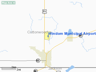
Location & QuickFacts
| FAA Information Effective: | 2008-09-25 |
| Airport Identifier: | MWM |
| Airport Status: | Operational |
| Longitude/Latitude: | 095-06-33.8700W/43-54-48.2460N
-95.109408/43.913402 (Estimated) |
| Elevation: | 1410 ft / 429.77 m (Surveyed) |
| Land: | 74 acres |
| From nearest city: | 3 nautical miles N of Windom, MN |
| Location: | Cottonwood County, MN |
| Magnetic Variation: | 03E (2005) |
Owner & Manager
| Ownership: | Publicly owned |
| Owner: | City Of Windom |
| Address: | 444-9th St., Po Box 38
Windom, MN 56101 |
| Phone number: | 507-831-6129 |
| Manager: | Brian Underwood |
| Address: | 48572 County Rd 44
Windom, MN 56101 |
| Phone number: | 507-830-0273 |
Airport Operations and Facilities
| Airport Use: | Open to public |
| Wind indicator: | Yes |
| Segmented Circle: | No |
| Control Tower: | No |
| Lighting Schedule: | DUSK-DAWN
ACTVT MIRL RY 17/35 AND REIL RYS 17 & 35 - 122.800. |
| Beacon Color: | Clear-Green (lighted land airport) |
| Landing fee charge: | No |
| Sectional chart: | Omaha |
| Region: | AGL - Great Lakes |
| Boundary ARTCC: | ZMP - Minneapolis |
| Tie-in FSS: | PNM - Princeton |
| FSS on Airport: | No |
| FSS Toll Free: | 1-800-WX-BRIEF |
| NOTAMs Facility: | MWM (NOTAM-d service avaliable) |
| Federal Agreements: | NY1 |
Airport Communications
Airport Services
| Fuel available: | 100LL
FUEL AVAIL 24 HRS W CREDIT CARD. |
Runway Information
Runway 17/35
| Dimension: | 3599 x 75 ft / 1097.0 x 22.9 m |
| Surface: | ASPH, Good Condition |
| Weight Limit: | Single wheel: 15000 lbs.
Dual wheel: 20000 lbs. |
| Edge Lights: | Medium |
| |
Runway 17 |
Runway 35 |
| Longitude: | 095-06-33.6780W | 095-06-33.9790W |
| Latitude: | 43-55-06.0460N | 43-54-30.5010N |
| Elevation: | 1407.00 ft | 1405.00 ft |
| Alignment: | 127 | 0 |
| Traffic Pattern: | Left | Left |
| Markings: | Non-precision instrument, Fair Condition
OLD MARKINGS BLEEDING THROUGH. | Non-precision instrument, Fair Condition |
| Runway End Identifier: | Yes | Yes |
| Obstruction: | , 50:1 slope to clear
RWY 17: +3' TREES, 30-200 FM RWY END, 210R. | 55 ft trees, 2100.0 ft from runway, 250 ft left of centerline, 34:1 slope to clear |
|
Radio Navigation Aids
| ID |
Type |
Name |
Ch |
Freq |
Var |
Dist |
| MWM | NDB | Windom | | 203.00 | 03E | 0.2 nm |
| MJQ | NDB | Jackson | | 353.00 | 04E | 16.9 nm |
| JYG | NDB | St James | | 260.00 | 04E | 24.5 nm |
| PUF | NDB | Puff | | 345.00 | 04E | 37.4 nm |
| ISB | NDB | Sibley | | 269.00 | 05E | 43.1 nm |
| LTU | NDB | Little Sioux | | 326.00 | 05E | 47.3 nm |
| SBU | NDB | Blue Earth | | 332.00 | 04E | 47.9 nm |
| ULM | NDB/DME | New Ulm | 050X | 272.00 | 04E | 35.9 nm |
| EST | VOR | Estherville | | 110.40 | 07E | 34.2 nm |
| OTG | VOR/DME | Worthington | 043X | 110.60 | 08E | 26.0 nm |
| RWF | VOR/DME | Redwood Falls | 080X | 113.30 | 07E | 33.3 nm |
| FRM | VOR/DME | Fairmont | 039X | 110.20 | 07E | 33.9 nm |
| MML | VOR/DME | Marshall | 047X | 111.00 | 05E | 44.6 nm |
| SPW | VOR/DME | Spencer | 037X | 110.00 | 05E | 45.3 nm |
Remarks
- BIRDS ON & INVOF ARPT.
- ULTRALIGHTS ON & INVOF ARPT.
- PROVIDED ANY OBSTRUCTION IN RY APCH SLOPE BE REMOVED OR LOWERED TO PROVIDE 20:1 CLEARANCE. LTR OF AGREEMENT BTWN SKYHAVEN & PHEASANT RUN ARPTS REFERRING TO TRAFFIC PATTERN.
Images and information placed above are from
http://www.airport-data.com/airport/MWM/
We thank them for the data!
| General Info
|
| Country |
United States
|
| State |
MINNESOTA
|
| FAA ID |
MWM
|
| Latitude |
43-54-48.246N
|
| Longitude |
095-06-33.870W
|
| Elevation |
1410 feet
|
| Near City |
WINDOM
|
We don't guarantee the information is fresh and accurate. The data may
be wrong or outdated.
For more up-to-date information please refer to other sources.
|
|


