 |
|
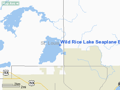
Wild Rice Lake Seaplane Base |
Location & QuickFacts
| FAA Information Effective: | 2008-09-25 |
| Airport Identifier: | MN35 |
| Airport Status: | Operational |
| Longitude/Latitude: | 092-09-43.6770W/46-53-59.7770N
-92.162133/46.899938 (Estimated) |
| Elevation: | 1380 ft / 420.62 m (Estimated) |
| Land: | 0 acres |
| From nearest city: | 9 nautical miles NW of Duluth, MN |
| Location: | St Louis County, MN |
| Magnetic Variation: | 02E (1985) |
Owner & Manager
| Ownership: | Privately owned |
| Owner: | Dr. Marvin G. Wick |
| Address: | 1699 Miller Road
Duluth, MN 55803 |
| Address: |
|
| Phone number: | 218-721-3259
724-6868 OFFICE. |
Airport Operations and Facilities
| Airport Use: | Private |
| Wind indicator: | No |
| Segmented Circle: | No |
| Control Tower: | No |
| Landing fee charge: | No |
| Sectional chart: | Green Bay |
| Region: | AGL - Great Lakes |
| Boundary ARTCC: | ZMP - Minneapolis |
| Tie-in FSS: | PNM - Princeton |
| FSS on Airport: | No |
| FSS Toll Free: | 1-800-WX-BRIEF |
Airport Services
| Fuel available: | 80 |
| Airframe Repair: | NONE |
| Power Plant Repair: | NONE |
Runway Information
Runway ALL/WAY
| Dimension: | 6000 x 6000 ft / 1828.8 x 1828.8 m |
| Surface: | WATER, |
| |
Runway ALL |
Runway WAY |
| Traffic Pattern: | Left | Left |
|
Radio Navigation Aids
| ID |
Type |
Name |
Ch |
Freq |
Var |
Dist |
| DL | NDB | Pykla | | 379.00 | 02E | 8.6 nm |
| SUW | NDB | Bong | | 260.00 | 01E | 12.8 nm |
| COQ | NDB | Cloquet | | 335.00 | 03E | 18.6 nm |
| TWM | NDB | Two Harbors | | 243.00 | 01E | 19.4 nm |
| BFW | NDB | Silver Bay | | 350.00 | 00E | 37.2 nm |
| OLG | NDB | Solon Springs | | 388.00 | 01E | 37.9 nm |
| MZH | NDB | Moose Lake | | 362.00 | 02E | 39.3 nm |
| LKI | TACAN | Lakeside | 011X | | 05E | 3.4 nm |
| HIB | VOR/DME | Hibbing | 045X | 110.80 | 02E | 32.8 nm |
| EVM | VOR/DME | Eveleth | 019X | 108.20 | 01E | 34.3 nm |
| DLH | VORTAC | Duluth | 073X | 112.60 | 05E | 6.1 nm |
Remarks
- TFC PTN TO BE COMPATIBLE WITH DULUTH MUNI.
Images and information placed above are from
http://www.airport-data.com/airport/MN35/
We thank them for the data!
| General Info
|
| Country |
United States
|
| State |
MINNESOTA
|
| FAA ID |
MN35
|
| Latitude |
46-53-59.777N
|
| Longitude |
092-09-43.677W
|
| Elevation |
1380 feet
|
| Near City |
DULUTH
|
We don't guarantee the information is fresh and accurate. The data may
be wrong or outdated.
For more up-to-date information please refer to other sources.
|
|


