 |
|
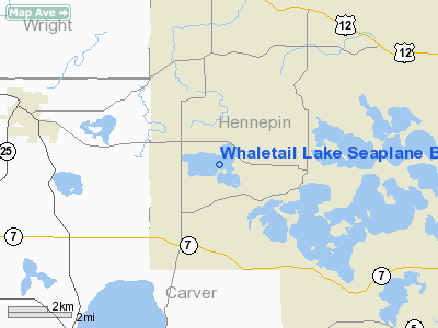
Whaletail Lake Seaplane Base |
Location & QuickFacts
| FAA Information Effective: | 2008-09-25 |
| Airport Identifier: | 95MN |
| Airport Status: | Operational |
| Longitude/Latitude: | 093-43-21.8670W/44-56-19.8680N
-93.722741/44.938852 (Estimated) |
| Elevation: | 948 ft / 288.95 m (Estimated) |
| Land: | 558 acres |
| From nearest city: | 3 nautical miles N of Minnetrista, MN |
| Location: | Hennepin County, MN |
| Magnetic Variation: | () |
Owner & Manager
| Ownership: | Privately owned |
| Owner: | Steve Petrich |
| Address: | 7805 Deer Creek Circle
Minnetrista, MN 55359 |
| Phone number: | 952-472-3350 |
| Manager: | Steve Petrich |
| Address: | 7805 Deer Creek Circle
Minnetrista, MN 55359 |
| Phone number: | 952-472-3350 |
Airport Operations and Facilities
| Airport Use: | Private |
| Control Tower: | No |
| Sectional chart: | Twin Cities |
| Region: | AGL - Great Lakes |
| Boundary ARTCC: | ZMP - Minneapolis |
| Tie-in FSS: | PNM - Princeton |
| FSS Toll Free: | 1-800-WX-BRIEF |
Runway Information
Runway 07W/25W
| Dimension: | 7800 x 600 ft / 2377.4 x 182.9 m |
| Surface: | WATER, |
| |
Runway 07W |
Runway 25W |
| Traffic Pattern: | Left | Left |
|
Runway 09W/27W
| Dimension: | 6720 x 600 ft / 2048.3 x 182.9 m |
| Surface: | WATER, |
| |
Runway 09W |
Runway 27W |
| Traffic Pattern: | Left | Left |
|
Runway 18W/36W
| Dimension: | 5440 x 500 ft / 1658.1 x 152.4 m |
| Surface: | WATER, |
| |
Runway 18W |
Runway 36W |
| Traffic Pattern: | Left | Left |
|
Radio Navigation Aids
| ID |
Type |
Name |
Ch |
Freq |
Var |
Dist |
| GYL | NDB | Glencoe | | 407.00 | 03E | 18.8 nm |
| MS | NDB | Narco | | 266.00 | 02E | 27.7 nm |
| HCD | NDB | Hutchinson | | 209.00 | 04E | 28.6 nm |
| PPI | NDB | Hopey | | 400.00 | 03E | 33.5 nm |
| PNM | NDB | Princeton | | 368.00 | 03E | 37.9 nm |
| CBG | NDB | Cambridge | | 350.00 | 03E | 42.0 nm |
| OEO | NDB | Osceola | | 233.00 | 01E | 49.2 nm |
| ULM | NDB/DME | New Ulm | 050X | 272.00 | 04E | 49.9 nm |
| FCM | VOR/DME | Flying Cloud | 055X | 111.80 | 06E | 13.2 nm |
| MSP | VOR/DME | Minneapolis | 100X | 115.30 | 02E | 20.9 nm |
| STC | VOR/DME | St Cloud | 058X | 112.10 | 03E | 39.4 nm |
| MKT | VOR/DME | Mankato | 045X | 110.80 | 07E | 44.0 nm |
| FOW | VOR/DME | Halfway | 049X | 111.20 | 02E | 46.6 nm |
| GEP | VORTAC | Gopher | 120X | 117.30 | 06E | 19.4 nm |
| FGT | VORTAC | Farmington | 104X | 115.70 | 06E | 29.6 nm |
| DWN | VORTAC | Darwin | 027X | 109.00 | 07E | 32.3 nm |
| MSP | VOT | Minneapolis St Paul | | 111.00 | | 21.9 nm |
| STP | VOT | St Paul | | 114.40 | | 28.2 nm |
Remarks
- 322 FT TOWER 1/2 NM S OF SPB.
Images and information placed above are from
http://www.airport-data.com/airport/95MN/
We thank them for the data!
We don't guarantee the information is fresh and accurate. The data may
be wrong or outdated.
For more up-to-date information please refer to other sources.
|
|


