 |
|
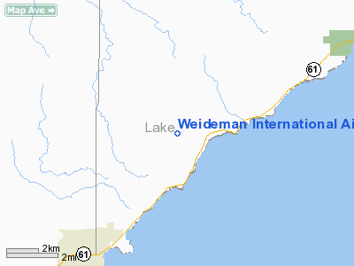
Weideman International Airport |
Location & QuickFacts
| FAA Information Effective: | 2008-09-25 |
| Airport Identifier: | 63MN |
| Airport Status: | Operational |
| Longitude/Latitude: | 091-36-00.6310W/47-05-39.7480N
-91.600175/47.094374 (Estimated) |
| Elevation: | 930 ft / 283.46 m (Estimated) |
| Land: | 0 acres |
| From nearest city: | 4 nautical miles NE of Two Harbors, MN |
| Location: | Lake County, MN |
| Magnetic Variation: | 01E (1985) |
Owner & Manager
| Ownership: | Privately owned |
| Owner: | Kyle Weideman |
| Address: | 2232 Hwy 3
Two Harbors, MN 55616 |
| Phone number: | 218-834-3476 |
| Manager: | Kyle Weideman |
| Address: | 2232 Hwy 3
Two Harbors, MN 55616 |
| Phone number: | 218-834-3476 |
Airport Operations and Facilities
| Airport Use: | Private |
| Segmented Circle: | No |
| Control Tower: | No |
| Sectional chart: | Green Bay |
| Region: | AGL - Great Lakes |
| Boundary ARTCC: | ZMP - Minneapolis |
| Tie-in FSS: | PNM - Princeton |
| FSS on Airport: | No |
| FSS Toll Free: | 1-800-WX-BRIEF |
Runway Information
Runway NE/SW
| Dimension: | 2000 x 60 ft / 609.6 x 18.3 m |
| Surface: | TURF, |
| |
Runway NE |
Runway SW |
| Traffic Pattern: | Left | Left |
|
Radio Navigation Aids
| ID |
Type |
Name |
Ch |
Freq |
Var |
Dist |
| TWM | NDB | Two Harbors | | 243.00 | 01E | 6.4 nm |
| BFW | NDB | Silver Bay | | 350.00 | 00E | 12.1 nm |
| SUW | NDB | Bong | | 260.00 | 01E | 31.8 nm |
| DL | NDB | Pykla | | 379.00 | 02E | 34.4 nm |
| ENY | NDB | Kennedy | | 254.00 | 02E | 43.1 nm |
| COQ | NDB | Cloquet | | 335.00 | 03E | 44.1 nm |
| OLG | NDB | Solon Springs | | 388.00 | 01E | 47.5 nm |
| LKI | TACAN | Lakeside | 011X | | 05E | 28.3 nm |
| EVM | VOR/DME | Eveleth | 019X | 108.20 | 01E | 41.6 nm |
| ASX | VOR/DME | Ashland | 039X | 110.20 | 02E | 43.2 nm |
| ELO | VOR/DME | Ely | 033X | 109.60 | 00E | 44.7 nm |
| HIB | VOR/DME | Hibbing | 045X | 110.80 | 02E | 46.8 nm |
| DLH | VORTAC | Duluth | 073X | 112.60 | 05E | 30.3 nm |
Remarks
- DO NOT CHART.
- FILED FOR RECORD PURPOSES ONLY.
Images and information placed above are from
http://www.airport-data.com/airport/63MN/
We thank them for the data!
| General Info
|
| Country |
United States
|
| State |
MINNESOTA
|
| FAA ID |
63MN
|
| Latitude |
47-05-39.748N
|
| Longitude |
091-36-00.631W
|
| Elevation |
930 feet
|
| Near City |
TWO HARBORS
|
We don't guarantee the information is fresh and accurate. The data may
be wrong or outdated.
For more up-to-date information please refer to other sources.
|
|


