 |
|
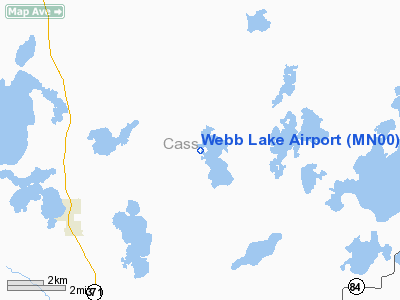
Location & QuickFacts
| FAA Information Effective: | 2008-09-25 |
| Airport Identifier: | MN00 |
| Airport Status: | Operational |
| Longitude/Latitude: | 094-25-30.0000W/46-57-37.8000N
-94.425000/46.960500 (Estimated) |
| Elevation: | 1359 ft / 414.22 m (Surveyed) |
| Land: | 30 acres |
| From nearest city: | 6 nautical miles SW of Hackensack, MN |
| Location: | Cass County, MN |
| Magnetic Variation: | 03E (1995) |
Owner & Manager
| Ownership: | Privately owned |
| Owner: | John D. Justad |
| Address: | 2792 Chimney Point Drive Nw
Hackensack, MN 56452 |
| Phone number: | 218-682-2818 |
| Manager: | John D. Justad |
| Address: | 2792 Chimney Point Drive Nw
Hackensack, MN 56452 |
| Phone number: | 218-682-2818 |
Airport Operations and Facilities
| Airport Use: | Private |
| Wind indicator: | Yes |
| Segmented Circle: | No |
| Control Tower: | No |
| Sectional chart: | Twin Cities |
| Region: | AGL - Great Lakes |
| Boundary ARTCC: | ZMP - Minneapolis |
| Tie-in FSS: | PNM - Princeton |
| FSS Toll Free: | 1-800-WX-BRIEF |
Runway Information
Runway 14/32
| Dimension: | 2000 x 40 ft / 609.6 x 12.2 m |
| Surface: | ASPH, |
| |
Runway 14 |
Runway 32 |
| Traffic Pattern: | Left | Left |
| Obstruction: | 30 ft trees, 550.0 ft from runway | 20 ft trees, 325.0 ft from runway |
|
Radio Navigation Aids
| ID |
Type |
Name |
Ch |
Freq |
Var |
Dist |
| XVG | NDB | Longville | | 392.00 | 04E | 9.2 nm |
| PWC | NDB | Pine River | | 330.00 | 03E | 14.1 nm |
| PK | NDB | Spida | | 269.00 | 04E | 23.8 nm |
| SAZ | NDB | Staples | | 257.00 | 04E | 38.1 nm |
| AIT | NDB | Aitkin | | 397.00 | 03E | 39.6 nm |
| PKD | VOR/DME | Park Rapids | 043X | 110.60 | 04E | 26.8 nm |
| GPZ | VOR/DME | Grand Rapids | 051X | 111.40 | 06E | 40.2 nm |
| BRD | VORTAC | Brainerd | 116X | 116.90 | 03E | 40.3 nm |
| BJI | VORTAC | Bemidji | 023X | 108.60 | 04E | 44.3 nm |
Remarks
- 1000 FT TOWER 3 MILES SW OF ARPT.
- PRVDD CLEAR 20:1 APCH; CLEAR OBSTN FREE ZONE (OF2); CLEAR RY SAFETY AREA (RSA).
Images and information placed above are from
http://www.airport-data.com/airport/MN00/
We thank them for the data!
| General Info
|
| Country |
United States
|
| State |
MINNESOTA
|
| FAA ID |
MN00
|
| Latitude |
46-57-35.350N
|
| Longitude |
094-25-28.960W
|
| Elevation |
1350 feet
|
| Near City |
HACKENSACK
|
We don't guarantee the information is fresh and accurate. The data may
be wrong or outdated.
For more up-to-date information please refer to other sources.
|
|


