 |
|
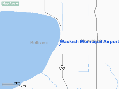
Waskish Municipal Airport |
Location & QuickFacts
| FAA Information Effective: | 2008-09-25 |
| Airport Identifier: | VWU |
| Airport Status: | Operational |
| Longitude/Latitude: | 094-30-58.9000W/48-09-03.6000N
-94.516361/48.151000 (Estimated) |
| Elevation: | 1181 ft / 359.97 m (Estimated) |
| Land: | 36 acres |
| From nearest city: | 1 nautical miles S of Waskish, MN |
| Location: | Beltrami County, MN |
| Magnetic Variation: | 04E (1985) |
Owner & Manager
| Ownership: | Publicly owned |
| Owner: | Town Board Of Waskish |
| Address: | 53939 Sandy Ridge Road Ne
Waskish, MN 56685 |
| Phone number: | 218-647-8568 |
| Manager: | David Leonhardt |
| Address: | Hc78 Box 51
Waskish, MN 56685 |
| Phone number: | 218-647-8565 |
Airport Operations and Facilities
| Airport Use: | Open to public |
| Wind indicator: | Yes |
| Segmented Circle: | No |
| Control Tower: | No |
| Landing fee charge: | No |
| Sectional chart: | Twin Cities |
| Region: | AGL - Great Lakes |
| Boundary ARTCC: | ZMP - Minneapolis |
| Tie-in FSS: | PNM - Princeton |
| FSS on Airport: | No |
| FSS Toll Free: | 1-800-WX-BRIEF |
| NOTAMs Facility: | VWU (NOTAM-d service avaliable) |
Airport Communications
Airport Services
Runway Information
Runway 02/20
| Dimension: | 3700 x 150 ft / 1127.8 x 45.7 m |
| Surface: | TURF, Fair Condition
SOME SOFT SPOTS AND WEAK TURF. |
| |
Runway 02 |
Runway 20 |
| Longitude: | 094-31-10.9100W | 094-30-46.8700W |
| Latitude: | 48-08-47.1700N | 48-09-19.9600N |
| Traffic Pattern: | Left | Left |
| Markings: | None,
RY 02/20 MKD WITH YELLOW CONES. | None, |
| Runway End Identifier: | No | No |
| Touchdown Lights: | No | No |
| Obstruction: | 57 ft trees, 285.0 ft from runway, 150 ft right of centerline, 5:1 slope to clear | 71 ft trees, 1575.0 ft from runway, 120 ft right of centerline, 22:1 slope to clear |
|
Radio Navigation Aids
| ID |
Type |
Name |
Ch |
Freq |
Var |
Dist |
| FOZ | NDB | Bigfork | | 345.00 | 02E | 41.1 nm |
| BDE | VOR/DME | Baudette | 053X | 111.60 | 04E | 34.6 nm |
| BJI | VORTAC | Bemidji | 023X | 108.60 | 04E | 40.2 nm |
Remarks
Images and information placed above are from
http://www.airport-data.com/airport/VWU/
We thank them for the data!
| General Info
|
| Country |
United States
|
| State |
MINNESOTA
|
| FAA ID |
VWU
|
| Latitude |
48-09-14.865N
|
| Longitude |
094-31-00.840W
|
| Elevation |
1181 feet
|
| Near City |
WASKISH
|
We don't guarantee the information is fresh and accurate. The data may
be wrong or outdated.
For more up-to-date information please refer to other sources.
|
|


