 |
|
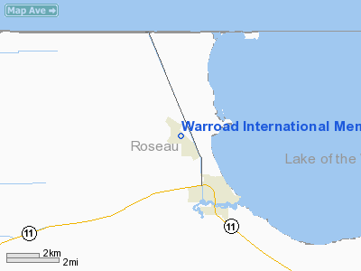
Warroad International Memorial Airport |
Warroad International Airport
Swede Carlson Field |
| IATA: RRT – ICAO: KRRT – FAA LID: RRT |
| Summary |
| Airport type |
Public |
| Owner |
City of Warroad |
| Serves |
Warroad, Minnesota |
| Elevation AMSL |
1,074 ft / 327 m |
| Coordinates |
48°56′29″N 095°20′54″W / 48.94139°N 95.34833°W / 48.94139; -95.34833 |
| Runways |
| Direction |
Length |
Surface |
| ft |
m |
| 13/31 |
5,400 |
1,646 |
Asphalt |
| 4/22 |
3,000 |
914 |
Turf |
| Statistics (2007) |
| Aircraft operations |
9,000 |
| Based aircraft |
25 |
| Source: Federal Aviation Administration |
Warroad International Memorial Airport (IATA: RRT, ICAO: KRRT, FAA LID: RRT), also known as Warroad International Airport or Swede Carlson Field, is a city-owned public-use airport located two nautical miles (4 km) northwest of the central business district of Warroad, a city in Roseau County, Minnesota, United States.
Facilities and aircraft
Warroad International Memorial Airport covers an area of 320 acres (129 ha) at an elevation of 1,074 feet (327 m) above mean sea level. It has two runways: 13/31 has an asphalt pavement measuring 5,400 by 100 feet (1,646 x 30 m) and 4/22 has a turf surface measuring 3,000 by 150 feet (914 x 46 m).
For the 12-month period ending August 30, 2007, the airport had 9,000 aircraft operations, an average of 24 per day, all of which were general aviation. At that time there were 25 aircraft based at this airport: 76% single-engine, 20% multi-engine and 4% jet.
Airport services include a US Customs office.
The above content comes from Wikipedia and is published under free licenses – click here to read more.
Location & QuickFacts
| FAA Information Effective: | 2008-09-25 |
| Airport Identifier: | RRT |
| Airport Status: | Operational |
| Longitude/Latitude: | 095-20-54.4000W/48-56-29.3000N
-95.348444/48.941472 (Estimated) |
| Elevation: | 1074 ft / 327.36 m (Surveyed) |
| Land: | 320 acres |
| From nearest city: | 2 nautical miles NW of Warroad, MN |
| Location: | Roseau County, MN |
| Magnetic Variation: | 04E (1995) |
Owner & Manager
| Ownership: | Publicly owned |
| Owner: | City Of Warroad |
| Address: | City Hall, P.o. Box 50
Warroad, MN 56763 |
| Phone number: | 218-386-1454 |
| Manager: | Bruce Maclean
AMGR LIVES ON ARPT. |
| Address: | P.o. Box T
Warroad, MN 56763 |
| Phone number: | 218-386-1691 |
Airport Operations and Facilities
| Airport Use: | Open to public |
| Wind indicator: | Yes |
| Segmented Circle: | No |
| Control Tower: | No |
| Lighting Schedule: | DUSK-DAWN
ACTVT HIRL RY 13/31; REIL RY 13 & MALSR RY 31 - CTAF. PAPI RYS 13 & 31 OPER 24 HRS. |
| Beacon Color: | Clear-Green (lighted land airport) |
| Landing fee charge: | No |
| Sectional chart: | Twin Cities |
| Region: | AGL - Great Lakes |
| Traffic Pattern Alt: | 800 ft |
| Boundary ARTCC: | ZMP - Minneapolis |
| Tie-in FSS: | PNM - Princeton |
| FSS on Airport: | No |
| FSS Toll Free: | 1-800-WX-BRIEF |
| NOTAMs Facility: | RRT (NOTAM-d service avaliable) |
| Federal Agreements: | NGY |
Airport Communications
| CTAF: | 123.050 |
| Unicom: | 123.050 |
Airport Services
| Fuel available: | 100LLA |
| Airframe Repair: | NONE |
| Power Plant Repair: | NONE |
| Bottled Oxygen: | NONE |
| Bulk Oxygen: | NONE |
Runway Information
Runway 04/22
| Dimension: | 3000 x 150 ft / 914.4 x 45.7 m |
| Surface: | TURF, Good Condition |
| |
Runway 04 |
Runway 22 |
| Longitude: | 095-21-20.2200W | 095-20-50.4400W |
| Latitude: | 48-56-24.9000N | 48-56-47.0600N |
| Alignment: | 42 | 127 |
| Traffic Pattern: | Left | Left |
| Obstruction: | 60 ft trees, 1800.0 ft from runway, 30:1 slope to clear | 35 ft trees, 1300.0 ft from runway, 250 ft left of centerline, 37:1 slope to clear |
|
Runway 13/31
| Dimension: | 5400 x 100 ft / 1645.9 x 30.5 m |
| Surface: | ASPH, Good Condition |
| Weight Limit: | Single wheel: 30000 lbs.
Dual wheel: 40000 lbs. |
| Edge Lights: | High |
| |
Runway 13 |
Runway 31 |
| Longitude: | 095-21-15.1400W | 095-20-21.6400W |
| Latitude: | 48-56-45.5300N | 48-56-05.5600N |
| Elevation: | 1071.00 ft | 1073.00 ft |
| Alignment: | 127 | 127 |
| ILS Type: | | ILS/DME
|
| Traffic Pattern: | Left | Left |
| Markings: | Precision instrument, Good Condition | Precision instrument, Good Condition |
| Crossing Height: | 29.00 ft | 29.00 ft |
| VASI: | 4-light PAPI on left side | 4-light PAPI on left side |
| Visual Glide Angle: | 3.00° | 3.00° |
| Approach lights: | | MALSR |
| Runway End Identifier: | Yes | |
| Centerline Lights: | No | No |
| Touchdown Lights: | No | No |
| Obstruction: | , 50:1 slope to clear | 84 ft trees, 3200.0 ft from runway, 35:1 slope to clear |
|
Radio Navigation Aids
| ID |
Type |
Name |
Ch |
Freq |
Var |
Dist |
| PFT | NDB | Piney Pinecreek | | 342.00 | 05E | 25.1 nm |
| ROX | VOR/DME | Roseau | 025X | 108.80 | 05E | 14.7 nm |
| BDE | VOR/DME | Baudette | 053X | 111.60 | 04E | 32.1 nm |
Remarks
Images and information placed above are from
http://www.airport-data.com/airport/RRT/
We thank them for the data!
| General Info
|
| Country |
United States
|
| State |
MINNESOTA
|
| FAA ID |
RRT
|
| Latitude |
48-56-29.000N
|
| Longitude |
095-20-54.200W
|
| Elevation |
1074 feet
|
| Near City |
WARROAD
|
We don't guarantee the information is fresh and accurate. The data may
be wrong or outdated.
For more up-to-date information please refer to other sources.
|
|


