 |
|
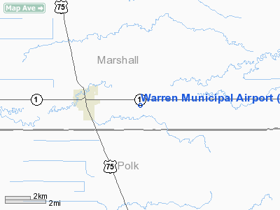
Location & QuickFacts
| FAA Information Effective: | 2008-09-25 |
| Airport Identifier: | D37 |
| Airport Status: | Operational |
| Longitude/Latitude: | 096-42-40.1000W/48-11-28.0000N
-96.711139/48.191111 (Estimated) |
| Elevation: | 886 ft / 270.05 m (Estimated) |
| Land: | 167 acres |
| From nearest city: | 2 nautical miles E of Warren, MN |
| Location: | Marshall County, MN |
| Magnetic Variation: | 05E (2000) |
Owner & Manager
| Ownership: | Publicly owned |
| Owner: | City Of Warren |
| Address: | 120 E Bridge Ave
Warren, MN 56762 |
| Phone number: | 218-745-5343 |
| Manager: | Todd Hanson |
| Address: | 120 E. Bridge Ave.
Warren, MN 56762 |
| Phone number: | 218-745-5343 |
Airport Operations and Facilities
| Airport Use: | Open to public |
| Wind indicator: | Yes |
| Segmented Circle: | No |
| Control Tower: | No |
| Lighting Schedule: | DUSK-DAWN |
| Beacon Color: | Clear-Green (lighted land airport) |
| Landing fee charge: | No |
| Sectional chart: | Twin Cities |
| Region: | AGL - Great Lakes |
| Boundary ARTCC: | ZMP - Minneapolis |
| Tie-in FSS: | PNM - Princeton |
| FSS on Airport: | No |
| FSS Toll Free: | 1-800-WX-BRIEF |
| NOTAMs Facility: | PNM (NOTAM-d service avaliable) |
| Federal Agreements: | Y1 |
Airport Communications
| CTAF: | 122.800 |
| Unicom: | 122.800 |
Airport Services
Runway Information
Runway 04/22
| Dimension: | 2606 x 200 ft / 794.3 x 61.0 m |
| Surface: | TURF, Good Condition |
| |
Runway 04 |
Runway 22 |
| Longitude: | 096-42-57.2000W | 096-42-27.1000W |
| Latitude: | 48-11-20.9000N | 48-11-36.9000N |
| Elevation: | 886.00 ft | 884.00 ft |
| Alignment: | 52 | 127 |
| Traffic Pattern: | Left | Left |
| Obstruction: | 33 ft trees, 600.0 ft from runway, 120 ft left of centerline, 18:1 slope to clear | 18 ft road, 540.0 ft from runway, 30:1 slope to clear |
|
Runway 12/30
| Dimension: | 3205 x 75 ft / 976.9 x 22.9 m |
| Surface: | ASPH, Good Condition |
| Weight Limit: | Single wheel: 26000 lbs. |
| Edge Lights: | Non-standard lighting system
RWY 12/30 NSTD MIRL. RY END LGTS POSITIONED AT PAVEMENT EDGE. RWY LIGHTS NOT FRANGIBLE. RWY 30, VISUAL LIGHTING ON INSTR RWY. |
| |
Runway 12 |
Runway 30 |
| Longitude: | 096-42-56.4000W | 096-42-20.4000W |
| Latitude: | 48-11-37.5000N | 48-11-16.9000N |
| Elevation: | 886.00 ft | 884.00 ft |
| Traffic Pattern: | Left | Left |
| Markings: | Non-precision instrument, Good Condition | Non-precision instrument, Good Condition |
| Obstruction: | 20 ft road, 450.0 ft from runway, 260L/ ft right of centerline, 12:1 slope to clear
RWY 12 +15 FT TREES 100-150 FT FROM RY END, 150R. | 80 ft trees, 1880.0 ft from runway, 260 ft right of centerline, 21:1 slope to clear |
|
Radio Navigation Aids
| ID |
Type |
Name |
Ch |
Freq |
Var |
Dist |
| CKN | NDB | Crookston | | 400.00 | 07E | 21.5 nm |
| RDR | TACAN | Red River | 111X | | 06E | 31.2 nm |
| TVF | VOR/DME | Thief River Falls | 021X | 108.40 | 08E | 22.3 nm |
| GFK | VOR/DME | Grand Forks | 090X | 114.30 | 09E | 23.8 nm |
| HML | VORTAC | Humboldt | 071X | 112.40 | 09E | 43.8 nm |
Remarks
- ULTRALIGHT ACTIVITY ON & INVOF ARPT.
- DEER ON & INVOF AIRPORT.
Images and information placed above are from
http://www.airport-data.com/airport/D37/
We thank them for the data!
| General Info
|
| Country |
United States
|
| State |
MINNESOTA
|
| FAA ID |
D37
|
| Latitude |
48-11-28.000N
|
| Longitude |
096-42-40.100W
|
| Elevation |
886 feet
|
| Near City |
WARREN
|
We don't guarantee the information is fresh and accurate. The data may
be wrong or outdated.
For more up-to-date information please refer to other sources.
|
|


