 |
|
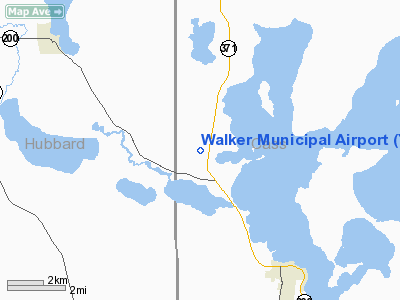
Location & QuickFacts
| FAA Information Effective: | 2008-09-25 |
| Airport Identifier: | Y49 |
| Airport Status: | Operational |
| Longitude/Latitude: | 094-38-43.5000W/47-09-34.4000N
-94.645417/47.159556 (Estimated) |
| Elevation: | 1364 ft / 415.75 m (Surveyed) |
| Land: | 257 acres |
| From nearest city: | 4 nautical miles NW of Walker, MN |
| Location: | Cass County, MN |
| Magnetic Variation: | 04E (1985) |
Owner & Manager
| Ownership: | Publicly owned |
| Owner: | City Of Walker |
| Address: | Box 207
Walker, MN 56484 |
| Phone number: | 218-547-1619 |
| Manager: | Ken Bresley |
| Address: | 6909 Hwy 371
Walker, MN 56484 |
| Phone number: | 218-547-1616 |
Airport Operations and Facilities
| Airport Use: | Open to public |
| Wind indicator: | Yes |
| Segmented Circle: | No |
| Control Tower: | No |
| Lighting Schedule: | DUSK-DAWN
ACTVT MIRL RY 15/33 & PAPI RYS 15 & 33 & REIL RYS 15 & 33 - CTAF. |
| Beacon Color: | Clear-Green (lighted land airport) |
| Landing fee charge: | No |
| Sectional chart: | Twin Cities |
| Region: | AGL - Great Lakes |
| Boundary ARTCC: | ZMP - Minneapolis |
| Tie-in FSS: | PNM - Princeton |
| FSS on Airport: | No |
| FSS Toll Free: | 1-800-WX-BRIEF |
| NOTAMs Facility: | PNM (NOTAM-d service avaliable) |
| Federal Agreements: | N |
Airport Communications
Airport Services
| Fuel available: | 100LL
FUEL AVBL 24 HOURS BY CREDIT CARD. |
| Airframe Repair: | NONE |
| Power Plant Repair: | NONE |
| Bottled Oxygen: | NONE |
| Bulk Oxygen: | NONE |
Runway Information
Runway 15/33
| Dimension: | 3210 x 75 ft / 978.4 x 22.9 m |
| Surface: | ASPH, Fair Condition |
| Edge Lights: | Medium |
| |
Runway 15 |
Runway 33 |
| Alignment: | 127 | 127 |
| Traffic Pattern: | Left | Left |
| Markings: | Basic, Poor Condition | Basic, Poor Condition
MARKINGS FADED. |
| VASI: | 4-light PAPI on left side | 4-light PAPI on left side |
| Runway End Identifier: | Yes | Yes |
| Centerline Lights: | No | No |
| Touchdown Lights: | No | No |
| Obstruction: | 56 ft trees, 470.0 ft from runway, 170 ft right of centerline, 4:1 slope to clear | 90 ft trees, 2000.0 ft from runway, 200 ft right of centerline, 20:1 slope to clear |
|
Radio Navigation Aids
| ID |
Type |
Name |
Ch |
Freq |
Var |
Dist |
| XVG | NDB | Longville | | 392.00 | 04E | 20.5 nm |
| PK | NDB | Spida | | 269.00 | 04E | 23.8 nm |
| PWC | NDB | Pine River | | 330.00 | 03E | 28.1 nm |
| SAZ | NDB | Staples | | 257.00 | 04E | 47.2 nm |
| PKD | VOR/DME | Park Rapids | 043X | 110.60 | 04E | 23.5 nm |
| GPZ | VOR/DME | Grand Rapids | 051X | 111.40 | 06E | 47.3 nm |
| BJI | VORTAC | Bemidji | 023X | 108.60 | 04E | 29.4 nm |
Images and information placed above are from
http://www.airport-data.com/airport/Y49/
We thank them for the data!
| General Info
|
| Country |
United States
|
| State |
MINNESOTA
|
| FAA ID |
Y49
|
| Latitude |
47-09-29.843N
|
| Longitude |
094-38-45.984W
|
| Elevation |
1364 feet
|
| Near City |
WALKER
|
We don't guarantee the information is fresh and accurate. The data may
be wrong or outdated.
For more up-to-date information please refer to other sources.
|
|


