 |
|
Coordinates: 46°27′01″N 095°12′39″W / 46.45028°N 95.21083°W / 46.45028; -95.21083
| Wadena Municipal Airport |
| IATA: none – ICAO: KADC – FAA LID: ADC |
| Summary |
| Airport type |
Public |
| Owner |
City of Wadena |
| Serves |
Wadena, Minnesota |
| Elevation AMSL |
1,369 ft / 417 m |
| Runways |
| Direction |
Length |
Surface |
| ft |
m |
| 16/34 |
4,005 |
1,221 |
Asphalt |
| Statistics (2005) |
| Aircraft operations |
5,410 |
| Source: Federal Aviation Administration |
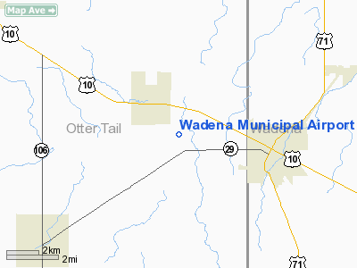
Wadena Municipal Airport (ICAO: KADC, FAA LID: ADC) is a public airport located three miles (5 km) west of the central business district of Wadena, a city in Otter Tail County, Minnesota, United States. It is owned by the City of Wadena.
Although most U.S. airports use the same three-letter location identifier for the FAA and IATA, Wadena Municipal Airport is assigned ADC by the FAA but has no designation from the IATA (which assigned ADC to Andakombe, Papua New Guinea).
Facilities and aircraft
Wadena Municipal Airport has one asphalt paved runway (16/34) measuring 4,005 x 75 ft. (1,221 x 23 m). For the 12-month period ending August 31, 2005, the airport had 5,410 aircraft operations: 99.9% general aviation and 0.1% military.
The above content comes from Wikipedia and is published under free licenses – click here to read more.
Location & QuickFacts
| FAA Information Effective: | 2008-09-25 |
| Airport Identifier: | ADC |
| Airport Status: | Operational |
| Longitude/Latitude: | 095-12-39.4370W/46-27-00.9710N
-95.210955/46.450270 (Estimated) |
| Elevation: | 1369 ft / 417.27 m (Surveyed) |
| Land: | 0 acres |
| From nearest city: | 3 nautical miles W of Wadena, MN |
| Location: | Otter Tail County, MN |
| Magnetic Variation: | 04E (2000) |
Owner & Manager
| Ownership: | Publicly owned |
| Owner: | City Of Wadena |
| Address: | 8 Bryant Ave Se, Box 30
Wadena, MN 56482 |
| Phone number: | 218-631-7707 |
| Manager: | Stanley Weitemeir |
| Address: | 33512 335th St
Wadena, MN 56482 |
| Phone number: | 218-820-2427 |
Airport Operations and Facilities
| Airport Use: | Open to public |
| Wind indicator: | Yes |
| Segmented Circle: | No |
| Control Tower: | No |
| Lighting Schedule: | DUSK-DAWN
ACTVT MIRL RY 16/34 PAPI & REIL RYS 16 & 34 - CTAF. |
| Beacon Color: | Clear-Green (lighted land airport) |
| Sectional chart: | Twin Cities |
| Region: | AGL - Great Lakes |
| Boundary ARTCC: | ZMP - Minneapolis |
| Tie-in FSS: | PNM - Princeton |
| FSS on Airport: | No |
| FSS Toll Free: | 1-800-WX-BRIEF |
| NOTAMs Facility: | ADC (NOTAM-d service avaliable) |
Airport Communications
| CTAF: | 122.800 |
| Unicom: | 122.800 |
Airport Services
| Fuel available: | 100LLMOGAS
FUEL AVBL 24 HRS WITH CREDIT CARD. |
| Airframe Repair: | MAJOR |
| Power Plant Repair: | MAJOR |
Runway Information
Runway 16/34
| Dimension: | 4005 x 75 ft / 1220.7 x 22.9 m |
| Surface: | ASPH, Good Condition |
| Edge Lights: | Medium |
| |
Runway 16 |
Runway 34 |
| Longitude: | 095-12-47.7680W | 095-12-31.1070W |
| Latitude: | 46-27-19.8810N | 46-26-42.0610N |
| Elevation: | 1369.00 ft | 1357.00 ft |
| Alignment: | 127 | 127 |
| Traffic Pattern: | Left | Left |
| Markings: | Non-precision instrument, Good Condition | Non-precision instrument, Good Condition |
| Crossing Height: | 42.00 ft | 42.00 ft |
| VASI: | 4-light PAPI on left side | 4-light PAPI on left side |
| Visual Glide Angle: | 3.00° | 3.00° |
| Runway End Identifier: | Yes | Yes |
|
Radio Navigation Aids
| ID |
Type |
Name |
Ch |
Freq |
Var |
Dist |
| SAZ | NDB | Staples | | 257.00 | 04E | 17.3 nm |
| PK | NDB | Spida | | 269.00 | 04E | 25.0 nm |
| PWC | NDB | Pine River | | 330.00 | 03E | 38.0 nm |
| EE | NDB | Tamie | | 374.00 | 04E | 39.8 nm |
| XCR | NDB | Ripley | | 404.00 | 03E | 42.4 nm |
| LXL | NDB | Little Falls | | 359.00 | 03E | 47.0 nm |
| GHW | NDB | Glenwood | | 346.00 | 03E | 48.7 nm |
| RYM | TACAN | Camp Ripley | 048X | | 03E | 41.6 nm |
| PKD | VOR/DME | Park Rapids | 043X | 110.60 | 04E | 27.5 nm |
| AXN | VOR/DME | Alexandria | 075X | 112.80 | 07E | 29.6 nm |
| DTL | VOR/DME | Detroit Lakes | 049X | 111.20 | 05E | 35.9 nm |
| FFM | VOR/DME | Fergus Falls | 041X | 110.40 | 05E | 40.4 nm |
| BRD | VORTAC | Brainerd | 116X | 116.90 | 03E | 49.5 nm |
Remarks
- GCO AVBL ON FREQ 121.725 THRU MINNEAPOLIS ARTCC & FLT SVCS.
- ULTRALIGHT ACTIVITY ON & INVOF ARPT.
Images and information placed above are from
http://www.airport-data.com/airport/ADC/
We thank them for the data!
| General Info
|
| Country |
United States
|
| State |
MINNESOTA
|
| FAA ID |
ADC
|
| Latitude |
46-27-00.971N
|
| Longitude |
095-12-39.437W
|
| Elevation |
1369 feet
|
| Near City |
WADENA
|
We don't guarantee the information is fresh and accurate. The data may
be wrong or outdated.
For more up-to-date information please refer to other sources.
|
|


